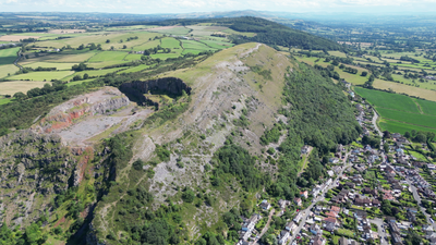
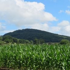
Moel Hiraddug, Iron Age contour fort in Dyserth, Wales.
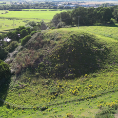
Moel Hiraddug is an Iron Age hill fort positioned along a limestone ridge in Denbighshire. The site features multiple defensive banks and interior structures spread across the elevated terrain, with evidence of settlement platforms integrated into the sloping ground.
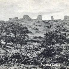
The fort originated in the Iron Age with occupation layers extending back to the Late Bronze Age. The site was continuously modified over centuries before eventually being abandoned, though its defensive structures remained visible on the landscape.
The name reflects its location on a prominent Welsh hill, and the site shows visible traces of occupation platforms carved into the slopes that visitors can still observe today.
Access to the site is open and unrestricted, but visitors should prepare for uneven ground and steep slopes throughout the area. Sturdy footwear is advisable, particularly in the northern section where quarrying has altered the terrain.
Four internal banks divide the fort into separate enclosures with multiple gateways, indicating a deliberate design for controlling movement and access. This internal organization reveals how inhabitants managed different functions within the fortified space.
Location: Denbighshire
Elevation above the sea: 265 m
GPS coordinates: 53.29263,-3.40632
Latest update: December 14, 2025 16:41
The Gop
3 km
Bodrhyddan Hall
1.8 km
St Beuno’s Ignatian Spirituality Centre
4.3 km
Dyserth Waterfall
1.3 km
Twthill Castle
3.8 km
Mynydd y Cwm
1.7 km
St Michael's Church
2.9 km
Dyserth Castle
1.7 km
Golden Grove
4.2 km
Church Of Saint Mary
4.2 km
Church of St Bridget, Dyserth
1.4 km
Church of Saints Mael and Sulien
799 m
Church Of St Mary
3 km
Cross In Churchyard Of The Church Of St Michael & All Angels
2.9 km
Church Of St Melyd
2.9 km
Rhuddlan Bridge
4.2 km
Pont Dafydd
3.7 km
Rhuddlan Chapel
3.9 km
Clive Engine House, Talargoch Mine
1.9 km
Tremeirchion Cross
4.3 km
The Banquet House, Princes Road (Ne Side)
3.7 km
Trelawnyd Memorial Hall
3.1 km
No 4, (Parliament House) Parliament Street Sw Side
4 km
No 1, (Parliament House), Parliament Street Sw Side
4 km
Dovecote at Gop Farm
2.7 km
Churchyard Cross, Church Street (Sw Side)
4.2 km
Lychgate to Churchyard, Church Street (Sw Side)
4.1 km
Ebeneser Welsh Independent Chapel
3.2 kmVisited this place? Tap the stars to rate it and share your experience / photos with the community! Try now! You can cancel it anytime.
Discover hidden gems everywhere you go!
From secret cafés to breathtaking viewpoints, skip the crowded tourist spots and find places that match your style. Our app makes it easy with voice search, smart filtering, route optimization, and insider tips from travelers worldwide. Download now for the complete mobile experience.
A unique approach to discovering new places❞
— Le Figaro
All the places worth exploring❞
— France Info
A tailor-made excursion in just a few clicks❞
— 20 Minutes