·

Enable Location

We need your location to show you interesting places around you

Discover nearby places

Find interesting locations and hidden gems around you

Precise directions

Get accurate directions and distances to places

Your location is never shared with other users. It's only used when you tap the location button.

Twyford Wood

Log in to your account

Start exploring — it's free

Trusted by 62,734 travelers worldwide

Continue with Google
Continue with Apple
or

We will send you a code to connect

By continuing, you accept our Terms and Conditions and our Privacy Policy

Check your inbox

We've sent a pincode in your inbox. Please enter the code below.

Twyford Wood

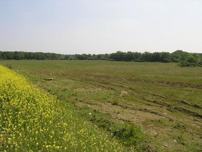
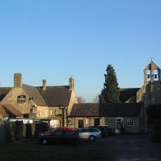
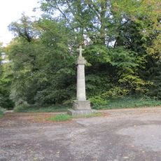
Twyford Wood, Public park in Lincolnshire, England.

Twyford Wood is a woodland park in Lincolnshire featuring mixed forest with both coniferous and deciduous trees spread across the site. A network of walking paths winds through the different areas, allowing visitors to move through the landscape on foot.

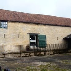
The site functioned as RAF North Witham during World War II, serving the United States Army Air Forces until 1945. After the war, the airfield was gradually transformed into woodland.

The Lincolnshire branch of Butterfly Conservation manages sections of the woodland to protect and monitor various butterfly species, including dingy and grizzled skippers.

A parking area near the A151 road provides access to the woodland and its network of walking trails. The paths suit different levels of mobility and allow visitors to explore at their own pace.

Concrete remnants of former military runways are scattered among the trees, remnants of the wartime past. This blend of nature reclaiming old infrastructure creates an unusual and thought-provoking landscape.

The community of curious travelers

AroundUs brings together thousands of curated places, local tips, and hidden gems, enriched daily by 60,000 contributors worldwide.

Start exploring
Location
GPS coordinates
52.79620,-0.59546
Latest update
December 13, 2025 17:05
Around this place
Woolsthorpe Manor
United Kingdom

Woolsthorpe Manor

2.8 km
Church of St Mary and St Andrew, Stoke Rochford
United Kingdom

Church of St Mary and St Andrew, Stoke Rochford

5.1 km
Church of St Thomas A Becket
United Kingdom

Church of St Thomas A Becket

4.3 km
Church of St John the Baptist
United Kingdom

Church of St John the Baptist

4.1 km
Church of St Peter
United Kingdom

Church of St Peter

4.3 km
Church of St Nicholas
United Kingdom

Church of St Nicholas

3.8 km
Church of St John the Baptist
United Kingdom

Church of St John the Baptist

2.1 km
Church of St Mary, North Witham
United Kingdom

Church of St Mary, North Witham

2.3 km
The Angel Inn
United Kingdom

The Angel Inn

4.1 km
Church of St Nicholas
United Kingdom

Church of St Nicholas

4.5 km
Village Pump
United Kingdom

Village Pump

5.2 km
Horse Monument In Morkery Woods, Grid Reference 955185
United Kingdom

Horse Monument In Morkery Woods, Grid Reference 955185

4.6 km
Milestone, North Side Of B676 By Birkholme House
United Kingdom

Milestone, North Side Of B676 By Birkholme House

2.2 km
39 And 41, High Street
United Kingdom

39 And 41, High Street

4.4 km
Barn At Woolsthorpe Manor
United Kingdom

Barn At Woolsthorpe Manor

2.7 km
Saxon cross in churchyard of parish church, South Stoke
United Kingdom

Saxon cross in churchyard of parish church, South Stoke

5.2 km
Milestone, On North Side Of B676 Near Heath Farm
United Kingdom

Milestone, On North Side Of B676 Near Heath Farm

3.7 km
Milestone, 10 Yards East Of Junction With A1
United Kingdom

Milestone, 10 Yards East Of Junction With A1

1.2 km
Old School
United Kingdom

Old School

4.1 km
4, Spring Lane
United Kingdom

4, Spring Lane

2.1 km
The Old Black Bull
United Kingdom

The Old Black Bull

2 km
Cross
United Kingdom

Cross

4.3 km
Milestone, 20 Yards West Of Colsterworth Pasture Lodge
United Kingdom

Milestone, 20 Yards West Of Colsterworth Pasture Lodge

1.1 km
1 and 2, School Close
United Kingdom

1 and 2, School Close

5.2 km
Old School And School House
United Kingdom

Old School And School House

5.2 km
Milestone, West Of Garage
United Kingdom

Milestone, West Of Garage

5.3 km
3 Gatepiers, Wall And Lodge, South East Entrance,550 Metres South-South East Of Stoke Rochford Hall
United Kingdom

3 Gatepiers, Wall And Lodge, South East Entrance,550 Metres South-South East Of Stoke Rochford Hall

5.3 km
Milestone, Stamford Road, nr No 17
United Kingdom

Milestone, Stamford Road, nr No 17

2 km
Show the full map
« Twyford Wood - Public park in Lincolnshire, England » is provided by Around Us (aroundus.com). Images and texts are derived from Wikimedia project under a Creative Commons license. You are allowed to copy, distribute, and modify copies of this page, under the conditions set by the license, as long as this note is clearly visible.

Discover hidden gems everywhere you go!

From secret cafés to breathtaking viewpoints, skip the crowded tourist spots and find places that match your style. Our app makes it easy with voice search, smart filtering, route optimization, and insider tips from travelers worldwide. Download now for the complete mobile experience.

Around Us App Screenshot

A unique approach to discovering new places

Le Figaro

All the places worth exploring

France Info

A tailor-made excursion in just a few clicks

20 Minutes

Around Us
Travel Guide & Maps
Download

Send to your phone

QR Code
1

Open the camera app on your mobile.

2

Point at the QR code with your camera. A notification will appear.

3

Tap the notification to open the link.