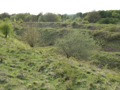
Twywell Hills and Dales, Nature reserve in East Northamptonshire, England
Twywell Hills and Dales is a nature reserve in East Northamptonshire containing limestone grasslands, woodlands, and ponds that formed from old quarrying sites. These varied habitats spread across roughly 55 hectares and support numerous wildlife species throughout the year.
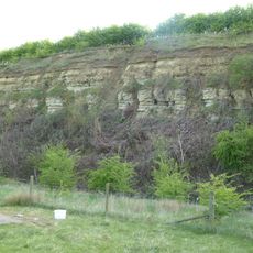
The area was once part of the royal hunting grounds of Rockingham Forest before becoming a quarrying site for iron ore and limestone starting in 1880. Operations ended in 1974, leaving behind the ponds that now define the reserve's natural character.
Visitors can watch rare butterfly species thriving across the open grasslands and wooded areas. The landscape supports diverse insect and plant interactions that are easily observed while walking through the different sections.
The site is open 24 hours and offers free parking for visitors. Walking paths guide you through the different terrain sections, allowing you to explore at your own pace and see the various landscapes.
Twywell Gullet provides specialized habitats for ground-nesting bees, wasps, and rare beetle species found nowhere else in the region. These areas are so valuable that the entire site holds the designation of Site of Special Scientific Interest.
The community of curious travelers
AroundUs brings together thousands of curated places, local tips, and hidden gems, enriched daily by 60,000 contributors worldwide.