Tynron Doon, Iron Age hillfort archaeological site in Dumfries and Galloway, Scotland.
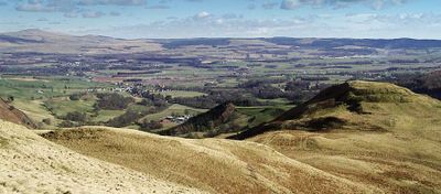
Tynron Doon is an Iron Age fortified site situated in the Scaur hills of southern Scotland. The location has an oval plateau shape and is defined by three defensive ditches and two ramparts on its western side that remain visible today.
The fortification was established during the Iron Age and remained occupied across many centuries. By the 16th century, inhabitants constructed a tower-like structure in the northwestern section.
The location functioned as a beacon point for local sheriffs during the 15th century to relay messages across the landscape. The elevated position made it valuable for communication between distant communities.
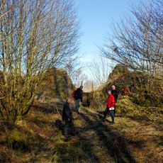
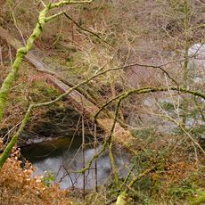
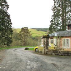
The ascent to the site requires following uphill paths with steady climbing. Weather conditions are changeable, so visitors should bring warm and waterproof clothing.
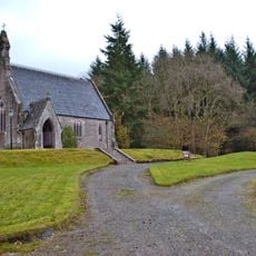
Stones from the medieval tower were later reused as building materials for a nearby church between 1700 and 1750. This shows how materials were repurposed across generations in the region.
GPS coordinates: 55.22556,-3.85703
Latest update: December 14, 2025 11:40
Drumlanrig Castle
6.2 km
Tibbers Castle
6 km
Nith Bridge,cross 180m W of
5.1 km
Thornhill Market Cross
6.1 km
Nith Bridge
5.3 km
Tynron Parish Church
1.7 km
Kirkland, Glencairn Parish Church
3.6 km
Glenluiart
6.3 km
Moniaive, North Street, St Ninian's Parish Church
5.1 km
Churchyard of Glencairn Parish Church
3.6 km
Church, Dunreggan
4.8 km
Cample, Viaduct
7.8 km
Carronhill Glen, Viaduct
7.1 km
Moniaive, High Street, George Hotel
5 km
Keir Mill, Church And Churchyard
4 km
Laird's Bridge
3.8 km
South Lodge And Gatepiers, Maxwelton House
4.6 km
Barjarg House, Drybridge
7.2 km
Maxwelton House
4.3 km
Tower House, Ayr Street, Moniaive
5.1 km
Renwick's Monument, Moniaive
5.6 km
Drumlanrig Estate, Creel Bridge
7.5 km
Lodge, Craigdarroch
7.9 km
Maxwelton House, Episcopal Chapel And Lych Gate
4.4 km
Drumlanrig Estate, Bridge
7.1 km
Kirkland, Cairn Water, Kirkland Bridge
3.9 km
Closeburn, War Memorial
7.9 km
Kirkland, Signpost At Junction Of A702 And B729
3.7 kmVisited this place? Tap the stars to rate it and share your experience / photos with the community! Try now! You can cancel it anytime.
Discover hidden gems everywhere you go!
From secret cafés to breathtaking viewpoints, skip the crowded tourist spots and find places that match your style. Our app makes it easy with voice search, smart filtering, route optimization, and insider tips from travelers worldwide. Download now for the complete mobile experience.
A unique approach to discovering new places❞
— Le Figaro
All the places worth exploring❞
— France Info
A tailor-made excursion in just a few clicks❞
— 20 Minutes