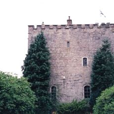
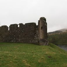
Tibbers Castle, Medieval fortress ruins in Dumfries and Galloway, Scotland.
Tibbers Castle is a medieval fortress ruin standing on a ridge above the River Nith in Dumfries and Galloway. The site displays the remains of both a motte and bailey, the two defining structures of this early castle design.
The fortress was built around 1250 and changed hands multiple times during the Anglo-Scottish wars between English forces and Scottish nobles. By 1313 this period of conflict ended, marking a significant shift in the site's strategic role.
The castle's name comes from the Gaelic word 'Toibar' meaning well, reflecting the early settlement patterns of the region. This linguistic connection to the land remains visible to visitors walking through the site today.
The site holds protected monument status and visitors should check local guidelines before visiting to understand access rules and any restrictions. Sturdy footwear is recommended due to the terrain and weather conditions in the area.
Excavations in 1864 uncovered coins from Edward II, revealing the site's direct historical ties to English rule during this period. More recent geophysical surveys in 2014 discovered hidden timber structures within the bailey that had remained hidden for centuries.
The community of curious travelers
AroundUs brings together thousands of curated places, local tips, and hidden gems, enriched daily by 60,000 contributors worldwide.