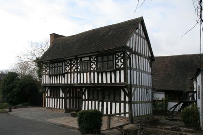
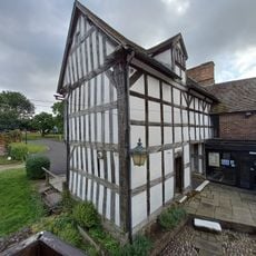
West Bromwich Manor House, Medieval manor house in West Bromwich, England
West Bromwich Manor House is a medieval timber-framed building with original construction dating from around 1270. The structure contains a Great Hall and other connected chambers built using traditional medieval building techniques.
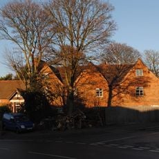
The original estate was founded around 1270 as the administrative center of a large agricultural territory. The building survived through the region's industrial transformation and was eventually converted into a museum.
The house tells the story of how local families lived and worked across different periods in this region. Rooms reveal everyday habits and social structures from medieval times through later eras.
The museum is accessible with facilities for visitors with reduced mobility and nearby parking available. Knowledgeable staff are present to guide visitors through the different spaces and answer questions.
Ongoing archaeological work beneath the Great Hall regularly reveals details about medieval daily life that were previously unknown. These discoveries show that the ground beneath the building holds stories about the people who once lived and worked here.
Location: Sandwell
GPS coordinates: 52.54670,-1.99330
Latest update: December 12, 2025 12:05
Sandwell Valley Country Park
2.6 km
Wednesbury Museum and Art Gallery
1.9 km
Ridgacre Branch
2 km
St Gabriel's Church, Walsall
2.5 km
Wednesbury Town Hall
2 km
Annunciation Church
2.6 km
Church of St Paul
2 km
Sot's Hole Local Nature Reserve
2.1 km
West Bromwich Manor House
3 m
Church of St Bartholomew
2.1 km
Church of St Francis of Assisi
651 m
Church of All Saints
1.5 km
Farley Clock Tower
2.6 km
Sot's Hole gate
2.2 km
Bluebell
2.2 km
Wednesbury Museum and Art Gallery
2 km
St Paul
2.6 km
Horse and Jockey
1.8 km
Wednesbury Library
1.8 km
Old Blue Ball Public House
2.3 km
Hill House
2.3 km
Post box B71 46
2.4 km
Holyhead House
1.7 km
Wednesbury Adult Education Centre
2 km
Wednesbury Old Post Office
1.9 km
Milestone Approximately 10 Metres East Of No 136
1.5 km
Brickfields Bridge Footbridge East Of Junction With Rushall Canal, Within M5/M6 Junction Tame Valley Canal
2.6 km
Milestone, Dudley Street, Guns village, by No. 28
2.6 kmVisited this place? Tap the stars to rate it and share your experience / photos with the community! Try now! You can cancel it anytime.
Discover hidden gems everywhere you go!
From secret cafés to breathtaking viewpoints, skip the crowded tourist spots and find places that match your style. Our app makes it easy with voice search, smart filtering, route optimization, and insider tips from travelers worldwide. Download now for the complete mobile experience.
A unique approach to discovering new places❞
— Le Figaro
All the places worth exploring❞
— France Info
A tailor-made excursion in just a few clicks❞
— 20 Minutes