Enable Location

We need your location to show you interesting places around you

Discover nearby places

Find interesting locations and hidden gems around you

Precise directions

Get accurate directions and distances to places

Your location is never shared with other users. It's only used when you tap the location button.

Wingfield Manor

Log in to your account

Start exploring — it's free

Trusted by 61,871 travelers worldwide

Continue with Google
Continue with Apple
or

We will send you a code to connect

By continuing, you accept our Terms and Conditions and our Privacy Policy

Check your inbox

We've sent a pincode in your inbox. Please enter the code below.

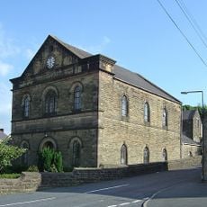
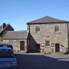
Wingfield Manor, Medieval manor house ruins in South Wingfield, England.

Wingfield Manor is a medieval manor house ruin featuring two enclosed courtyards with multiple surviving structures. The most striking remains include a defensive tower reaching about 22 meters in height and the foundation traces of a large ceremonial hall.

Ralph Lord Cromwell, Treasurer of England, began construction of this manor in 1441 under King Henry VI. It later served as an important place of confinement during the 16th century for prisoners of note.

The place holds strong connections to Mary Queen of Scots, who spent years imprisoned within these walls under guard. Visitors can walk through the actual spaces where this significant chapter of English history unfolded.

The site sits within an active working farm and is currently closed to visitors due to ongoing structural repairs. Check local information before attempting a visit to confirm current access conditions.

The ruins contain one of England's earliest flushing toilets, installed in 1596 during a period of technical advancement. This feature reveals how forward-thinking sanitary engineering had become at a major estate of that era.

The community of curious travelers

AroundUs brings together thousands of curated places, local tips, and hidden gems, enriched daily by 60,000 contributors worldwide.

Start exploring
Location
GPS coordinates
53.08910,-1.44303
Latest update
December 7, 2025 20:41
Around this place
National Tramway Museum
United Kingdom

National Tramway Museum

2.9 km
Alfreton Hall
United Kingdom

Alfreton Hall

3.4 km
Church of St Mary
United Kingdom

Church of St Mary

2.6 km
All Saints' Church, South Wingfield
United Kingdom

All Saints' Church, South Wingfield

1.3 km
Church of St Matthew
United Kingdom

Church of St Matthew

2.7 km
Christ Church
United Kingdom

Christ Church

2.8 km
Crich Baptist Chapel
United Kingdom

Crich Baptist Chapel

2.5 km
Milepost At Entrance Gates To Park Lodge
United Kingdom

Milepost At Entrance Gates To Park Lodge

2.8 km
Sherwood Foresters Memorial Tower
United Kingdom

Sherwood Foresters Memorial Tower

3.1 km
Amber Mill Bridge (Spc8 61)
United Kingdom

Amber Mill Bridge (Spc8 61)

2.5 km
Crich Wesleyan Chapel And Attached Walls
United Kingdom

Crich Wesleyan Chapel And Attached Walls

2.6 km
Metropolitan Police Public Call Post At The National Tramway Museum
United Kingdom

Metropolitan Police Public Call Post At The National Tramway Museum

2.9 km
K1 Telephone Box At The National Tramway Museum
United Kingdom

K1 Telephone Box At The National Tramway Museum

2.9 km
Wingfield Hall
United Kingdom

Wingfield Hall

285 m
Milepost
United Kingdom

Milepost

1.6 km
Crich Stand Tower
United Kingdom

Crich Stand Tower

3.1 km
Penfold post box at the National Tramway Museum
United Kingdom

Penfold post box at the National Tramway Museum

2.9 km
Wingfield Tunnel North Portal
United Kingdom

Wingfield Tunnel North Portal

1.9 km
South Wingfield Footpath Bridge (Spc8 56)
United Kingdom

South Wingfield Footpath Bridge (Spc8 56)

1.2 km
Railway Bridge To The South East Of Dale Bridge
United Kingdom

Railway Bridge To The South East Of Dale Bridge

2 km
Milepost To The West Of The Junction Of Chesterfield Road And Wood Lane
United Kingdom

Milepost To The West Of The Junction Of Chesterfield Road And Wood Lane

2.9 km
Milepost 20 Metres South East Of The Former Rising Sun Public House
United Kingdom

Milepost 20 Metres South East Of The Former Rising Sun Public House

2.5 km
Milepost At Sk 369 522
United Kingdom

Milepost At Sk 369 522

2.7 km
Railway Bridge To The West Of Weirmill Bridge
United Kingdom

Railway Bridge To The West Of Weirmill Bridge

1.2 km
Railway Bridge South Of South Wingfield Stationmaster's House
United Kingdom

Railway Bridge South Of South Wingfield Stationmaster's House

1.4 km
Milepost, bottom of hill, NE of Crich village
United Kingdom

Milepost, bottom of hill, NE of Crich village

2 km
Milestone, Chase Cliff
United Kingdom

Milestone, Chase Cliff

3.3 km
Milepost, S of Toadhole Furnace
United Kingdom

Milepost, S of Toadhole Furnace

2.2 km
Show the full map
« Wingfield Manor - Medieval manor house ruins in South Wingfield, England » is provided by Around Us (aroundus.com). Images and texts are derived from Wikimedia project under a Creative Commons license. You are allowed to copy, distribute, and modify copies of this page, under the conditions set by the license, as long as this note is clearly visible.

Discover hidden gems everywhere you go!

From secret cafés to breathtaking viewpoints, skip the crowded tourist spots and find places that match your style. Our app makes it easy with voice search, smart filtering, route optimization, and insider tips from travelers worldwide. Download now for the complete mobile experience.

Around Us App Screenshot

A unique approach to discovering new places

Le Figaro

All the places worth exploring

France Info

A tailor-made excursion in just a few clicks

20 Minutes

Around Us
Travel Guide & Maps
Download

Send to your phone

QR Code
1

Open the camera app on your mobile.

2

Point at the QR code with your camera. A notification will appear.

3

Tap the notification to open the link.