Enable Location

We need your location to show you interesting places around you

Discover nearby places

Find interesting locations and hidden gems around you

Precise directions

Get accurate directions and distances to places

Your location is never shared with other users. It's only used when you tap the location button.

Log in to your account

Start exploring — it's free

Trusted by 68,736 travelers worldwide

Continue with Google
Continue with Apple
or

We will send you a code to connect

By continuing, you accept our Terms and Conditions and our Privacy Policy

Check your inbox

We've sent a pincode in your inbox. Please enter the code below.

Wood Farm
Discussion Reviews Photo
39.1k Popularity

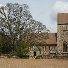
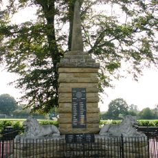
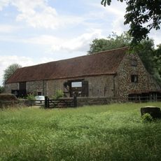
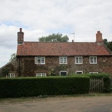
Wood Farm, Agricultural land at Sandringham Estate, England.

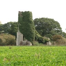
Wood Farm is agricultural land on the Sandringham Estate in Norfolk, used for crop production and livestock farming. The property forms part of a larger royal estate that covers thousands of hectares across the region.

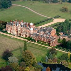
The Sandringham Estate was acquired by King Edward VII in 1862 as a royal country residence. The farming operations developed over time into a functioning agricultural business with contemporary management practices.

The farm participates in the Duke of Edinburgh Award program, providing agricultural education and hands-on experience to young participants learning about farming.

The location is part of a private estate with limited public access. Visitors can explore the outer areas of the Sandringham Estate where certain pathways offer views across the farming areas.

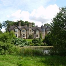
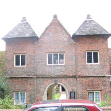
Prince Philip used the connected farmhouse as his residence after stepping back from public duties, creating a new chapter for the location. This change of purpose gave the farm added significance in the life of the modern royal family.

The community of curious travelers

AroundUs brings together thousands of curated places, local tips, and hidden gems, enriched daily by 60,000 contributors worldwide.

Start exploring
Location
GPS coordinates
52.82290,0.45580
Latest update
December 17, 2025 09:19
Around this place
Sandringham House
United Kingdom

Sandringham House

4 km
York Cottage
United Kingdom

York Cottage

4.1 km
St Mary Magdalene Church, Sandringham
United Kingdom

St Mary Magdalene Church, Sandringham

3.6 km
Castle Rising Castle
United Kingdom

Castle Rising Castle

3.5 km
Snettisham RSPB reserve
United Kingdom

Snettisham RSPB reserve

3.9 km
Sandringham Museum & Stables Tearoom
United Kingdom

Sandringham Museum & Stables Tearoom

4.2 km
Church of All Saints
United Kingdom

Church of All Saints

3.9 km
Ruins of castle and eleventh century church
United Kingdom

Ruins of castle and eleventh century church

3.5 km
Church of St Peter and St Paul
United Kingdom

Church of St Peter and St Paul

4.1 km
Church of St Nicholas
United Kingdom

Church of St Nicholas

4.5 km
Church of St Peter
United Kingdom

Church of St Peter

349 m
Church of St Lawrence
United Kingdom

Church of St Lawrence

3.2 km
Sandringham War Memorial
United Kingdom

Sandringham War Memorial

3.6 km
Wolferton Station Downside
United Kingdom

Wolferton Station Downside

826 m
Lamp Post At Tf 6660 2473 Circa 50 Metres North West Of Barn At Castle Farm
United Kingdom

Lamp Post At Tf 6660 2473 Circa 50 Metres North West Of Barn At Castle Farm

3.3 km
Wolferton Station Signal Box
United Kingdom

Wolferton Station Signal Box

768 m
Dersingham War Memorial
United Kingdom

Dersingham War Memorial

4.3 km
K6 Telephone Kiosk At Tf 6663 2475
United Kingdom

K6 Telephone Kiosk At Tf 6663 2475

3.3 km
Barns At Castle Farm Circa 150 Metres South Of Church Of St Laurence
United Kingdom

Barns At Castle Farm Circa 150 Metres South Of Church Of St Laurence

3.3 km
Lamp Post At Tf 6666 2473 Circa 20 Metres North Of Barn At Castle Farm
United Kingdom

Lamp Post At Tf 6666 2473 Circa 20 Metres North Of Barn At Castle Farm

3.3 km
Trinity Hospital (hospital Of The Holy And Undivided Trinity) And Attached Enclosing Walls, Circa 30 Metres East Of Church Of St
United Kingdom

Trinity Hospital (hospital Of The Holy And Undivided Trinity) And Attached Enclosing Walls, Circa 30 Metres East Of Church Of St

3.2 km
20 And 21, Low Road
United Kingdom

20 And 21, Low Road

3.1 km
Market Cross
United Kingdom

Market Cross

3.2 km
Butler's Cross
United Kingdom

Butler's Cross

2.5 km
St Felix's Church, Babingley
United Kingdom

St Felix's Church, Babingley

2 km
Milestone, roadside at TF6758228356
United Kingdom

Milestone, roadside at TF6758228356

2.1 km
Milestone, roadside at TF6747026830
United Kingdom

Milestone, roadside at TF6747026830

2.2 km
Milestone, 6yds S of village sign at jct with Heath Rd
United Kingdom

Milestone, 6yds S of village sign at jct with Heath Rd

3.5 km
Show the full map
Reviews
Share your experience

No review yet

Discussions
Start a discussion...

No discussion yet

« Wood Farm - Agricultural land at Sandringham Estate, England » is provided by Around Us (aroundus.com). Images and texts are derived from Wikimedia project under a Creative Commons license. You are allowed to copy, distribute, and modify copies of this page, under the conditions set by the license, as long as this note is clearly visible.

Discover hidden gems everywhere you go!

From secret cafés to breathtaking viewpoints, skip the crowded tourist spots and find places that match your style. Our app makes it easy with voice search, smart filtering, route optimization, and insider tips from travelers worldwide. Download now for the complete mobile experience.

Around Us App Screenshot

A unique approach to discovering new places

Le Figaro

All the places worth exploring

France Info

A tailor-made excursion in just a few clicks

20 Minutes

Around Us
Travel Guide & Maps
Download

Send to your phone

QR Code
1

Open the camera app on your mobile.

2

Point at the QR code with your camera. A notification will appear.

3

Tap the notification to open the link.