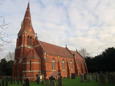
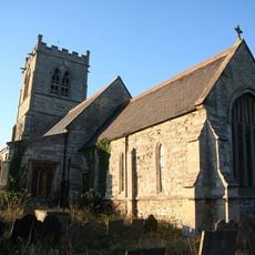
All Saints' Church, Winthorpe, Parish church in Winthorpe, England
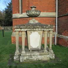
All Saints' Church in Winthorpe is a parish church completed in 1888, built from red Walkeringham brick with Ancaster stone detailing. The building features a prominent tower containing multiple bells and is accessed through gate piers that are separately listed.
The current church was built in 1888, replacing two earlier churches that once stood on the same site, with the oldest dating to the 13th century. This represents a long continuity of religious building at this location spanning over 600 years.
This church serves as a gathering place for worship and community life in the village. It belongs to a larger network of eleven parishes in the region that work together as the East Trent Group of Churches.
The church is easy to locate thanks to its distinctive gate piers at the entrance and hosts regular worship services plus community events throughout the year. Visitors should plan to arrive during service times or check ahead for special events and opening hours.
During excavations for the 1888 construction, workers uncovered gunpowder remains and rows of skeletons without coffins dating to the English Civil War period. This surprising discovery reveals that intense conflict once touched this quiet village location centuries ago.
Location: Winthorpe
Inception: 1888
Architects: Sidney Gambier-Parry
GPS coordinates: 53.09827,-0.78865
Latest update: December 14, 2025 17:43
Newark Air Museum
2.1 km
Langford Hall
1.6 km
St. Leonard's Church, Newark
1.3 km
Winthorpe Bridge
763 m
St. Wilfrid's Church, South Muskham
2 km
Smeaton's Arches
2.3 km
Winthorpe Hall
216 m
Newark Dyke Bridge
1.3 km
Alishaan Restaurant
2 km
Jubilee Bridge, Newark-on-Trent
2.3 km
The Old Malt Shovel Public House
2.4 km
Fiddler's Elbow Bridge, Newark
1.6 km
Muskham Railway Viaduct
1.3 km
Muskham Bridge
2.4 km
27, 29, 31, Northgate
2.4 km
38, Northgate
2.5 km
Shalem House The Friary 1 To 4
2.5 km
Handley House And Adjoining Former House To Left
2.6 km
Northgate House And Adjoining Boundary Wall
2.6 km
Village Cross
444 m
Number 35 And Adjoining Malthouse, Kiln And Stable
2.4 km
47 And 49, Appleton Gate
2.6 km
Thompson Tomb In Church Of All Saints, Church Yard, 15 Feet South Of Baptistry
25 m
Midland Railway Viaduct
1.6 km
Langford medieval village, including moat and open field system, 450m north west of Elmtree Farm
2.5 km
Civil War town defences within the Friary Garden
2.5 km
A46 Nether Lock Viaduct
1.5 km
Dial House
409 mVisited this place? Tap the stars to rate it and share your experience / photos with the community! Try now! You can cancel it anytime.
Discover hidden gems everywhere you go!
From secret cafés to breathtaking viewpoints, skip the crowded tourist spots and find places that match your style. Our app makes it easy with voice search, smart filtering, route optimization, and insider tips from travelers worldwide. Download now for the complete mobile experience.
A unique approach to discovering new places❞
— Le Figaro
All the places worth exploring❞
— France Info
A tailor-made excursion in just a few clicks❞
— 20 Minutes