Enable Location

We need your location to show you interesting places around you

Discover nearby places

Find interesting locations and hidden gems around you

Precise directions

Get accurate directions and distances to places

Your location is never shared with other users. It's only used when you tap the location button.

St Robert's Church

Log in to your account

Start exploring — it's free

Trusted by 61,782 travelers worldwide

Continue with Google
Continue with Apple
or

We will send you a code to connect

By continuing, you accept our Terms and Conditions and our Privacy Policy

Check your inbox

We've sent a pincode in your inbox. Please enter the code below.

St Robert's Church

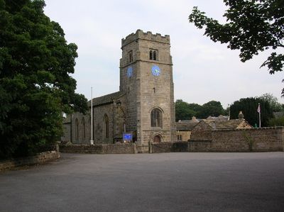
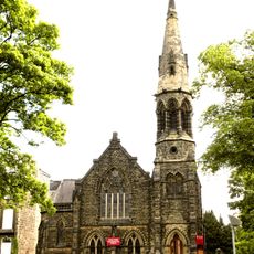
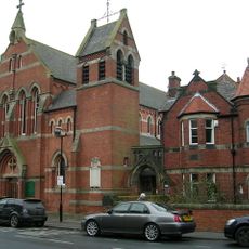
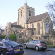
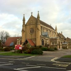
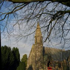
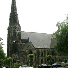
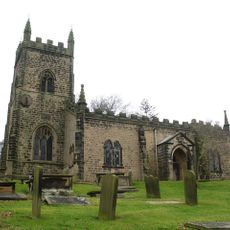
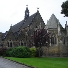
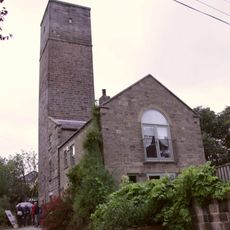
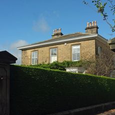
St Robert's Church, Medieval church in Pannal, England.

Description

St Robert's Church is a medieval religious building in Pannal featuring stone walls, traditional stained glass windows, and architectural details from that era. The structure displays period-appropriate construction methods and materials visible throughout its interior and exterior.

History

The church was founded in 1301 and has remained at this location throughout centuries. It has continuously served the local parish for more than seven hundred years.

Culture

The church serves as a gathering place where locals come together for worship and community celebrations throughout the year. It remains central to the religious and social fabric of the surrounding area.

Practical

The church is located in the Pannal suburb and is open to visitors interested in attending services or exploring the interior. It is helpful to be aware of active worship times, as these take priority.

Did you know?

The building holds Grade II* listed status, placing it among England's most protected structures due to its architectural and historical value. This designation means it is recognized as particularly important to the nation's heritage.

Inception
14 century
Architectural style
medieval architecture
GPS coordinates
53.96080,-1.53667
Latest update
December 13, 2025 11:44

AroundUs brings together thousands of curated places, local tips, and hidden gems, enriched daily by 60,000 contributors worldwide. Discover all places nearby (Pannal and Burn Bridge).

Around this place
RHS Garden Harlow Carr
United Kingdom

RHS Garden Harlow Carr

3.3 km
Rudding Park
United Kingdom

Rudding Park

3.2 km
Crimple Valley Viaduct
United Kingdom

Crimple Valley Viaduct

1.9 km
Tewit Well
United Kingdom

Tewit Well

2.7 km
West Park United Reformed Church, Harrogate
United Kingdom

West Park United Reformed Church, Harrogate

3.3 km
St. Robert's Church, Harrogate
United Kingdom

St. Robert's Church, Harrogate

3.2 km
St Mary's Church
United Kingdom

St Mary's Church

3.1 km
St. Mark's Church, Harrogate
United Kingdom

St. Mark's Church, Harrogate

2.4 km
Church of All Saints
United Kingdom

Church of All Saints

2.9 km
Trinity Methodist Church, Harrogate
United Kingdom

Trinity Methodist Church, Harrogate

2.8 km
Church of All Saints
United Kingdom

Church of All Saints

3.2 km
Roman Catholic Chapel Approximately 20 Metres North Of Rudding Park House
United Kingdom

Roman Catholic Chapel Approximately 20 Metres North Of Rudding Park House

3.2 km
Harrogate Library
United Kingdom

Harrogate Library

3.4 km
Harlow Hill Tower (Observatory)
United Kingdom

Harlow Hill Tower (Observatory)

3 km
Harlow Hill Water Tower
United Kingdom

Harlow Hill Water Tower

3 km
Boundary Stone At Ngr Se 300508
United Kingdom

Boundary Stone At Ngr Se 300508

1.1 km
Boundary Stone Of Former Knaresborough Forest
United Kingdom

Boundary Stone Of Former Knaresborough Forest

358 m
29 And 29A, York Place
United Kingdom

29 And 29A, York Place

3.2 km
Boundary Stone, Kirkby Overblow And Rigton Parishes
United Kingdom

Boundary Stone, Kirkby Overblow And Rigton Parishes

1.7 km
Boundary Stone At Wareholes Well, Approximately 30 Metres From Road Side
United Kingdom

Boundary Stone At Wareholes Well, Approximately 30 Metres From Road Side

2.3 km
Milestone, The Stray, opp. "Muckles"
United Kingdom

Milestone, The Stray, opp. "Muckles"

3.2 km
Boundary Stone Next To Lane End Farm
United Kingdom

Boundary Stone Next To Lane End Farm

3.3 km
Boundary Marker At Ngr Se 303500
United Kingdom

Boundary Marker At Ngr Se 303500

1.7 km
Mile Post At Ngr  Se 329530
United Kingdom

Mile Post At Ngr Se 329530

2.7 km
Boundary Stone Approximately 200 Metres East Of Low Snape Farmhouse
United Kingdom

Boundary Stone Approximately 200 Metres East Of Low Snape Farmhouse

2.3 km
Milestone, Otley Road, Harlow Hill, Harrogate
United Kingdom

Milestone, Otley Road, Harlow Hill, Harrogate

2.8 km
Milestone, Otley Road, Harlow Hill, Harrogate opp No. 125
United Kingdom

Milestone, Otley Road, Harlow Hill, Harrogate opp No. 125

2.7 km
Milestone, Leeds Road, nr Firs Avenue
United Kingdom

Milestone, Leeds Road, nr Firs Avenue

1.6 km
Show the full map
« St Robert's Church - Medieval church in Pannal, England » is provided by Around Us (aroundus.com). Images and texts are derived from Wikimedia project under a Creative Commons license. You are allowed to copy, distribute, and modify copies of this page, under the conditions set by the license, as long as this note is clearly visible.

Discover hidden gems everywhere you go!

From secret cafés to breathtaking viewpoints, skip the crowded tourist spots and find places that match your style. Our app makes it easy with voice search, smart filtering, route optimization, and insider tips from travelers worldwide. Download now for the complete mobile experience.

Around Us App Screenshot

A unique approach to discovering new places

Le Figaro

All the places worth exploring

France Info

A tailor-made excursion in just a few clicks

20 Minutes

Around Us
Travel Guide & Maps
Download

Send to your phone

QR Code
1

Open the camera app on your mobile.

2

Point at the QR code with your camera. A notification will appear.

3

Tap the notification to open the link.