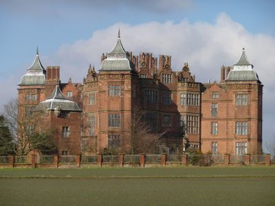
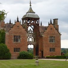
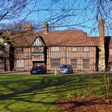
Westwood House, Grade I listed building in Westwood, England.
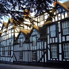
Westwood House is a Grade I listed building featuring a square central section with four projecting wings and large bay windows across its three-story facade. The structure has been divided into twelve apartments while preserving its original architectural character.
The house began as an Elizabethan banqueting hall around 1600 before receiving architectural additions during the Caroline period. It later served as a refuge for Royalist supporters during the English Civil War in the 1600s.
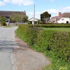
The house sits within Westwood Park, a registered historic landscape that shapes how visitors experience the surrounding grounds. The setting reinforces the connection between the building and its parkland heritage.
The building is now residential and divided into private apartments, so access to the interior is not available to visitors. You can view the exterior and surrounding parkland from public pathways in the area.
The four extending wings reflect deliberate Caroline-era additions to the original Elizabethan core, making the building a record of two different periods merged into one structure. This layering of architectural styles happened over the course of the 1600s without major reconstruction.
Location: Westwood
GPS coordinates: 52.27360,-2.18370
Latest update: December 10, 2025 16:25
Church of the Sacred Heart and St Catherine of Alexandria
2.5 km
Bowling Green Inn
2.3 km
Town Hall
2.4 km
The Venture Inn
3.1 km
Church of St Augustine
2.6 km
Church of St Peter
3 km
Church of St Michael, Salwarpe
1.9 km
Church of St Mary, Hampton Lovett
2.1 km
Church of St Mary
2.6 km
Church of St Andrew
2.5 km
Star And Garter Inn
2.5 km
King's Arms Public House
3.1 km
Raven Hotel
2.4 km
Talbot Hotel
2.5 km
73-77, Friar Street
2.3 km
Crown And Sandys Arms
3.1 km
2, Hanbury Road
2.8 km
Roman fort, Saxon church and medieval hospital at Dodderhill
2.7 km
Nos 1 And 2 The Gatehouse About 50 Yards East Of Westwood House
60 m
Barn About 30 Yards South-West Of Walnut Tree Farmhouse
3 km
43, High Street
2.5 km
Salwarpe Court
1.9 km
Salwarpe War Memorial
2 km
Droitwich War Memorial Stone
2.4 km
Milestone, Bromsgrove Road, Hill End, N of Dodderhill Road jct
2.9 km
Nos. 31-35 (odd) High Street, Droitwich
2.5 km
Milestone, N of Frenth Cottages, 30yds S of turning to Hampton Farm;
2.3 km
Milestone, Worcester Roadnr jct with Westwood Avenue, Witton
2.5 kmVisited this place? Tap the stars to rate it and share your experience / photos with the community! Try now! You can cancel it anytime.
Discover hidden gems everywhere you go!
From secret cafés to breathtaking viewpoints, skip the crowded tourist spots and find places that match your style. Our app makes it easy with voice search, smart filtering, route optimization, and insider tips from travelers worldwide. Download now for the complete mobile experience.
A unique approach to discovering new places❞
— Le Figaro
All the places worth exploring❞
— France Info
A tailor-made excursion in just a few clicks❞
— 20 Minutes