Lupton, Brixham

Log in to your account

AroundUs is a community-driven map of interesting places, built by curious explorers like you. It grows with every review, story, and photo you share.
Connect to save your favorite spots, contribute locations, and create personalized routes.
Continue with Google
Continue with Apple
Continue with X
Continue with Facebook
Continue with email
By continuing, you accept our Terms and Conditions and our Privacy Policy
Create an account
Add to collection
Map
Suggest a change
Share

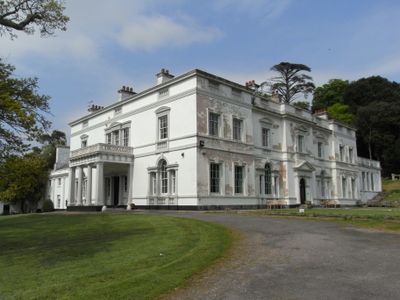
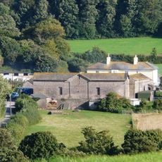
Lupton, Brixham, Grade II* listed manor house in Brixham, England.

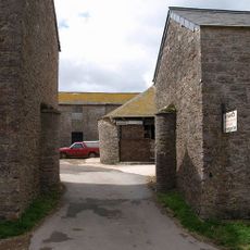
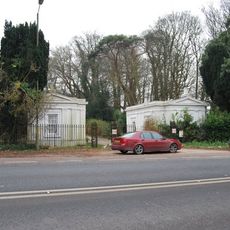
Lupton House is a manor set within large wooded grounds featuring formal gardens and sections with Italianate architectural design. The property spans approximately 108 hectares of varied landscape surrounding the main building.

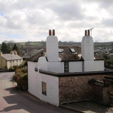
The house was built in the 1770s by Charles II Hayne, Sheriff of Devon, and later reshaped. During the 1840s, Sir John Yarde-Buller oversaw neo-classical modifications to the structure.

The house serves as a community gathering space where concerts, workshops, and local group meetings take place regularly. The rooms show how a private residence transformed into a place where people come together and experience events.

The Coach House Cafe on the grounds operates during the week and provides refreshments along with complimentary parking for visitors. It is best to arrive during daytime hours when facilities are open and the grounds can be fully explored.

A major fire in 1926 led to the house being rebuilt without its original third floor, yet it retained its Grade II* listed status when designated in 1949. This loss and preservation together tell the story of how the building overcame significant damage.

Location: Torbay

GPS coordinates: 50.38470,-3.54490

Latest update: December 11, 2025 11:09

Photos
Around this place
Elberry Cove
United Kingdom

Elberry Cove

2 km
Churston Court Inn
United Kingdom

Churston Court Inn

1.4 km
Church of St Mary the Virgin
United Kingdom

Church of St Mary the Virgin

1.9 km
Church of St Mary the Virgin
United Kingdom

Church of St Mary the Virgin

1.4 km
Weary Ploughman Public House
United Kingdom

Weary Ploughman Public House

1.5 km
Chapel of the Good Shepherd
United Kingdom

Chapel of the Good Shepherd

1.8 km
Watermans Arms Public House
United Kingdom

Watermans Arms Public House

1.8 km
Galmpton Windmill
United Kingdom

Galmpton Windmill

2.2 km
Elberry Farmhouse
United Kingdom

Elberry Farmhouse

2.1 km
Kennels To Lupton House
United Kingdom

Kennels To Lupton House

1 km
Sunpark
United Kingdom

Sunpark

1.5 km
Gatehouse And Gates Approximately 20 Metres West North West Of Church Of St Mary The Virgin
United Kingdom

Gatehouse And Gates Approximately 20 Metres West North West Of Church Of St Mary The Virgin

1.8 km
Milestone At Sx 8846 5627
United Kingdom

Milestone At Sx 8846 5627

2.2 km
Tollgate House
United Kingdom

Tollgate House

1.3 km
Vale House
United Kingdom

Vale House

1.8 km
Alston Farmhouse, Including Front Garden Wall And Gate
United Kingdom

Alston Farmhouse, Including Front Garden Wall And Gate

590 m
Milepost Plaque At Sx 913 554
United Kingdom

Milepost Plaque At Sx 913 554

1.1 km
Hill House Nursing Home Including Front Wall And Gate Piers
United Kingdom

Hill House Nursing Home Including Front Wall And Gate Piers

1.6 km
West Terrace
United Kingdom

West Terrace

832 m
Churchyard Wall And Gates On South And East Sides Of Church Of St Mary The Virgin
United Kingdom

Churchyard Wall And Gates On South And East Sides Of Church Of St Mary The Virgin

1.4 km
47, Milton Street
United Kingdom

47, Milton Street

1.5 km
Milestone Approximately 440 Metres South West Of Pennhill
United Kingdom

Milestone Approximately 440 Metres South West Of Pennhill

1.7 km
Farm Buildings To North East And North West Of Elberry Farmhouse Including Walls, Gates And Piers
United Kingdom

Farm Buildings To North East And North West Of Elberry Farmhouse Including Walls, Gates And Piers

2.1 km
The Old Smithy, Including Front Garden Wall, Railing, Gate And Gate Piers
United Kingdom

The Old Smithy, Including Front Garden Wall, Railing, Gate And Gate Piers

813 m
Nos 1 And 2 Including Gate Piers And Garden Wall Facing Brixham Road
United Kingdom

Nos 1 And 2 Including Gate Piers And Garden Wall Facing Brixham Road

796 m
Cart Shed Immediately North East Of Elberry Farmhouse
United Kingdom

Cart Shed Immediately North East Of Elberry Farmhouse

2.1 km
Lodges, Gates, Flanking Walls And Railings At North Entrance To Gramercy Hall School
United Kingdom

Lodges, Gates, Flanking Walls And Railings At North Entrance To Gramercy Hall School

614 m
4, The Roundings
United Kingdom

4, The Roundings

1.9 km
Show the full map
Reviews

Visited this place? Tap the stars to rate it and share your experience / photos with the community! Try now! You can cancel it anytime.

« Lupton, Brixham - Grade II* listed manor house in Brixham, England » is provided by Around Us (aroundus.com). Images and texts are derived from Wikimedia project under a Creative Commons license. You are allowed to copy, distribute, and modify copies of this page, under the conditions set by the license, as long as this note is clearly visible.

Discover hidden gems everywhere you go!

From secret cafés to breathtaking viewpoints, skip the crowded tourist spots and find places that match your style. Our app makes it easy with voice search, smart filtering, route optimization, and insider tips from travelers worldwide. Download now for the complete mobile experience.

Around Us App Screenshot

A unique approach to discovering new places

Le Figaro

All the places worth exploring

France Info

A tailor-made excursion in just a few clicks

20 Minutes