Chest opened
+${chestReward.xp} XP
Explorer
NOUVEAU ×${chestReward.collectible.quantity}
tapez pour fermer
Chest locked

Open chests in the app

Around Us is built for your phone — chests unlock when you walk, explore and capture nearby places.

Enable Location

We need your location to show you interesting places around you

Discover nearby places

Find interesting locations and hidden gems around you

Precise directions

Get accurate directions and distances to places

Your location is never shared with other users. It's only used when you tap the location button.

Wey and Godalming Navigations

Log in to your account

Start exploring — it's free

Trusted by 72,977 travelers worldwide

Continue with Google
Continue with Apple
or

We will send you a code to connect

By continuing, you accept our Terms and Conditions and our Privacy Policy

Check your inbox

We've sent a pincode in your inbox. Please enter the code below.

Wey and Godalming Navigations
Discussion Reviews 1 Photos
10.3k Popularity

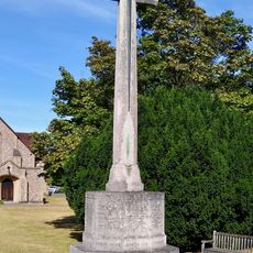
Wey and Godalming Navigations, Historic waterway system in Surrey, England.

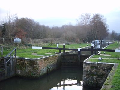
The Wey and Godalming Navigations is a canal system in Surrey that runs from the River Thames near Weybridge to Godalming. The network includes multiple locks and accommodates various types of vessels along its length.

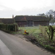
The waterway was developed starting in the 17th century as a trade route to bring goods to the region. Later expansions strengthened its role as an important transport link for the local economy.

Dapdune Wharf serves as the National Trust center along the waterway and tells the story of how goods once moved by boat through the region. The site reflects the importance this route held for trade and local life in past centuries.

The system is usable by boaters with different types of vessels, but certain points require advance planning. It helps to check conditions and any required permissions before setting out on the water.

Many of the original mechanical features from the 17th century still work today and can be observed by visitors. These preserved structures offer a rare glimpse into historical engineering techniques.

The community of curious travelers

AroundUs brings together thousands of curated places, local tips, and hidden gems, enriched daily by 60,000 contributors worldwide.

Start exploring
Location
GPS coordinates
51.33190,-0.48772
Latest update
December 10, 2025 15:54
Around this place
Brooklands Museum
United Kingdom

Brooklands Museum

2.8 km
Byfleet Manor
United Kingdom

Byfleet Manor

1.7 km
Mercedes-Benz World
United Kingdom

Mercedes-Benz World

2.7 km
Newark Priory
United Kingdom

Newark Priory

2.9 km
London Bus Museum
United Kingdom

London Bus Museum

2.8 km
G-BBDG
United Kingdom

G-BBDG

3.1 km
Foxwarren Park
United Kingdom

Foxwarren Park

2.5 km
RHS Garden, Wisley
United Kingdom

RHS Garden, Wisley

2.3 km
Entrance Walls And Gate Piers To Byfleet Manor House
United Kingdom

Entrance Walls And Gate Piers To Byfleet Manor House

1.6 km
St Nicholas's Church, Pyrford
United Kingdom

St Nicholas's Church, Pyrford

2.5 km
Wisley Church
United Kingdom

Wisley Church

713 m
Church of St John the Baptist
United Kingdom

Church of St John the Baptist

1.3 km
Church of St Mary the Virgin
United Kingdom

Church of St Mary the Virgin

841 m
Brooklands Industrial Park Building Ti20 (Former Aero Control Tower)
United Kingdom

Brooklands Industrial Park Building Ti20 (Former Aero Control Tower)

1.9 km
Pyrford War Memorial
United Kingdom

Pyrford War Memorial

2.5 km
All Saints Church
United Kingdom

All Saints Church

2.4 km
Millstream House  Ockham Mill
United Kingdom

Millstream House Ockham Mill

2.4 km
Old School House
United Kingdom

Old School House

1.3 km
The Arch
United Kingdom

The Arch

2.5 km
The Clubhouse, Brooklands Museum
United Kingdom

The Clubhouse, Brooklands Museum

3 km
Brooklands motor racing circuit, remains of the pre-World War II aerodrome, World War II Bofors tower and shelters, and the Brooklands memorial
United Kingdom

Brooklands motor racing circuit, remains of the pre-World War II aerodrome, World War II Bofors tower and shelters, and the Brooklands memorial

2.5 km
Byfleet War Memorial
United Kingdom

Byfleet War Memorial

1 km
Barn 5 Yards West Of Wheelers Farm House
United Kingdom

Barn 5 Yards West Of Wheelers Farm House

2.5 km
West Byfleet War Memorial
United Kingdom

West Byfleet War Memorial

1.3 km
The Pyrford Stone
United Kingdom

The Pyrford Stone

2.2 km
Milestone, S of jct with M25 on slip road (Old Lane)
United Kingdom

Milestone, S of jct with M25 on slip road (Old Lane)

2.8 km
Milestone, Wisley Common near RHS Gardens, NE of footbridge, S bound carriageway
United Kingdom

Milestone, Wisley Common near RHS Gardens, NE of footbridge, S bound carriageway

2.7 km
Royal Horticultural Society Offices, Wisley Gardens
United Kingdom

Royal Horticultural Society Offices, Wisley Gardens

2.3 km
Show the full map
Reviews
Share your experience

No review yet

Discussions
Start a discussion...

No discussion yet

« Wey and Godalming Navigations - Historic waterway system in Surrey, England » is provided by Around Us (aroundus.com). Images and texts are derived from Wikimedia project under a Creative Commons license. You are allowed to copy, distribute, and modify copies of this page, under the conditions set by the license, as long as this note is clearly visible.

Discover hidden gems everywhere you go!

From secret cafés to breathtaking viewpoints, skip the crowded tourist spots and find places that match your style. Our app makes it easy with voice search, smart filtering, route optimization, and insider tips from travelers worldwide. Download now for the complete mobile experience.

Around Us App Screenshot

A unique approach to discovering new places

Le Figaro

All the places worth exploring

France Info

A tailor-made excursion in just a few clicks

20 Minutes

Around Us
Travel Guide & Maps
Download

Send to your phone

QR Code
1

Open the camera app on your mobile.

2

Point at the QR code with your camera. A notification will appear.

3

Tap the notification to open the link.