Middleton Hall, Country house in Middleton, England
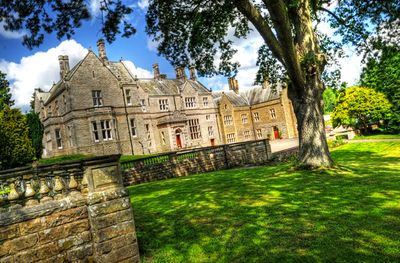
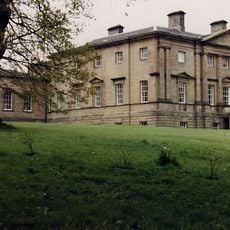
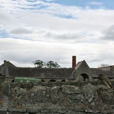
Middleton Hall is an English country house with a Georgian west wing from the late 18th century, alongside older structures including a Tudor barn complex with a 16th-century jettied building. The estate sits beside two walled gardens that historically served both practical and ornamental purposes for the household.
The estate traces its roots to Norman times when it passed through aristocratic hands, with one family holding it for many centuries as their country seat. By the 17th century, resident naturalists and scholars brought recognition to the property through their work.
The name reflects the location in a middle valley, showing roots in medieval settlement patterns. The buildings and gardens reveal how wealthy families shaped their estates and lived across different periods.
The site is actively maintained by a restoration trust working to preserve the main buildings and garden areas. Visitors should be aware that ongoing restoration work may affect access to certain sections of the property.
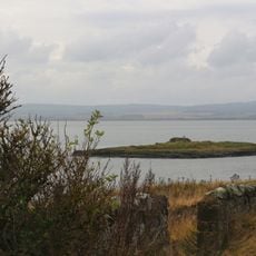
The estate includes one of the largest man-made lakes in the region, now bordering a nature reserve for birds and wildlife. Few visitors realize this water feature was originally created for very different reasons than conservation.
Location: Middleton
Website: http://exploremiddletonhall.co.uk
GPS coordinates: 55.61310,-1.85139
Latest update: December 14, 2025 16:43
Lindisfarne War Memorial
6.9 km
Belford Hall
2.1 km
Westhall
1.7 km
Colour Heugh and Bowden Doors
3.7 km
Guile Point East Alignment Beacon/ Lighthouse
6.2 km
Heugh Hill Lighthouse
6.9 km
Guile Point West mark
6.1 km
Church of St Mary, Belford
2.1 km
Church of St Nicholas
6.5 km
The Blue Bell Hotel
2.1 km
Sutton (?) Memorial c.25 yards south-west of Church of St Mary
7 km
Spindlestone Ducket
5.6 km
Fenham Castle
5.3 km
Milepost Circa 100 Yards South Of Junction With B6348
6.1 km
Farmbuildings Circa 50 Yards East Of Spindlestone Farmhouse
6.1 km
Medieval chapel and associated building on St Cuthbert's Isle
6.7 km
Kyloe Hills promontory fort
5.4 km
Navigation beacons at north end of Ross Links
6.1 km
Buckton Dovecote
3.4 km
Belford Station
3.6 km
Boundary cross 170m south west of Herring House
7 km
Market Cross In Front Of Blue Bell Hotel
2.1 km
38-46, High Street
2.3 km
Milepost At Kyloe Vicarage
6.1 km
Buckton Moor North camp
4.1 km
Milepost, 14m S of Meadows Farm entrance
2.9 km
Milepost, Middleton
683 m
Milepost, North Bank
1.5 kmVisited this place? Tap the stars to rate it and share your experience / photos with the community! Try now! You can cancel it anytime.
Discover hidden gems everywhere you go!
From secret cafés to breathtaking viewpoints, skip the crowded tourist spots and find places that match your style. Our app makes it easy with voice search, smart filtering, route optimization, and insider tips from travelers worldwide. Download now for the complete mobile experience.
A unique approach to discovering new places❞
— Le Figaro
All the places worth exploring❞
— France Info
A tailor-made excursion in just a few clicks❞
— 20 Minutes