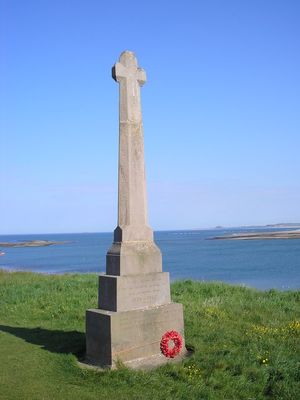
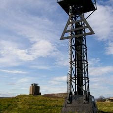
Lindisfarne War Memorial, War memorial in Holy Island, England
Lindisfarne War Memorial is a stone monument standing on The Heugh, a small rise on Holy Island, with names of fallen soldiers carved into its base stones. The shaft tapers upward with short crossed arms near the top, built from locally quarried pink stone that has weathered the coastal winds for more than a century.
The memorial was unveiled in 1922 and initially carried names of those who died in the First World War, with Second World War casualties added later. Winter storms in the 1980s caused significant damage that required repairs to restore the structure.
Sir Edwin Lutyens, who designed the memorial, applied the same architectural principles he used for the Cenotaph in London and other national monuments.
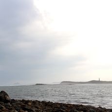
The memorial sits on an exposed rise where coastal winds are strong, so dress appropriately for the island weather whatever the season. The monument is always accessible, though reaching the island itself depends on tides, so plan your visit with local tide schedules in mind.
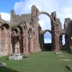
The memorial was designed by Edwin Lutyens, the architect behind London's famous Cenotaph. Its location on the island creates a visual line connecting the monument with the castle and priory ruins that rise in the distance.
Location: Holy Island
Official opening: June 4, 1922
Made from material: dimension stone
Address: The Heugh, Holy Island, Northumberland
GPS coordinates: 55.66826,-1.80067
Latest update: December 12, 2025 12:08
Lindisfarne Priory
101 m
Lindisfarne Castle
1 km
Lindisfarne National Nature Reserve
1 km
Guile Point East Alignment Beacon/ Lighthouse
1.2 km
Heugh Hill Lighthouse
68 m
Church of St Mary
135 m
Guile Point West mark
1.2 km
The Ship Inn
346 m
The Old Post Office
223 m
Lindisfarne Priory, Museum and Shop
184 m
Sutton (?) Memorial c.25 yards south-west of Church of St Mary
130 m
Sally's Gift Shop
320 m
Walled garden circa 400 yards north of Lindisfarne Castle
1 km
Navigation beacons at north end of Ross Links
1.2 km
Falkland House
314 m
Medieval chapel and associated building on St Cuthbert's Isle
331 m
Lindisfarne lime kilns
1.2 km
Boundary cross 170m south west of Herring House
81 m
House Occupied By Miss Wallace
281 m
Osborne's Fort
309 m
House Occupied By Miss Selby Sinton
263 m
The Iron Rails
347 m
Seaburn House
369 m
Cross base c.5 yards east of Church of St Mary
127 m
Farne View
298 m
`The Palace' medieval house and Tudor supply base, Holy Island village
317 m
North View
323 m
Links View
369 mVisited this place? Tap the stars to rate it and share your experience / photos with the community! Try now! You can cancel it anytime.
Discover hidden gems everywhere you go!
From secret cafés to breathtaking viewpoints, skip the crowded tourist spots and find places that match your style. Our app makes it easy with voice search, smart filtering, route optimization, and insider tips from travelers worldwide. Download now for the complete mobile experience.
A unique approach to discovering new places❞
— Le Figaro
All the places worth exploring❞
— France Info
A tailor-made excursion in just a few clicks❞
— 20 Minutes