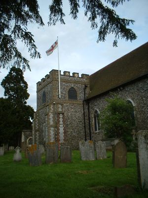
Church of All Saints, Orpington, Medieval church in Orpington, England
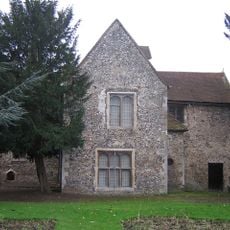
Church of All Saints is a medieval building in Orpington constructed with stone walls and flint rubble, with modern extensions added during the twentieth century. The complex includes the original church structure along with extensive parish rooms designed for community activities and gatherings.
The building began as a church in 1070, with later additions including a western doorway in the late 1100s and a northeastern tower in the 1200s. These gradual additions over several centuries show how the structure evolved to meet the needs of the parish.
The church serves as a gathering place where the community comes together for regular worship. Visitors can see objects that span centuries of spiritual life, including an Anglo-Saxon sundial and a stone baptismal font that connect the present day to past generations.
The site is located in a residential neighborhood and accessible by local transport. Visitors should check ahead since worship services follow a regular schedule and the church's opening times for visitors may vary accordingly.
A tomb recess inside holds the remains of Nicholas de Ystele, a rector from the 1300s who served the parish for many years. This burial site offers a direct link to the individual leaders who shaped the community's religious life across generations.
The community of curious travelers
AroundUs brings together thousands of curated places, local tips, and hidden gems, enriched daily by 60,000 contributors worldwide.