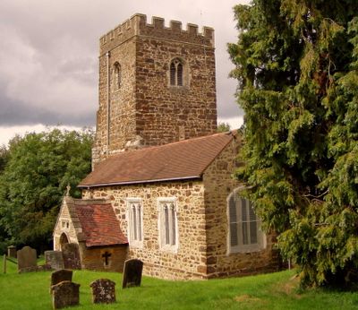
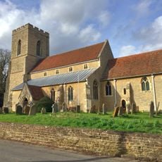
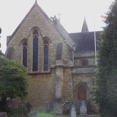
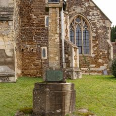
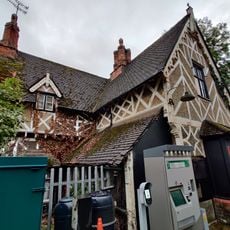
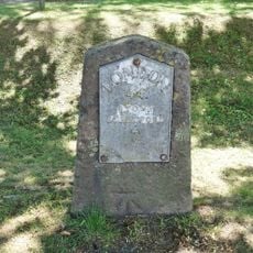
Church of All Saints, Medieval parish church in Bow Brickhill, United Kingdom
Church of All Saints is a medieval parish church located in the Buckinghamshire countryside near Milton Keynes, featuring stone walls and traditional architectural elements throughout its structure. The building stands as a focal point within the village landscape, displaying the solid construction typical of its period.
The church was established in medieval times as a parish place of worship and has continued serving the local population across many centuries. Its Grade II* listed status acknowledges its exceptional historical value to the architectural heritage of the region.
The church serves the local community as a gathering place for worship, celebrations, and village events that connect residents throughout the year.
The church grounds are accessible daily for exploration from outside, while entry to the interior requires visiting during scheduled services or arranging access through the local parish office. Planning ahead by contacting the church community ensures you can see the interior at a convenient time.
The stone walls display medieval construction techniques that reveal how craftsmen of the period shaped and fitted stones together with remarkable precision. These building methods, visible in the mortar patterns and joinery, are often overlooked but offer a tangible connection to medieval craftsmanship.
Location: Bow Brickhill
Website: http://bowbrickhill.com/church.html
GPS coordinates: 52.00060,-0.67371
Latest update: December 14, 2025 18:41
Church of St Mary
2.8 km
Bow Brickhill War Memorial
476 m
Wavendon Heath Ponds
2 km
Magiovinium
3 km
Church of St Mary Magdalen
2 km
Church of St Martin
2.9 km
Church of Saint Michael
2 km
The Red Lion Public House
2.8 km
Woburn Sands and Aspley Heath War Memorial
2.2 km
Little Brickhill War Memorial
2 km
Caldecotte Miniature Railway
2.6 km
59, Aylesbury Street
3 km
The Green Man Public House
1.9 km
60, Watling Street
3 km
Fenny Stratford Station Building
3 km
Lock View Pine View
2.8 km
Lock
2.8 km
49 And 51, Aylesbury Street
3 km
Bollards Along Raised Terrace Of Number 60
3 km
Fenny Lodge Former Stable Block To Fenny Lodge
2.9 km
48, Watling Street
2.9 km
11 And 13, Watling Street
2.9 km
Pump House
2.8 km
43, Aylesbury Street
3 km
Milestone, Watling Street; between river bridge and canal bridge, opp. Attic Restaurant
2.7 km
Milestone, north-bound carriageway, just before slip road to Little Brickhill
2.7 km
Milepost, Newport Road; by The Wavenden Arms (formally Leathern Bottle) PH
3 km
Milepost, Station Road; 100m SE of level crossing at Woburn Sands Railway Station
2.4 kmVisited this place? Tap the stars to rate it and share your experience / photos with the community! Try now! You can cancel it anytime.
Discover hidden gems everywhere you go!
From secret cafés to breathtaking viewpoints, skip the crowded tourist spots and find places that match your style. Our app makes it easy with voice search, smart filtering, route optimization, and insider tips from travelers worldwide. Download now for the complete mobile experience.
A unique approach to discovering new places❞
— Le Figaro
All the places worth exploring❞
— France Info
A tailor-made excursion in just a few clicks❞
— 20 Minutes