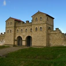
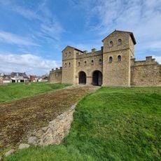
Clifford's Fort, Military fort in North Shields, England
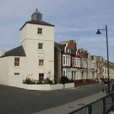
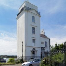
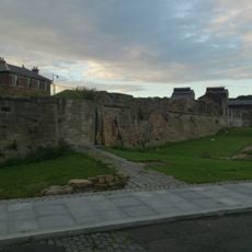
Clifford's Fort is a stone fortification at the mouth of the River Tyne featuring robust walls and a three-story redoubt designed for harbor protection. The site includes a riverside gun battery and now houses the Old Low Light Museum, which displays exhibits about maritime activities and coastal defense.
The fort was built in 1672 during the Anglo-Dutch Wars and initially held about 30 cannons for harbor defense. It operated under Tynemouth Castle's command until 1839, when it became independent as the port grew in importance.
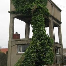
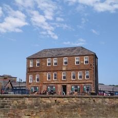
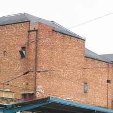
The site held significance as a fish processing hub, showing how military spaces became part of the working harbor. Visitors can observe the traces of this shift from defense to industry in the layout and structures that remain.
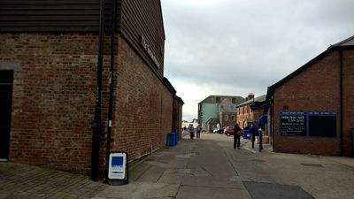
The site is easily accessible from the street and has mostly flat pathways that make it comfortable to explore. Plan time to visit the museum and walk around the structures to get a full sense of the place's layout and history.
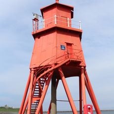
From 1888 to 1928 the fort served as headquarters for submarine miners who deployed underwater explosives to defend the harbor. This unusual use of the fortification shows how coastal defense adapted to new military technology.
Location: North Tyneside
GPS coordinates: 55.00980,-1.43348
Latest update: December 14, 2025 13:02
Arbeia South Shields Roman Fort
620 m
Tyne Turrets
668 m
Christ Church, North Shields
951 m
Tynemouth Town Hall
660 m
Arbeia, South Shields Roman Fort
642 m
Herd Groyne Light
558 m
Fish Quay Old Low Light
13 m
Fish Quay New Lighthouses
307 m
Old Lowlight Heritage Centre
31 m
Fish Quay Old High Light
224 m
Fish Quay High Light
307 m
Fish Quay Low Light
100 m
New Princes Theatre
978 m
Statue of Duke of Northumberland, South of Master Mariners' Homes
574 m
Church of St Augustin
626 m
Littlehaven Beach
899 m
Master Mariners' Homes
584 m
First World War Memorial Opposite Number 6
1 km
Piers And Walls To West And South Of Christ Church
979 m
South African War Memorial Opposite Number 2
1 km
Land Of Green Ginger Shopping Mall And Former Church Hall Adjoining On East
992 m
Clifford's Fort Trinity House Almshouses And Boundary Stone Attached
32 m
Main Passenger Building Of Tynemouth Old Railway Station
794 m
Ballard's Smoke House Clifford's Fort And Boundary Stones Attached
72 m
1, Howard Street
630 m
1-3, Tynemouth Terrace
888 m
Clifford's Fort South And East Wall Facing River
56 m
Milestone, North Shields, Albion Road, by Christ Church churchyard entrance
950 mVisited this place? Tap the stars to rate it and share your experience / photos with the community! Try now! You can cancel it anytime.
Discover hidden gems everywhere you go!
From secret cafés to breathtaking viewpoints, skip the crowded tourist spots and find places that match your style. Our app makes it easy with voice search, smart filtering, route optimization, and insider tips from travelers worldwide. Download now for the complete mobile experience.
A unique approach to discovering new places❞
— Le Figaro
All the places worth exploring❞
— France Info
A tailor-made excursion in just a few clicks❞
— 20 Minutes