
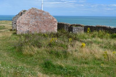
The Old Redoubt and later Victorian Rifle Range Target, 540m south west of Berry Head Fort
The Old Redoubt and later Victorian Rifle Range Target, 540m south west of Berry Head Fort, architectural structure in Brixham, Torbay, England, UK

Berry Head Lighthouse
803 m
Ash Hole Cavern
715 m
British Seaman’s Boys' Home
1.2 km
Berry Head House
661 m
Ranscombe House Hotel
1.2 km
Brixham War Memorial
1.2 km
Nos 18 And 20 Including Gate Piers On Street
1.2 km
Cod Rock
896 m
Ramparts, Counterscarp Revetment, Glacis, Musketry Wall Of Southern Fort
41 m
No 12 Including Front Area Wall And Railing
843 m
Gateway To Wolborough House
1 km
Napoleonic Fort Guardhouse, Approximately 30 Metres Inside Entrance To Northern Fort
411 m
Nos 39-49 Including Front Garden Walls And Railings
1.2 km
Board Of Ordnance Boundary Stone No 3 At Sx 9400 5615
153 m
Former Artillery Store Approximately 12 Metres West Of Coastguard Lookout In Northern Fort
626 m
Ruined Magazine And Blast Wall 1.8 Metres West Of Guardhouse, Southern Fort
44 m
Board Of Ordnance Boundary Stone No. 1 At Sx 9400 5595
236 m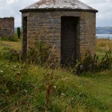
Sentry Box In Northern Fort, Approximately 3 Metres North Of Hm Coastguard Lookout
652 m
1, 2 And 3, Heath Road
1.3 km
Wolborough House
984 m
Hardy's Head Battery At Sx 9440 5675
548 m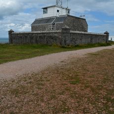
Hm Coastguard Lookout In Northern Fort Including Perimeter Wall
642 m
Nos 14-32 Including Front Garden Walls And Railings
807 m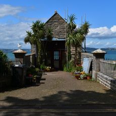
Hm Coastguard Rescue Station Including Walls, Piers, Railings At Front Approach
783 m
Slipway And Hard, Brixham Outer Harbour
1.1 km
Berry Head Fort and battery and Hardy's Head Battery
498 m
Ramparts, Revetments, North Battery Platform, North And South Musketry Walls Of Northern Fort
407 m
Nos 31, 33 And 35 Including Front Garden Wall
1.3 kmReviews
Visited this place? Tap the stars to rate it and share your experience / photos with the community! Try now! You can cancel it anytime.
Discover hidden gems everywhere you go!
From secret cafés to breathtaking viewpoints, skip the crowded tourist spots and find places that match your style. Our app makes it easy with voice search, smart filtering, route optimization, and insider tips from travelers worldwide. Download now for the complete mobile experience.

A unique approach to discovering new places❞
— Le Figaro
All the places worth exploring❞
— France Info
A tailor-made excursion in just a few clicks❞
— 20 Minutes