Harting Beacon: a hilltop enclosure, Anglo-Saxon burial mound and telegraph station on Beacon and Pen Hills
Harting Beacon: a hilltop enclosure, Anglo-Saxon burial mound and telegraph station on Beacon and Pen Hills, Archaeological site on Beacon Hill, West Sussex, England
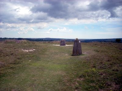
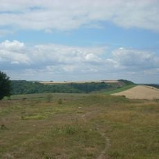
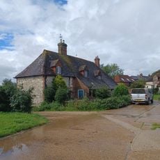
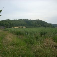
Harting Beacon is a fortified hilltop site in West Sussex featuring visible defensive ramparts and ditches spread across several hectares. The location contains remains of an 18th-century telegraph station and evidence of earlier structures that may have served as storage buildings.
Excavations from 1948 to 1952 uncovered evidence of Late Bronze Age fortifications at the site, while it was later reused as a telegraph station during the Georgian period. These layers show how the location was reoccupied and repurposed over thousands of years.
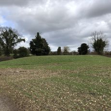
The Anglo-Saxon burial mound shows how burial practices and settlement patterns evolved in early medieval times. Visitors can observe how different periods are layered at this location.
The site is accessible through multiple walking paths from surrounding areas and provides good views across the landscape. Wear sturdy footwear as paths are uneven and the terrain spreads across hillsides.
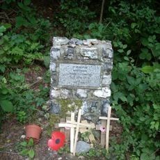
In February 1936, a Royal Air Force aircraft crashed on the site, killing three crew members. This event is now little known to most visitors, though it marks a silent memorial from that era.
Location: Elsted and Treyford
Location: Harting
GPS coordinates: 50.95820,-0.85230
Latest update: December 12, 2025 17:46
Uppark
2.8 km
Monkton House
2.5 km
Devil's Jumps
2 km
Vandalian Tower
2.2 km
Church of St Mary
2.1 km
The Parish Church of St Mary & St Gabriel, South Harting
2.6 km
The Ship Inn
2.5 km
Church of St Michael
4.3 km
Church of St Andrew
2.8 km
Church of St Peter
3.6 km
The Parish Church of St Mary
4.6 km
The Parish Church of St Paul
1.8 km
Ruins Of The Old Parish Church Of St Mary
1.8 km
Treyford Manor
1.8 km
The Old Inn
3.3 km
The Coach And Horses Public House
4.6 km
Kent House
1.8 km
Terwick Mill
4.6 km
Harting War Memorial
2.5 km
Hptm J. Oestermann Memorial, Treyford
1.9 km
The Stable Block At Up Park To The North West Of The House
2.8 km
Marden Farmhouse
1.5 km
Bevis's Thumb long barrow, 370m west of Fernbeds Farm
3.4 km
The Village Well Head And Pump
3.7 km
Torberry hillfort
3.4 km
Old Manor House
4.1 km
Treyford Manor Farmhouse
1.8 km
Brook House
1.8 kmVisited this place? Tap the stars to rate it and share your experience / photos with the community! Try now! You can cancel it anytime.
Discover hidden gems everywhere you go!
From secret cafés to breathtaking viewpoints, skip the crowded tourist spots and find places that match your style. Our app makes it easy with voice search, smart filtering, route optimization, and insider tips from travelers worldwide. Download now for the complete mobile experience.
A unique approach to discovering new places❞
— Le Figaro
All the places worth exploring❞
— France Info
A tailor-made excursion in just a few clicks❞
— 20 Minutes