Ashridge Commons and Woods, Protected natural area in Hertfordshire, England
Description
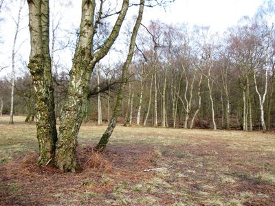
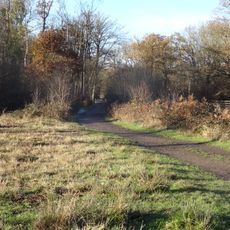
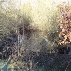
Ashridge Commons and Woods is a protected natural area within the Chiltern Hills comprising woodlands, grasslands, and scrublands spread across a large territory. The site supports a wide range of plant and animal life in these interconnected habitats.
History
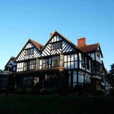
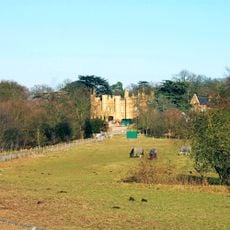
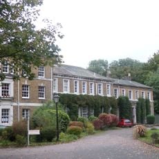
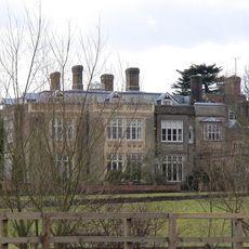
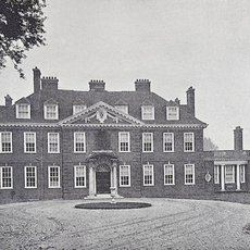
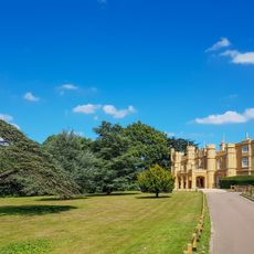
The land was formerly part of Ashridge Priory, established in 1283, which later became a royal residence for King Henry VIII's children. Following the priory's dissolution, the estate gradually transformed into the natural landscape seen today.
Culture
The site maintains its status as a crucial ecological research area, providing scientists with opportunities to study rare bird species and woodland ecosystems.
Practical
The site is accessible through several entrances, including Moneybury Hill in Ringshall, where marked trails guide visitors through the landscape. Sturdy footwear is recommended as conditions underfoot can vary with the weather.
Did you know?
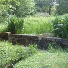
Several small ponds within the woods create specific habitats for amphibians and invertebrates. These water bodies add considerably to the site's overall ecological diversity.
AroundUs brings together thousands of curated places, local tips, and hidden gems, enriched daily by 60,000 contributors worldwide. Discover all places nearby (United Kingdom).
Warner Bros. Studio Tour London – The Making of Harry Potter
3.6 km
Bhaktivedanta Manor
4 km
Wall Hall
1.7 km
High Elms Manor
2 km
Munden House
1 km
Hunton Park
4.1 km
Bricket Wood Common
0 mHarebreaks Wood
3.4 km
Moor Mill Quarry, West
2 km
Stanborough Park Church
2.3 km
Church of St John the Baptist
2.7 km
Church of the Ascension
4.3 km
Church of St Lawrence the Martyr
3.7 km
Church of the Holy Trinity
3.2 km
Church of St Andrew
4.1 km
Wall Hall (The Mansion)
1.7 km
Granary About 50 Metres South East Of Wall Hall Home Farm House
2 km
Replica of the Mohne Dam, in the grounds of the Building Research Establishment, Garston
820 m
Watford Central Library
4.8 km
Bridge Number 163 50 Metres South West Of Grove Wharf
4.8 km
Abbots Langley War Memorial About 40 Metres East North East Of Church Of St Lawerence
3.7 km
Benskin's House
4.2 km
London Coal Duty Marker On Verge Near Number 67
4.4 km
Watford Tunnel, South Entrance To West Tunnel
3.9 km
London Coal Duty Boundary Marker At Tq 1164 9657
4.6 km
Mile Post On Towing Path Immediately South Of Bridge Carrying A 405 Over Canal
4.8 km
Five Arches, Railway Viaduct 200 Metres North of Water Lane
4.6 km
Milestone, Watling Street, 30m S of Station Road
3.5 kmDiscover hidden gems everywhere you go!
From secret cafés to breathtaking viewpoints, skip the crowded tourist spots and find places that match your style. Our app makes it easy with voice search, smart filtering, route optimization, and insider tips from travelers worldwide. Download now for the complete mobile experience.
A unique approach to discovering new places❞
— Le Figaro
All the places worth exploring❞
— France Info
A tailor-made excursion in just a few clicks❞
— 20 Minutes