Bricket Wood Common

Log in to your account

AroundUs is a community-driven map of interesting places, built by curious explorers like you. It grows with every review, story, and photo you share.
Connect to save your favorite spots, contribute locations, and create personalized routes.
Continue with Google
Continue with Apple
Continue with X
Continue with Facebook
Continue with email
By continuing, you accept our Terms and Conditions and our Privacy Policy
Create an account
Add to collection
Map
Suggest a change
Share

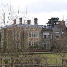
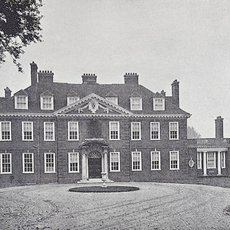
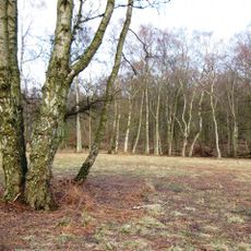
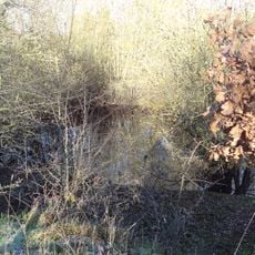
Bricket Wood Common, Protected natural area in Hertfordshire, England

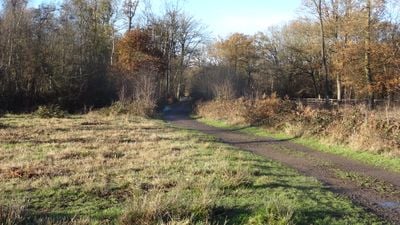
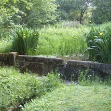
Bricket Wood Common is a protected natural site in Hertfordshire covering ancient woodland, lowland heath, and scattered ponds across its area. The landscape supports a range of plant and animal species adapted to different soil types and moisture levels found throughout the reserve.

The land served local communities for centuries as grazing ground and a source of wood before receiving protected status. In 1984 it was formally designated as a Site of Special Scientific Interest because of its ecological value.

The site received designation as a Site of Special Scientific Interest in 1984, recognizing its substantial ecological value to the regional environment.

The site can be entered from multiple access points distributed around its perimeter, making it easy to plan your visit from different locations. You can visit throughout the year, though conditions underfoot and plant growth change with the seasons.

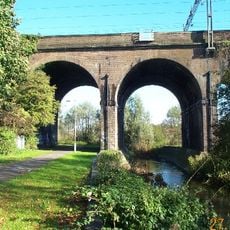
A railway line cuts through the reserve dividing it into distinct sections with their own plant and animal communities. This unexpected split creates varied ecological conditions within a single protected area.

GPS coordinates: 51.69640,-0.36640

Latest update: December 14, 2025 17:43

Photos
Around this place
Warner Bros. Studio Tour London – The Making of Harry Potter
United Kingdom

Warner Bros. Studio Tour London – The Making of Harry Potter

3.6 km
Bhaktivedanta Manor
United Kingdom

Bhaktivedanta Manor

4 km
Wall Hall
United Kingdom

Wall Hall

1.7 km
High Elms Manor
United Kingdom

High Elms Manor

2 km
Munden House
United Kingdom

Munden House

1 km
Hunton Park
United Kingdom

Hunton Park

4.1 km
Ashridge Commons and Woods
United Kingdom

Ashridge Commons and Woods

0 m
United Kingdom

Harebreaks Wood

3.4 km
Moor Mill Quarry, West
United Kingdom

Moor Mill Quarry, West

2 km
Stanborough Park Church
United Kingdom

Stanborough Park Church

2.3 km
Church of St John the Baptist
United Kingdom

Church of St John the Baptist

2.7 km
Church of the Ascension
United Kingdom

Church of the Ascension

4.3 km
Church of St Lawrence the Martyr
United Kingdom

Church of St Lawrence the Martyr

3.7 km
Church of the Holy Trinity
United Kingdom

Church of the Holy Trinity

3.2 km
Church of St Andrew
United Kingdom

Church of St Andrew

4.1 km
Wall Hall (The Mansion)
United Kingdom

Wall Hall (The Mansion)

1.7 km
Granary About 50 Metres South East Of Wall Hall Home Farm House
United Kingdom

Granary About 50 Metres South East Of Wall Hall Home Farm House

2 km
Replica of the Mohne Dam, in the grounds of the Building Research Establishment, Garston
United Kingdom

Replica of the Mohne Dam, in the grounds of the Building Research Establishment, Garston

820 m
Watford Central Library
United Kingdom

Watford Central Library

4.8 km
Bridge Number 163 50 Metres South West Of Grove Wharf
United Kingdom

Bridge Number 163 50 Metres South West Of Grove Wharf

4.8 km
Abbots Langley War Memorial About 40 Metres East North East Of Church Of St Lawerence
United Kingdom

Abbots Langley War Memorial About 40 Metres East North East Of Church Of St Lawerence

3.7 km
Benskin's House
United Kingdom

Benskin's House

4.2 km
London Coal Duty Marker On Verge Near Number 67
United Kingdom

London Coal Duty Marker On Verge Near Number 67

4.4 km
Watford Tunnel, South Entrance To West Tunnel
United Kingdom

Watford Tunnel, South Entrance To West Tunnel

3.9 km
London Coal Duty Boundary Marker At Tq 1164 9657
United Kingdom

London Coal Duty Boundary Marker At Tq 1164 9657

4.6 km
Mile Post On Towing Path Immediately South Of Bridge Carrying A 405 Over Canal
United Kingdom

Mile Post On Towing Path Immediately South Of Bridge Carrying A 405 Over Canal

4.8 km
Five Arches, Railway Viaduct 200 Metres North of Water Lane
United Kingdom

Five Arches, Railway Viaduct 200 Metres North of Water Lane

4.6 km
Milestone, Watling Street, 30m S of Station Road
United Kingdom

Milestone, Watling Street, 30m S of Station Road

3.5 km
Show the full map
Reviews

Visited this place? Tap the stars to rate it and share your experience / photos with the community! Try now! You can cancel it anytime.

« Bricket Wood Common - Protected natural area in Hertfordshire, England » is provided by Around Us (aroundus.com). Images and texts are derived from Wikimedia project under a Creative Commons license. You are allowed to copy, distribute, and modify copies of this page, under the conditions set by the license, as long as this note is clearly visible.

Discover hidden gems everywhere you go!

From secret cafés to breathtaking viewpoints, skip the crowded tourist spots and find places that match your style. Our app makes it easy with voice search, smart filtering, route optimization, and insider tips from travelers worldwide. Download now for the complete mobile experience.

Around Us App Screenshot

A unique approach to discovering new places

Le Figaro

All the places worth exploring

France Info

A tailor-made excursion in just a few clicks

20 Minutes