The Bedford

Log in to your account

AroundUs is a community-driven map of interesting places, built by curious explorers like you. It grows with every review, story, and photo you share.
Connect to save your favorite spots, contribute locations, and create personalized routes.
By continuing, you accept our Terms and Conditions and our Privacy Policy
Add to collection
Map
Suggest a change
Share

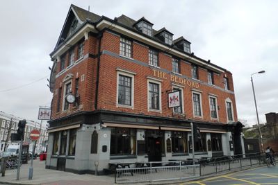
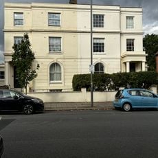
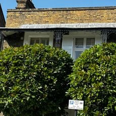
The Bedford, Grade II listed pub and music venue in Balham, London, England.

The Bedford is a Grade II listed building in Balham that operates as a pub, music venue, and hotel across multiple floors. The establishment contains several bars serving spirits, beers, and cocktails, alongside hotel rooms designed for overnight guests with comfortable furnishings and en-suite bathrooms.

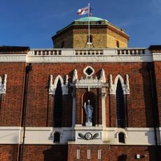
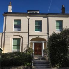
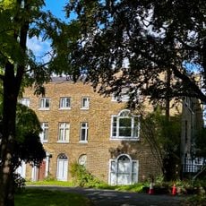
The original Bedford Hotel was built in the 1870s and was connected to a significant criminal investigation case in 1876 that took place on its premises. The current building was completely reconstructed in 1931, incorporating architectural styles popular during that period.

The venue has functioned as a performing space for live music over many decades, hosting acts across various genres from emerging artists to established names. This role has made it a fixture in London's music scene where visitors can experience the tradition of live entertainment in an intimate setting.

The venue is accessible by public transport due to its location in the Wandsworth area, making it straightforward for visitors to reach. It is advisable to check in advance for live performance schedules, as programming varies depending on the day and season.

The building from 1931 blends multiple design styles from that era, distinguishing it from typical London pubs of its kind. This carefully combined aesthetic approach creates an unusual interior environment for guests.

Location: London Borough of Wandsworth

Address: 77 Bedford Hill, London, SW12 9HD

Phone: +442086738787

Website: http://thebedford.co.uk

GPS coordinates: 51.44272,-0.14936

Latest update: December 12, 2025 09:00

Photos
Around this place
Du Cane Court
United Kingdom

Du Cane Court

535 m
Tooting Commons
United Kingdom

Tooting Commons

957 m
The Priory
United Kingdom

The Priory

766 m
Roman Catholic Church of St Anselm
United Kingdom

Roman Catholic Church of St Anselm

1 km
Church of Holy Trinity (Upper Tooting)
United Kingdom

Church of Holy Trinity (Upper Tooting)

1 km
Church of St Luke
United Kingdom

Church of St Luke

1.2 km
Tooting Fire Station
United Kingdom

Tooting Fire Station

1.1 km
The Ascension, Balham Hill
United Kingdom

The Ascension, Balham Hill

890 m
Church of St Mary
United Kingdom

Church of St Mary

352 m
The Church of St Mary Magdalene
United Kingdom

The Church of St Mary Magdalene

1.2 km
Bollards On North And South Sides Of Road Between Church Of The Ascension And Vicarage
United Kingdom

Bollards On North And South Sides Of Road Between Church Of The Ascension And Vicarage

903 m
St Thomas with St Stephen
United Kingdom

St Thomas with St Stephen

1.1 km
Hamilton Hall
United Kingdom

Hamilton Hall

519 m
Clapham South Deep Level Shelter
United Kingdom

Clapham South Deep Level Shelter

1.2 km
Number 100 (Including Iron Gate And Railings To Street Frontage)
United Kingdom

Number 100 (Including Iron Gate And Railings To Street Frontage)

1.1 km
Clapham South Deep Tube Shelter And Surface Building At Wandsworth Entrance
United Kingdom

Clapham South Deep Tube Shelter And Surface Building At Wandsworth Entrance

1 km
24 And 26, Old Devonshire Road Sw12
United Kingdom

24 And 26, Old Devonshire Road Sw12

437 m
1, Trinity Crescent SW17
United Kingdom

1, Trinity Crescent SW17

1 km
68, 70 And 72, Upper Tooting Road Sw17
United Kingdom

68, 70 And 72, Upper Tooting Road Sw17

1.3 km
6 And 8, Old Devonshire Road Sw12
United Kingdom

6 And 8, Old Devonshire Road Sw12

443 m
Bollards East And West Sides Of Street Near Junction With Nightingale Lane
United Kingdom

Bollards East And West Sides Of Street Near Junction With Nightingale Lane

1.1 km
13 boundary markers
United Kingdom

13 boundary markers

1.3 km
Five Bollards Off St James's Drive At Tq 276732
United Kingdom

Five Bollards Off St James's Drive At Tq 276732

1.1 km
26, Wandle Road SW17
United Kingdom

26, Wandle Road SW17

1.2 km
Mansbridge House
United Kingdom

Mansbridge House

468 m
Milestone, Clapham Common South Side
United Kingdom

Milestone, Clapham Common South Side

1.2 km
Boundary Wall Between Number 37 And Elf Filling Station Bearing Twin Plates (Fixed To East And West Sides)
United Kingdom

Boundary Wall Between Number 37 And Elf Filling Station Bearing Twin Plates (Fixed To East And West Sides)

1.1 km
St Anselms Convent School
United Kingdom

St Anselms Convent School

968 m
Show the full map
Reviews

Visited this place? Tap the stars to rate it and share your experience / photos with the community! Try now! You can cancel it anytime.

« The Bedford - Grade II listed pub and music venue in Balham, London, England » is provided by Around Us (aroundus.com). Images and texts are derived from Wikimedia project under a Creative Commons license. You are allowed to copy, distribute, and modify copies of this page, under the conditions set by the license, as long as this note is clearly visible.

Discover hidden gems everywhere you go!

From secret cafés to breathtaking viewpoints, skip the crowded tourist spots and find places that match your style. Our app makes it easy with voice search, smart filtering, route optimization, and insider tips from travelers worldwide. Download now for the complete mobile experience.

Around Us App Screenshot

A unique approach to discovering new places

Le Figaro

All the places worth exploring

France Info

A tailor-made excursion in just a few clicks

20 Minutes