Enable Location

We need your location to show you interesting places around you

Discover nearby places

Find interesting locations and hidden gems around you

Precise directions

Get accurate directions and distances to places

Your location is never shared with other users. It's only used when you tap the location button.

Carlisle city walls

Log in to your account

Start exploring — it's free

Trusted by 61,481 travelers worldwide

Continue with Google
Continue with Apple
or

We will send you a code to connect

By continuing, you accept our Terms and Conditions and our Privacy Policy

Check your inbox

We've sent a pincode in your inbox. Please enter the code below.

Carlisle city walls

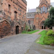
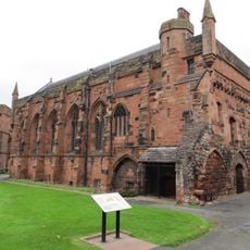
Carlisle city walls, Medieval city fortifications in Carlisle, England

Description

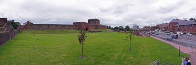
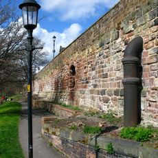
Carlisle city walls are medieval fortifications that once extended around the city center, with the West Walls section along the River Caldew remaining the most intact today. This preserved portion offers views across the surrounding urban landscape and connects toward the castle.

History

Romans first built defensive walls at this location, known as Luguvallum, but these were later replaced by Norman fortifications constructed in the 11th century. This transformation reflected the shift from Roman to medieval methods of protection.

Culture

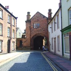
The three main gates - Caldew Gate, Botcher Gate, and English Gate - shaped the street names that exist in the city today. These names remain as reminders of how the walls once controlled movement through the community.

Practical

The West Walls section is best experienced on foot and offers a direct route toward the castle, making it easy to plan your visit. The path has uneven sections and old stonework, so wear suitable footwear for stability.

Did you know?

The walls contain specialized defensive features such as the Tile Tower and Sally Port, structures that played crucial roles during the many sieges the city experienced. These elements reveal how sophisticated medieval defensive tactics became over time.

Location
GPS coordinates
54.89400,-2.93900
Latest update
December 12, 2025 17:45

AroundUs brings together thousands of curated places, local tips, and hidden gems, enriched daily by 60,000 contributors worldwide. Discover all places nearby (Carlisle).

« Carlisle city walls - Medieval city fortifications in Carlisle, England » is provided by Around Us (aroundus.com). Images and texts are derived from Wikimedia project under a Creative Commons license. You are allowed to copy, distribute, and modify copies of this page, under the conditions set by the license, as long as this note is clearly visible.

Discover hidden gems everywhere you go!

From secret cafés to breathtaking viewpoints, skip the crowded tourist spots and find places that match your style. Our app makes it easy with voice search, smart filtering, route optimization, and insider tips from travelers worldwide. Download now for the complete mobile experience.

Around Us App Screenshot

A unique approach to discovering new places

Le Figaro

All the places worth exploring

France Info

A tailor-made excursion in just a few clicks

20 Minutes

Around Us
Travel Guide & Maps
Download

Send to your phone

QR Code
1

Open the camera app on your mobile.

2

Point at the QR code with your camera. A notification will appear.

3

Tap the notification to open the link.