Enable Location

We need your location to show you interesting places around you

Discover nearby places

Find interesting locations and hidden gems around you

Precise directions

Get accurate directions and distances to places

Your location is never shared with other users. It's only used when you tap the location button.

Hollybrook Cemetery

Log in to your account

Start exploring — it's free

Trusted by 62,020 travelers worldwide

Continue with Google
Continue with Apple
or

We will send you a code to connect

By continuing, you accept our Terms and Conditions and our Privacy Policy

Check your inbox

We've sent a pincode in your inbox. Please enter the code below.

Hollybrook Cemetery

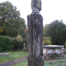
Hollybrook Cemetery, Grade II listed cemetery in Southampton, England

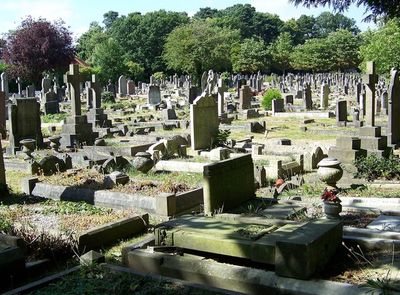
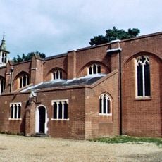
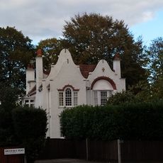
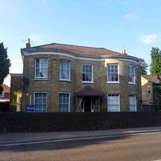
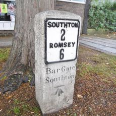
Hollybrook Cemetery is a burial ground with extensive grounds containing more than 50,000 graves spread across different sections. The site features a chapel for ceremonies and a distinctive entrance structure with architectural details.

The cemetery was established in 1911 and received its first burial in 1913, marking Southampton's growth during that period. It became a major burial site during both world wars.

The cemetery is organized into sections for different faith communities, reflecting Southampton's religious diversity in its layout. Walking through the grounds, you notice how these divisions show the city's long history of welcoming people from various backgrounds.

The grounds are walkable with clear pathways that help you navigate between different sections. Allow extra time for your visit since the site is spacious and worth exploring at a leisurely pace.

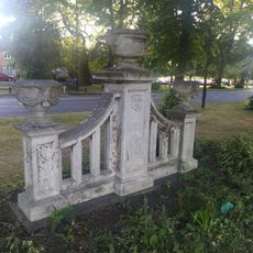
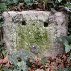
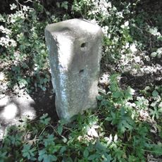
A memorial stone near the chapel incorporates materials from buildings destroyed during Southampton's bombing in World War II. This stone links the city's wartime destruction to a permanent place of remembrance.

The community of curious travelers

AroundUs brings together thousands of curated places, local tips, and hidden gems, enriched daily by 60,000 contributors worldwide.

Start exploring
Inception
1911
GPS coordinates
50.93600,-1.42900
Latest update
December 9, 2025 18:41
Around this place
Southampton Common
United Kingdom

Southampton Common

1.7 km
Southampton Old Cemetery
United Kingdom

Southampton Old Cemetery

2.1 km
La Sainte Union College of Higher Education
United Kingdom

La Sainte Union College of Higher Education

1.8 km
Highfield Church
United Kingdom

Highfield Church

2.5 km
Avenue Campus
United Kingdom

Avenue Campus

2 km
John Hansard Gallery
United Kingdom

John Hansard Gallery

2.1 km
Shirley Parish Church
United Kingdom

Shirley Parish Church

1 km
Boldrewood Campus
United Kingdom

Boldrewood Campus

1.7 km
St. Michael and All Angels Church, Bassett
United Kingdom

St. Michael and All Angels Church, Bassett

1.9 km
St James' Park, Southampton
United Kingdom

St James' Park, Southampton

1 km
Christ Church, Freemantle
United Kingdom

Christ Church, Freemantle

2.7 km
R J Mitchell Wind Tunnel
United Kingdom

R J Mitchell Wind Tunnel

2.4 km
Avenue St Andrew's United Reformed Church
United Kingdom

Avenue St Andrew's United Reformed Church

2.4 km
Shirley Baptist Church
United Kingdom

Shirley Baptist Church

1.5 km
Church of St John
United Kingdom

Church of St John

2.4 km
Church of England Mortuary Chapel At Southampton Old Cemetery
United Kingdom

Church of England Mortuary Chapel At Southampton Old Cemetery

2.1 km
The Crown Public House
United Kingdom

The Crown Public House

1.5 km
Regent Cinema
United Kingdom

Regent Cinema

1.6 km
Pearce Memorial At Southampton Old Cemetery
United Kingdom

Pearce Memorial At Southampton Old Cemetery

2.1 km
Monument Situated In Centre Of The Green Near The Junction With Padwell Road
United Kingdom

Monument Situated In Centre Of The Green Near The Junction With Padwell Road

2.8 km
Cutthorn
United Kingdom

Cutthorn

1.7 km
Milestone, Southampton Common
United Kingdom

Milestone, Southampton Common

1.7 km
The Dutch House
United Kingdom

The Dutch House

2.5 km
Milestone, Bassett Green Road; 100m NW crematorium
United Kingdom

Milestone, Bassett Green Road; 100m NW crematorium

2.8 km
369 And 371A, Millbrook Road
United Kingdom

369 And 371A, Millbrook Road

2.7 km
Milestone, Bassett, nr junction with Bassett Avenue, road to Gables Court
United Kingdom

Milestone, Bassett, nr junction with Bassett Avenue, road to Gables Court

1.9 km
Milestone, Tennis Centre,  Romsey Road, Nursling; opp. the Cedar School for the Physically handicapped,
United Kingdom

Milestone, Tennis Centre, Romsey Road, Nursling; opp. the Cedar School for the Physically handicapped,

2.3 km
Milestone, Shirley Road, Shirley
United Kingdom

Milestone, Shirley Road, Shirley

1.7 km
Show the full map
« Hollybrook Cemetery - Grade II listed cemetery in Southampton, England » is provided by Around Us (aroundus.com). Images and texts are derived from Wikimedia project under a Creative Commons license. You are allowed to copy, distribute, and modify copies of this page, under the conditions set by the license, as long as this note is clearly visible.

Discover hidden gems everywhere you go!

From secret cafés to breathtaking viewpoints, skip the crowded tourist spots and find places that match your style. Our app makes it easy with voice search, smart filtering, route optimization, and insider tips from travelers worldwide. Download now for the complete mobile experience.

Around Us App Screenshot

A unique approach to discovering new places

Le Figaro

All the places worth exploring

France Info

A tailor-made excursion in just a few clicks

20 Minutes

Around Us
Travel Guide & Maps
Download

Send to your phone

QR Code
1

Open the camera app on your mobile.

2

Point at the QR code with your camera. A notification will appear.

3

Tap the notification to open the link.