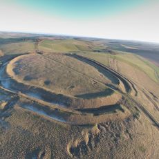
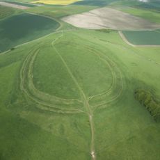
Hackpen White Horse, Horse hill figure on Hackpen Hill, Wiltshire, England.
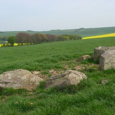
The Hackpen White Horse is a chalk figure cut into Hackpen Hill in the Marlborough Downs near Broad Hinton, measuring about 90 feet (27 meters) across and high. The white horse figure stands out distinctly from the surrounding grassland and can be seen from the nearby B4041 road.
The chalk figure was created in 1838 by Henry Eatwell, a parish clerk, to mark the coronation of Queen Victoria. It emerged around the same time as the Litlington White Horse and was part of a period when new horse figures were being made in England.
Local volunteers gather regularly to clean and maintain the white horse figure, a tradition that continues to connect the community together today.
You can park at the hilltop where the Ridgeway path meets the B4041 road, with a direct footpath leading to the chalk figure. The site is accessible year-round, though it is regularly cleaned and made more visible during winter months.
Unlike many other English horse figures, this one has perfectly square proportions, which sets it apart among the chalk figures across the country. This geometric quality makes it instantly recognizable and gives it a distinctive visual character among all horse figures.
Location: Broad Hinton
GPS coordinates: 51.47240,-1.81750
Latest update: December 10, 2025 16:23
Barbury Castle
2.6 km
St Nicholas's Church, Berwick Bassett
3.2 km
Church of St Mary Magdalene, Winterbourne Monkton
4.2 km
Church of St Peter Ad Vincula
2.7 km
Church of St Katherine and St Peter
2.6 km
Saucer barrow: part of a barrow cemetery west of Barbury Castle
2.4 km
Group of four round barrows 500m south-east of Avebury Down Barn, forming part of a Bronze Age round barrow cemetery on Avebury
4.1 km
Churchyard Cross And Lloyd Monument In Churchyard, 6 Metres South Of South Chapel, Church Of St Peter
2.7 km
142 And 143
3 km
Manor House
3.2 km
Milestone At Four Mile Clump
3.8 km
Richardson medieval settlement
3 km
Penning bell barrow 600m east of Avebury Down Barn
3.8 km
Little Thatch
3.8 km
Yew Trees
2.9 km
Milestone 160 Metres South Of Village Crossroads
3.2 km
19 And 20, Cliffe Pypard Road
2.8 km
Milestone Approximately 400 Metres North Of Manor Farm Entrance
3.4 km
Milestone
3.7 km
Milstone At Upper Herdswick Farm
3.2 km
Manor Farmhouse
3.1 km
Milestone 300 Metres East Of A4361 Junction
1.9 km
Marlborough House
2.8 km
Milestone West Of Dean Bottom
2.6 km
Manor House
2.6 km
Well View
2.7 km
Broad Hinton House
2.6 km
Barbury Castle Farm deserted Medieval village
2.6 kmVisited this place? Tap the stars to rate it and share your experience / photos with the community! Try now! You can cancel it anytime.
Discover hidden gems everywhere you go!
From secret cafés to breathtaking viewpoints, skip the crowded tourist spots and find places that match your style. Our app makes it easy with voice search, smart filtering, route optimization, and insider tips from travelers worldwide. Download now for the complete mobile experience.
A unique approach to discovering new places❞
— Le Figaro
All the places worth exploring❞
— France Info
A tailor-made excursion in just a few clicks❞
— 20 Minutes