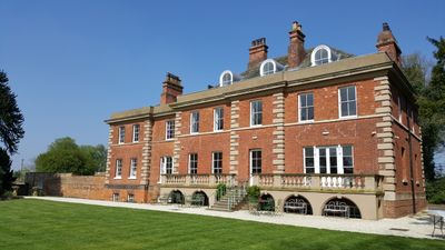
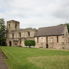
Hirst Priory, Grade II listed priory in Belton, England
Hirst Priory is a red brick building with multiple stories located on the site of medieval religious grounds in Belton. The interior displays historical features including lower levels and open hearths in rooms, while gardens and surrounding land areas remain part of the property.
A monastery once occupied this location in the 12th century before being dissolved by authorities. The current building was constructed in the 18th century when the Stovin family took over the land and transformed it into their private residence.
The place served as a religious outpost connected to nearby Nostell, functioning as both a prayer site and administrative center for the local faith community. Visitors today can sense the layered use of the space across different periods of occupation.
The property contains five guest bedrooms with private bathrooms and substantial outdoor grounds for activities and events. Visitors should know that it functions primarily as a venue and access to most areas is best arranged in advance through formal channels.
Excavations uncovered a square moat that once encircled the structure, with traces of it still visible in the modern landscape features. This water-based fortification helped protect and define the medieval estate during its early occupation.
The community of curious travelers
AroundUs brings together thousands of curated places, local tips, and hidden gems, enriched daily by 60,000 contributors worldwide.