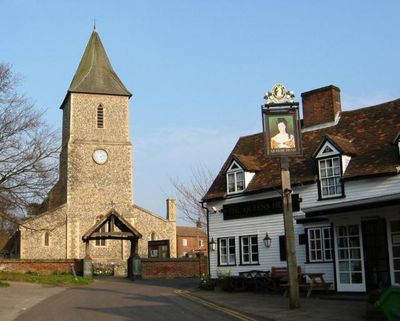
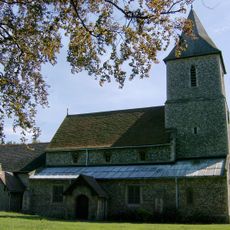
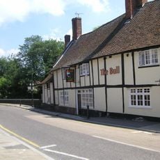
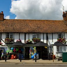
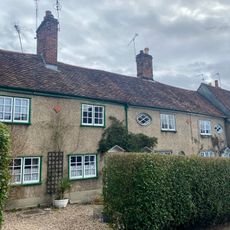
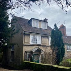
Queen's Head Public House, 17th-century pub in Sandridge, England
The Queen's Head is a 17th-century pub featuring timber framing and weather-boarded exterior walls that give it a distinctive village character. The building stands adjacent to St. Leonard's Church and holds Grade II listed status, protecting its traditional architectural elements.
This establishment was built in the 17th century and has functioned as a pub throughout the following centuries. The building's timber frame and preserved structural features reveal the construction methods of its era and its enduring role in village life.
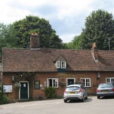
This pub serves as a gathering place where villagers come to socialize and maintain community bonds over drinks and conversation. The space reflects how English villages have historically organized their social life around such establishments.
The pub is located at 23 The Terrace in Sandridge village and operates throughout the week for visitors seeking drinks and conversation. Its position near St. Leonard's Church makes it straightforward to locate within the village.
The building manages to maintain both its historic protection and active function as a working pub, demonstrating how traditional English village establishments continue to serve their communities. Few structures achieve this balance between heritage preservation and contemporary use so effectively.
Location: Sandridge
Address: Church End, Sandridge, St. Albans, AL4 9DL
GPS coordinates: 51.78136,-0.30415
Latest update: December 14, 2025 09:42
Childwickbury Manor
3.1 km
Church of St. Peter, St. Albans
3.6 km
St Helen's Church, Wheathampstead
3.5 km
St Leonard's Church, Sandridge
41 mThe Wick Local Nature Reserve
2.2 km
Sandridge Lychgate
14 m
Church of St Saviour
3 km
The Bull Inn
3.6 km
St. Albans War Memorial
3.7 km
Elephant And Castle Public House
2.6 km
Pemberton Almshouses
3.5 km
Bleak House
3.7 km
Darbys Stores And Number 25
107 m
Milepost On North Side Of Road, South Of Oaklands College
3.5 km
105, St Peter's Street
3.6 km
The White House
3.6 km
Mile Post Opposite Beeson Mill Lane
3.5 km
John Bunyans Chimney
2.9 km
Forecourt Wall And Gateway To Pemberton Almshouses
3.5 km
Milepost Outside Number 11
3.7 km
97-101 And 101A, St Peter's Street
3.7 km
Milepost To West Of Junction With Royal Road
3.3 km
62-70, St Peter's Street
3.6 km
78, St Peter's Street
3.6 km
58 And 60, St Peter's Street
3.7 km
107, St Peter's Street
3.6 km
Milepost, Harpenden Road, N of Hertfordshire Way
2.5 km
Milepost, Old Harpenden Road, Bernard's Heath
2.5 kmVisited this place? Tap the stars to rate it and share your experience / photos with the community! Try now! You can cancel it anytime.
Discover hidden gems everywhere you go!
From secret cafés to breathtaking viewpoints, skip the crowded tourist spots and find places that match your style. Our app makes it easy with voice search, smart filtering, route optimization, and insider tips from travelers worldwide. Download now for the complete mobile experience.
A unique approach to discovering new places❞
— Le Figaro
All the places worth exploring❞
— France Info
A tailor-made excursion in just a few clicks❞
— 20 Minutes