Enable Location

We need your location to show you interesting places around you

Discover nearby places

Find interesting locations and hidden gems around you

Precise directions

Get accurate directions and distances to places

Your location is never shared with other users. It's only used when you tap the location button.

Alma

Log in to your account

Start exploring — it's free

Trusted by 63,722 travelers worldwide

Continue with Google
Continue with Apple
or

We will send you a code to connect

By continuing, you accept our Terms and Conditions and our Privacy Policy

Check your inbox

We've sent a pincode in your inbox. Please enter the code below.

Discussion Reviews 2 Photos
18.1k Popularity

Alma, city in Arkansas, USA

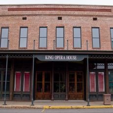
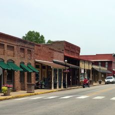
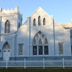
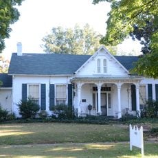
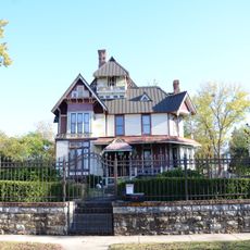
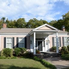
Alma is a small city in Crawford County, Arkansas, covering about 5.7 square miles with a population around 5,800 residents. The downtown area features simple streets lined with local shops, cafes, and a central park where community events are held.

Alma was founded in 1872 when early settlers purchased land from the government and began farming operations. Growth accelerated in the late 1800s after a railroad line was built through town, enabling shipment of cotton and timber to distant markets.

The town was once known as the Spinach Capital of the World due to its canning industry, and this legacy remains visible today. A large Popeye statue stands as a reminder of this unusual chapter, celebrating the crop that once defined the local economy.

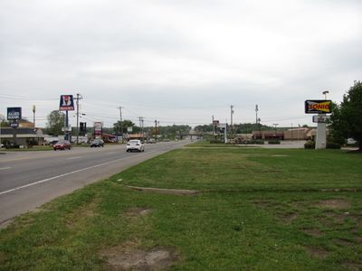
The city sits on Interstate 40, Interstate 540, and US Highway 71, making it easy to reach by car. Visitors will find hotels, an aquatic park, a golf course, restaurants, and a farmers market, with Fort Smith just 15 miles away and Fayetteville about 45 miles north.

During World War II, Alma became famous for its canning plants that processed spinach, earning the title Spinach Capital of the World. The town also holds an unusual place in American crime history, connected to an encounter with outlaws Bonnie and Clyde that resulted in the death of a deputy marshal.

The community of curious travelers

AroundUs brings together thousands of curated places, local tips, and hidden gems, enriched daily by 60,000 contributors worldwide.

Start exploring
Location
Inception
1874
Elevation above the sea
133 m
Part of
Arkansas's River Valley
GPS coordinates
35.47778,-94.22194
Latest update
February 17, 2026 00:00
Around this place
King Opera House
United States of America

King Opera House

11.8 km
Van Buren Historic District
United States of America

Van Buren Historic District

12.9 km
Van Buren Confederate Monument
United States of America

Van Buren Confederate Monument

13.1 km
Mount Olive United Methodist Church
United States of America

Mount Olive United Methodist Church

12.9 km
Bryan House
United States of America

Bryan House

12.6 km
Bob Burns House
United States of America

Bob Burns House

12.6 km
Drennen-Scott House
United States of America

Drennen-Scott House

12.9 km
Vietnamese Baptist Church
United States of America

Vietnamese Baptist Church

19.3 km
Lee Creek Bridge
United States of America

Lee Creek Bridge

15.2 km
Fishback Neighborhood Historic District
United States of America

Fishback Neighborhood Historic District

20 km
Frog Bayou Bridge
United States of America

Frog Bayou Bridge

16 km
Dr. Charles Fox Brown House
United States of America

Dr. Charles Fox Brown House

12.6 km
Saint Scholastica Convent
United States of America

Saint Scholastica Convent

18.9 km
William Ayers House
United States of America

William Ayers House

19.4 km
Van Buren Presbyterian Church
United States of America

Van Buren Presbyterian Church

12.8 km
First Evangelical Lutheran Church
United States of America

First Evangelical Lutheran Church

19.3 km
Henry Clay Mills House
United States of America

Henry Clay Mills House

11.6 km
Horace Franklin Rogers House
United States of America

Horace Franklin Rogers House

19.8 km
Wilhauf House
United States of America

Wilhauf House

13.2 km
Cedarville School Building
United States of America

Cedarville School Building

16.8 km
William J. Murphy House
United States of America

William J. Murphy House

19.9 km
Mulberry Home Economics Building
United States of America

Mulberry Home Economics Building

15.3 km
Bryant-Lasater House
United States of America

Bryant-Lasater House

15.8 km
Clarke-Harrell-Burson House
United States of America

Clarke-Harrell-Burson House

12.4 km
Henry "Harry" Charles Pernot House
United States of America

Henry "Harry" Charles Pernot House

12.6 km
Mulberry River Bridge
United States of America

Mulberry River Bridge

17.5 km
Popeye statue
United States of America

Popeye statue

118 m
Drennen Scott House
United States of America

Drennen Scott House

13.2 km
Show the full map
Reviews
Share your experience

No review yet

Discussions
Start a discussion...

No discussion yet

« Alma - city in Arkansas, USA » is provided by Around Us (aroundus.com). Images and texts are derived from Wikimedia project under a Creative Commons license. You are allowed to copy, distribute, and modify copies of this page, under the conditions set by the license, as long as this note is clearly visible.

Discover hidden gems everywhere you go!

From secret cafés to breathtaking viewpoints, skip the crowded tourist spots and find places that match your style. Our app makes it easy with voice search, smart filtering, route optimization, and insider tips from travelers worldwide. Download now for the complete mobile experience.

Around Us App Screenshot

A unique approach to discovering new places

Le Figaro

All the places worth exploring

France Info

A tailor-made excursion in just a few clicks

20 Minutes

Around Us
Travel Guide & Maps
Download

Send to your phone

QR Code
1

Open the camera app on your mobile.

2

Point at the QR code with your camera. A notification will appear.

3

Tap the notification to open the link.