Enable Location

We need your location to show you interesting places around you

Discover nearby places

Find interesting locations and hidden gems around you

Precise directions

Get accurate directions and distances to places

Your location is never shared with other users. It's only used when you tap the location button.

Ripley County

Log in to your account

Start exploring — it's free

Trusted by 61,892 travelers worldwide

Continue with Google
Continue with Apple
or

We will send you a code to connect

By continuing, you accept our Terms and Conditions and our Privacy Policy

Check your inbox

We've sent a pincode in your inbox. Please enter the code below.

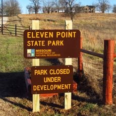
Ripley County, Administrative county in southeastern Missouri, United States

Ripley County is an administrative county in southeastern Missouri located in the Ozark region. The landscape features multiple rivers running through agricultural areas situated between the Current River and Mark Twain National Forest.

Established in 1833 from territory of Cape Girardeau County, the county originally encompassed a much larger area. Over time, sections were separated to form the neighboring counties of Oregon, Howell, Shannon, and Carter.

The county hosts genealogy centers where researchers study family histories, focusing on descendants of settlers from Irish, German, and English backgrounds.

Doniphan serves as the county seat and provides administrative services to residents. The courthouse located there, constructed in 1899, holds a place on the National Register of Historic Places.

The Natchitoches Trail, a historic pioneer route, passed through the region and was traveled by early settlers including Stephen F. Austin. This trail connects the area to important chapters of westward American expansion.

The community of curious travelers

AroundUs brings together thousands of curated places, local tips, and hidden gems, enriched daily by 60,000 contributors worldwide.

Start exploring
Location
Inception
1833
Capital city
Doniphan
Shares border with
Carter County, Randolph County, Clay County, Oregon County, Butler County
GPS coordinates
36.66000,-90.87000
Latest update
December 8, 2025 13:44
Around this place
Eleven Point State Park
United States of America

Eleven Point State Park

27.6 km
Rodgers Theatre
United States of America

Rodgers Theatre

43.9 km
Current River Cavern
United States of America

Current River Cavern

38.3 km
Williams-Gierth House
United States of America

Williams-Gierth House

43.2 km
North Main Street Historic District
United States of America

North Main Street Historic District

43.9 km
Mark Twain School
United States of America

Mark Twain School

43.5 km
Thomas Moore House
United States of America

Thomas Moore House

43.9 km
Wright-Dalton-Bell-Anchor Department Store Building
United States of America

Wright-Dalton-Bell-Anchor Department Store Building

43.8 km
Sheeks House
United States of America

Sheeks House

38.2 km
Oliver House
United States of America

Oliver House

38.1 km
Hillyard Cabin
United States of America

Hillyard Cabin

24.5 km
John Archibald Phillips House
United States of America

John Archibald Phillips House

43.5 km
Alfred W. Greer House
United States of America

Alfred W. Greer House

43.2 km
Moore-Dalton House
United States of America

Moore-Dalton House

43.9 km
Garfield Historic District
United States of America

Garfield Historic District

43.8 km
Cedar Grove School No. 81
United States of America

Cedar Grove School No. 81

37.2 km
St. Louis-San Francisco Railroad Depot
United States of America

St. Louis-San Francisco Railroad Depot

43.6 km
Ripley County Jail, Sheriff's Office and Sheriff's Residence
United States of America

Ripley County Jail, Sheriff's Office and Sheriff's Residence

6.1 km
Big Spring Historic District
United States of America

Big Spring Historic District

33.9 km
Randolph Columbus Barrett House
United States of America

Randolph Columbus Barrett House

6 km
Wheatley Public School
United States of America

Wheatley Public School

43.8 km
Rice-Upshaw House
United States of America

Rice-Upshaw House

35.1 km
Ripley County Courthouse
United States of America

Ripley County Courthouse

6.1 km
Baynham House
United States of America

Baynham House

26.6 km
Looney-French House
United States of America

Looney-French House

37 km
Clay County Courthouse, Western District
United States of America

Clay County Courthouse, Western District

38.3 km
Carter County Courthouse
United States of America

Carter County Courthouse

39.5 km
Baldy Lookout Tower
United States of America

Baldy Lookout Tower

20.6 km
Show the full map
Administrative divisions
« Ripley County - Administrative county in southeastern Missouri, United States » is provided by Around Us (aroundus.com). Images and texts are derived from Wikimedia project under a Creative Commons license. You are allowed to copy, distribute, and modify copies of this page, under the conditions set by the license, as long as this note is clearly visible.

Discover hidden gems everywhere you go!

From secret cafés to breathtaking viewpoints, skip the crowded tourist spots and find places that match your style. Our app makes it easy with voice search, smart filtering, route optimization, and insider tips from travelers worldwide. Download now for the complete mobile experience.

Around Us App Screenshot

A unique approach to discovering new places

Le Figaro

All the places worth exploring

France Info

A tailor-made excursion in just a few clicks

20 Minutes

Around Us
Travel Guide & Maps
Download

Send to your phone

QR Code
1

Open the camera app on your mobile.

2

Point at the QR code with your camera. A notification will appear.

3

Tap the notification to open the link.