Enable Location

We need your location to show you interesting places around you

Discover nearby places

Find interesting locations and hidden gems around you

Precise directions

Get accurate directions and distances to places

Your location is never shared with other users. It's only used when you tap the location button.

Loíza

Log in to your account

Start exploring — it's free

Trusted by 61,921 travelers worldwide

Continue with Google
Continue with Apple
or

We will send you a code to connect

By continuing, you accept our Terms and Conditions and our Privacy Policy

Check your inbox

We've sent a pincode in your inbox. Please enter the code below.

Loíza, Coastal municipality in San Juan metropolitan area, Puerto Rico.

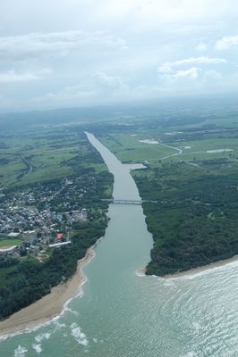
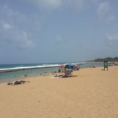
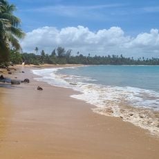
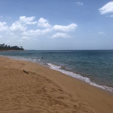
Loíza is a municipality on the northeastern coast of Puerto Rico, stretching along the Atlantic Ocean and marked by sandy beaches and palm-lined shores at sea level. The flat coastal plain offers wide beaches and natural habitats where mangrove and saltwater forests shape the landscape.

The municipality was founded in 1719 as a settlement for Spanish colonists and African descendants in the northeastern region. This establishment shaped the population composition and cultural roots that remain alive in the community today.

The municipality preserves African traditions through events like the Festival of Saint James, where music, dances, and local dishes fill the streets. These celebrations shape daily life and show the living cultural identity of the residents.

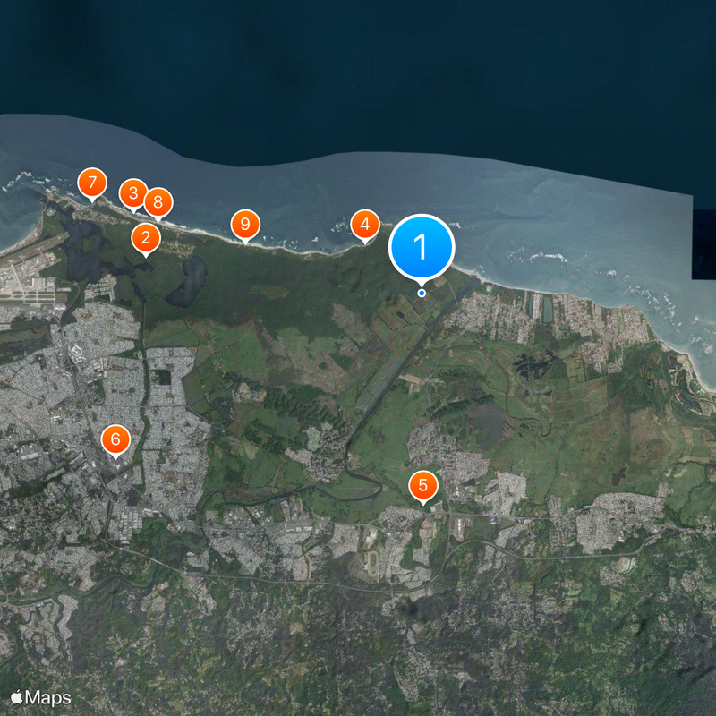
You can reach Loíza via the PR-187 highway from San Juan, where regular public transportation connects to neighboring municipalities. The best time to visit is outside the rainy season, when the weather is stable and beaches are accessible.

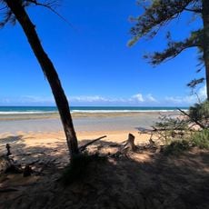
The Piñones area has a network of wooden boardwalks that lead through mangrove forests and connect local food stands with beach access. These pathways are popular with visitors who want to explore the mangrove ecosystem while sampling regional dishes.

The community of curious travelers

AroundUs brings together thousands of curated places, local tips, and hidden gems, enriched daily by 60,000 contributors worldwide.

Start exploring
Location
Inception
1719
Capital city
Loíza barrio-pueblo
Elevation above the sea
0 m
Shares border with
Río Grande, Canóvanas, Carolina
GPS coordinates
18.43417,-65.89278
Latest update
December 20, 2025 12:24
Around this place
Piñones State Forest
United States of America

Piñones State Forest

7.8 km
Pocita de Piñones
United States of America

Pocita de Piñones

8.4 km
Playa Vacía Talega
United States of America

Playa Vacía Talega

2.2 km
Villarán Bridge
United States of America

Villarán Bridge

5.9 km
Just 4 Fun
United States of America

Just 4 Fun

9.8 km
United States of America

Aviones Beach

9.7 km
Playa Torrecillas Piñones
United States of America

Playa Torrecillas Piñones

7.7 km
Playa de las Tres Palmitas
United States of America

Playa de las Tres Palmitas

5.2 km
United States of America

Mosaico Artístico No Somos Molinos, Somos Gigantes

10 km
United States of America

Mosaico de Country Club

10.4 km
United States of America

Cristóbal Colón

9.1 km
United States of America

Rey San Fernando III

9 km
United States of America

Mosaico de Rolling Hills

10.7 km
United States of America

Estatua de Jesús Toribio Piñero

9.5 km
United States of America

Río Grande Fire Station

9 km
United States of America

Mosaico de Sabana Abajo Norte

9.8 km
United States of America

Mosaico Artístico Ensueños de Gigantes

9.3 km
United States of America

Monumento Histórico Cueva María de la Cruz

1.4 km
United States of America

Mosaico de Villa Carolina 6ª Sección

7.9 km
United States of America

Mosaico de Sabana Abajo

10.4 km
United States of America

Mosaico de San Antón

10.5 km
United States of America

Mosaico de Villa Carolina 5ª Sección

7.9 km
United States of America

Mosaico de Villa Carolina 4ª Sección

8.4 km
United States of America

Mural Mosaico de la Poetisa Julia de Burgos

8.4 km
United States of America

Mosaico de Villa Carolina 2ª Sección

9.3 km
United States of America

Mosaico de Villa Carolina 1ª Sección

9.5 km
United States of America

Mosaico de Villa Carolina 3ª Sección

9 km
United States of America

Busto de Carlos "Carlín" Velázquez

4.7 km
Show the full map
« Loíza - Coastal municipality in San Juan metropolitan area, Puerto Rico » is provided by Around Us (aroundus.com). Images and texts are derived from Wikimedia project under a Creative Commons license. You are allowed to copy, distribute, and modify copies of this page, under the conditions set by the license, as long as this note is clearly visible.

Discover hidden gems everywhere you go!

From secret cafés to breathtaking viewpoints, skip the crowded tourist spots and find places that match your style. Our app makes it easy with voice search, smart filtering, route optimization, and insider tips from travelers worldwide. Download now for the complete mobile experience.

Around Us App Screenshot

A unique approach to discovering new places

Le Figaro

All the places worth exploring

France Info

A tailor-made excursion in just a few clicks

20 Minutes

Around Us
Travel Guide & Maps
Download

Send to your phone

QR Code
1

Open the camera app on your mobile.

2

Point at the QR code with your camera. A notification will appear.

3

Tap the notification to open the link.