·

Enable Location

We need your location to show you interesting places around you

Discover nearby places

Find interesting locations and hidden gems around you

Precise directions

Get accurate directions and distances to places

Your location is never shared with other users. It's only used when you tap the location button.

Englewood

Log in to your account

Start exploring — it's free

Trusted by 62,650 travelers worldwide

Continue with Google
Continue with Apple
or

We will send you a code to connect

By continuing, you accept our Terms and Conditions and our Privacy Policy

Check your inbox

We've sent a pincode in your inbox. Please enter the code below.

Englewood, Residential neighborhood in South Side, Chicago, US

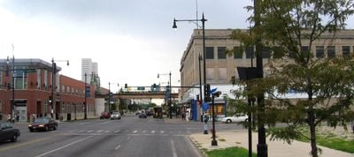
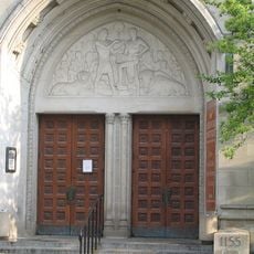
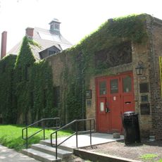
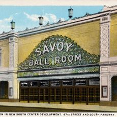
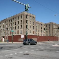
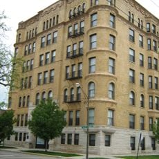
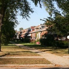
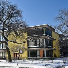
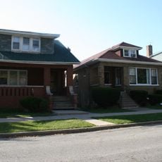
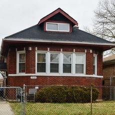
Englewood is a residential neighborhood on Chicago's South Side bounded by Garfield Boulevard, 75th Street, Racine Avenue, and Metra Railroad tracks. The area contains a mix of residential blocks, local businesses, schools, and public facilities including Kennedy-King College.

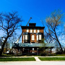
The area grew from oak forests and wetlands into a settlement after 1852 when railroad lines converged at Junction Grove. This rail infrastructure became the foundation for residential and commercial development in the decades that followed.

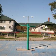
Music runs deep in the neighborhood through events like the Englewood Jazz Festival, which fills Hamilton Park with performances for several days each year. Local musicians and artists continue to shape the identity of this South Side community.

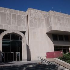
Transportation is convenient through the Red Line, Green Line, and Dan Ryan Expressway, connecting the neighborhood to the broader city. Kennedy-King College and numerous public schools serve the community with accessible locations throughout the area.

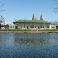
Hamilton Park and Sherman Park were designed by the Olmsted Brothers, the landscape architects behind the 1893 Chicago World's Fair. These two green spaces remain testament to their carefully planned design approach.

The community of curious travelers

AroundUs brings together thousands of curated places, local tips, and hidden gems, enriched daily by 60,000 contributors worldwide.

Start exploring
Location
Location
GPS coordinates
41.78000,-87.64500
Latest update
December 11, 2025 11:06
Around this place
Chicago Pile-1
United States of America

Chicago Pile-1

3.9 km
Oak Woods Cemetery
United States of America

Oak Woods Cemetery

3.9 km
Fountain of Time
United States of America

Fountain of Time

3.2 km
Nuclear Energy
United States of America

Nuclear Energy

3.9 km
Goldblatt's Building
United States of America

Goldblatt's Building

3.6 km
Institute for the Study of Ancient Cultures, West Asia & North Africa
United States of America

Institute for the Study of Ancient Cultures, West Asia & North Africa

4.1 km
Smart Museum of Art
United States of America

Smart Museum of Art

4 km
Joe and Rika Mansueto Library
United States of America

Joe and Rika Mansueto Library

3.9 km
Al-Sadiq Mosque
United States of America

Al-Sadiq Mosque

4.1 km
DuSable Museum of African American History
United States of America

DuSable Museum of African American History

3.4 km
Lorado Taft Midway Studios
United States of America

Lorado Taft Midway Studios

3.5 km
Renaissance Society
United States of America

Renaissance Society

3.8 km
Savoy Ballroom
United States of America

Savoy Ballroom

4 km
John Crerar Library
United States of America

John Crerar Library

3.7 km
George Herbert Jones Laboratory
United States of America

George Herbert Jones Laboratory

3.8 km
Harold Washington Cultural Center
United States of America

Harold Washington Cultural Center

4 km
Sherman Park
United States of America

Sherman Park

2 km
Michigan Boulevard Garden Apartments
United States of America

Michigan Boulevard Garden Apartments

3.8 km
Yale Apartments
United States of America

Yale Apartments

1.3 km
Raber House
United States of America

Raber House

1.8 km
DuSable Black History Museum and Education Center
United States of America

DuSable Black History Museum and Education Center

3.4 km
South Park Manor Historic District
United States of America

South Park Manor Historic District

3.3 km
Anthony Overton Elementary School
United States of America

Anthony Overton Elementary School

3.5 km
Cornell Square
United States of America

Cornell Square

3.3 km
West Chatham Bungalow Historic District
United States of America

West Chatham Bungalow Historic District

3.8 km
Auburn Gresham Bungalow Historic District
United States of America

Auburn Gresham Bungalow Historic District

3.4 km
Institute for the Study of Ancient Cultures Museum
United States of America

Institute for the Study of Ancient Cultures Museum

4.1 km
St. Martin de Tours Church
United States of America

St. Martin de Tours Church

1.3 km
Show the full map
« Englewood - Residential neighborhood in South Side, Chicago, US » is provided by Around Us (aroundus.com). Images and texts are derived from Wikimedia project under a Creative Commons license. You are allowed to copy, distribute, and modify copies of this page, under the conditions set by the license, as long as this note is clearly visible.

Discover hidden gems everywhere you go!

From secret cafés to breathtaking viewpoints, skip the crowded tourist spots and find places that match your style. Our app makes it easy with voice search, smart filtering, route optimization, and insider tips from travelers worldwide. Download now for the complete mobile experience.

Around Us App Screenshot

A unique approach to discovering new places

Le Figaro

All the places worth exploring

France Info

A tailor-made excursion in just a few clicks

20 Minutes

Around Us
Travel Guide & Maps
Download

Send to your phone

QR Code
1

Open the camera app on your mobile.

2

Point at the QR code with your camera. A notification will appear.

3

Tap the notification to open the link.