Enable Location

We need your location to show you interesting places around you

Discover nearby places

Find interesting locations and hidden gems around you

Precise directions

Get accurate directions and distances to places

Your location is never shared with other users. It's only used when you tap the location button.

Fisher Hill Historic District

Log in to your account

Start exploring — it's free

Trusted by 62,614 travelers worldwide

Continue with Google
Continue with Apple
or

We will send you a code to connect

By continuing, you accept our Terms and Conditions and our Privacy Policy

Check your inbox

We've sent a pincode in your inbox. Please enter the code below.

Fisher Hill Historic District, Historic residential district in Brookline, United States.

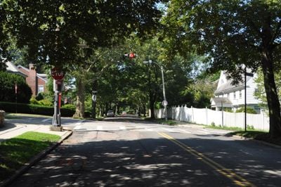
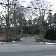
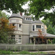
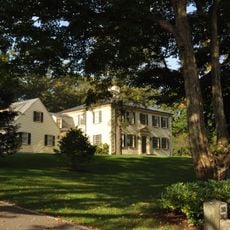
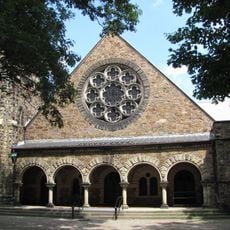
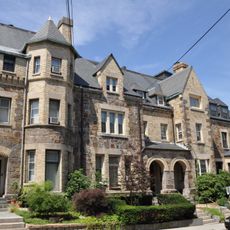
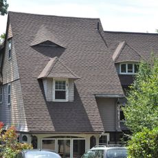
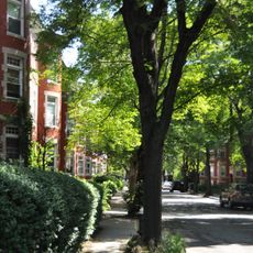
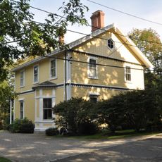
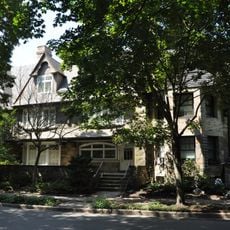
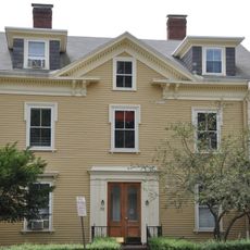
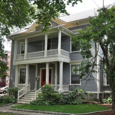
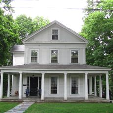
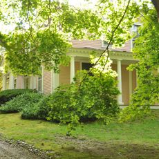
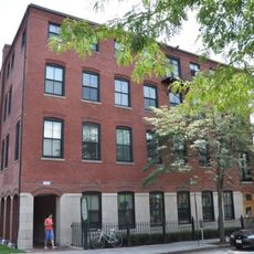
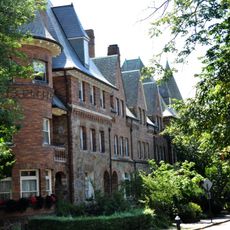
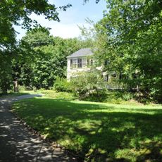
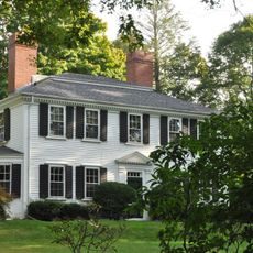
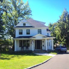
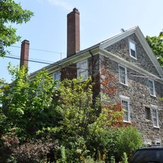
Fisher Hill Historic District is a residential neighborhood in Brookline featuring homes built between the 1880s and early 1900s in a range of architectural styles from classical to contemporary interpretations. The district spans roughly 150 acres with buildings arranged along tree-shaded streets that follow the original landscape design.

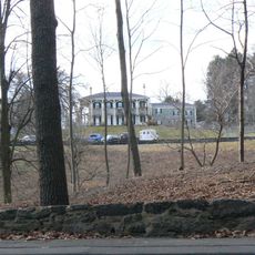
Development began in the 1880s under landscape designers Frederick Law Olmsted and John Charles Olmsted, who created the original subdivision plan for the area. A building restriction established in 1914 limited construction to single-family residences, preventing denser development.

The neighborhood was designed as a suburb for Boston's affluent families, and residents still maintain the quiet, tree-lined streets that define daily life here. Walking through, you notice how the generous lots and substantial homes reflect the aspirations of people who wanted distance from the city.

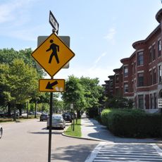
The district stretches from Chestnut Hill Avenue to Dean Road and is best explored on foot at your own pace. The wide streets and continuous sidewalks make walking through comfortable regardless of your starting point.

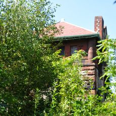
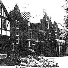
Each home was designed by a different architect for wealthy patrons, creating a remarkable collection of individual architectural expressions throughout the neighborhood. This variety makes the streets feel like an open-air gallery where no two houses are quite alike.

The community of curious travelers

AroundUs brings together thousands of curated places, local tips, and hidden gems, enriched daily by 60,000 contributors worldwide.

Start exploring
Location
GPS coordinates
42.33111,-71.14139
Latest update
December 14, 2025 18:15
Around this place
Fisher Hill Reservoir
United States of America

Fisher Hill Reservoir

283 m
Lewis Cabot Estate
United States of America

Lewis Cabot Estate

962 m
Reservoir Park
United States of America

Reservoir Park

654 m
Fernwood
United States of America

Fernwood

1.3 km
Perkins Estate
United States of America

Perkins Estate

1.2 km
Old Burying Ground
United States of America

Old Burying Ground

1.2 km
Lynch-O'Gorman House
United States of America

Lynch-O'Gorman House

1.3 km
Benjamin White House
United States of America

Benjamin White House

1.2 km
Beacon Street Historic District
United States of America

Beacon Street Historic District

1.2 km
Brookline Town Green Historic District
United States of America

Brookline Town Green Historic District

960 m
Green Hill Historic District
United States of America

Green Hill Historic District

1.3 km
Beaconsfield Terraces Historic District
United States of America

Beaconsfield Terraces Historic District

822 m
House at 89 Rawson Road and 86 Colburne Crescent
United States of America

House at 89 Rawson Road and 86 Colburne Crescent

737 m
Strathmore Road Historic District
United States of America

Strathmore Road Historic District

706 m
Charles Heath House
United States of America

Charles Heath House

599 m
House at 12–16 Corey Road
United States of America

House at 12–16 Corey Road

785 m
Robert S. Davis House
United States of America

Robert S. Davis House

1.2 km
House at 44 Stanton Road
United States of America

House at 44 Stanton Road

1.2 km
House at 155 Reservoir
United States of America

House at 155 Reservoir

788 m
Gen. Simon Elliot House
United States of America

Gen. Simon Elliot House

771 m
Ritchie Building
United States of America

Ritchie Building

1.3 km
Kilsyth Terrace
United States of America

Kilsyth Terrace

315 m
Timothy Corey House No. 1
United States of America

Timothy Corey House No. 1

1.2 km
Ebenezer Heath House
United States of America

Ebenezer Heath House

669 m
House at 83 Penniman Place
United States of America

House at 83 Penniman Place

575 m
Timothy Corey House No. 2
United States of America

Timothy Corey House No. 2

1.2 km
Metropolitan Waterworks Museum
United States of America

Metropolitan Waterworks Museum

1.2 km
Leavitt-Riedler Pumping Engine
United States of America

Leavitt-Riedler Pumping Engine

1.2 km
Show the full map
« Fisher Hill Historic District - Historic residential district in Brookline, United States » is provided by Around Us (aroundus.com). Images and texts are derived from Wikimedia project under a Creative Commons license. You are allowed to copy, distribute, and modify copies of this page, under the conditions set by the license, as long as this note is clearly visible.

Discover hidden gems everywhere you go!

From secret cafés to breathtaking viewpoints, skip the crowded tourist spots and find places that match your style. Our app makes it easy with voice search, smart filtering, route optimization, and insider tips from travelers worldwide. Download now for the complete mobile experience.

Around Us App Screenshot

A unique approach to discovering new places

Le Figaro

All the places worth exploring

France Info

A tailor-made excursion in just a few clicks

20 Minutes

Around Us
Travel Guide & Maps
Download

Send to your phone

QR Code
1

Open the camera app on your mobile.

2

Point at the QR code with your camera. A notification will appear.

3

Tap the notification to open the link.