Enable Location

We need your location to show you interesting places around you

Discover nearby places

Find interesting locations and hidden gems around you

Precise directions

Get accurate directions and distances to places

Your location is never shared with other users. It's only used when you tap the location button.

Fisher Hill Reservoir

Log in to your account

Start exploring — it's free

Trusted by 62,589 travelers worldwide

Continue with Google
Continue with Apple
or

We will send you a code to connect

By continuing, you accept our Terms and Conditions and our Privacy Policy

Check your inbox

We've sent a pincode in your inbox. Please enter the code below.

Fisher Hill Reservoir, stuwmeer in de Verenigde Staten

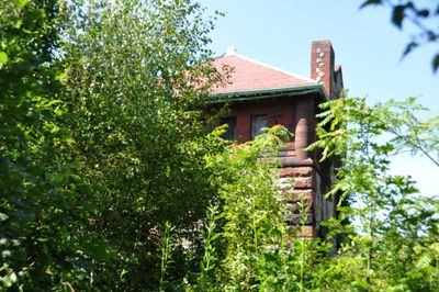
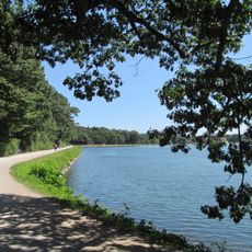
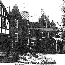
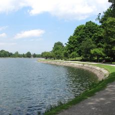
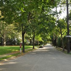
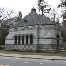
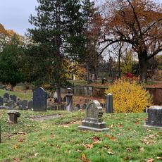
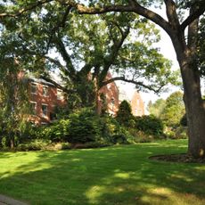
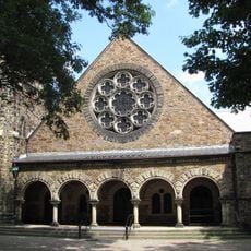
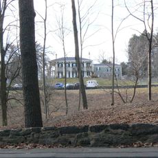
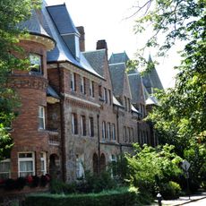
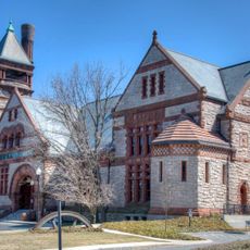
Fisher Hill Reservoir is a historic park and water infrastructure site in Brookline, Massachusetts, originally built in the late 1800s as a water storage facility for the Boston region. The grounds cover about ten acres and feature preserved earthworks showing the former basin shape, a restored gatehouse building in Richardsonian Romanesque style with granite promenade, walking paths, play areas, and natural plantings of maple, oak, and other native species.

The facility was built from 1886 to 1887 and served as a key part of Boston's water system. It operated for over 60 years before being decommissioned in the 1950s, after which the site remained unused until the town of Brookline purchased the land in 2001 with plans to transform it into a public park.

The name refers to the geographic location of the former water storage facility on Fisher Hill. Today the site serves as a neighborhood gathering place where residents walk, play, and hold community events, while the restored gatehouse building stands as a physical reminder of the site's functional past.

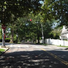
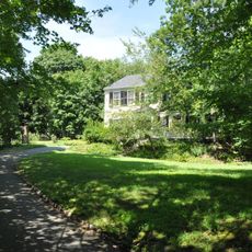
The site is easily accessible with established paths suitable for all visitors that wind along the natural landforms. The park is open year-round and offers activities like soccer and picnics in warmer months, while the slopes double as sledding hills during winter.

A striking feature often overlooked is the carved granite wall marking the former high water level at 241 feet (73 meters), with steel letters inlaid to help visitors understand the historical water height. This small detail connects visitors directly to the engineering aspects of the water system that once operated here.

The community of curious travelers

AroundUs brings together thousands of curated places, local tips, and hidden gems, enriched daily by 60,000 contributors worldwide.

Start exploring
Location
GPS coordinates
42.32917,-71.14361
Latest update
February 9, 2026 08:20
Around this place
Chestnut Hill Reservoir
United States of America

Chestnut Hill Reservoir

1.4 km
Chestnut Hill Reservation
United States of America

Chestnut Hill Reservation

1.4 km
Lewis Cabot Estate
United States of America

Lewis Cabot Estate

737 m
Reservoir Park
United States of America

Reservoir Park

650 m
Chestnut Hill Historic District
United States of America

Chestnut Hill Historic District

1.3 km
Chestnut Hill Reservoir Historic District
United States of America

Chestnut Hill Reservoir Historic District

1.4 km
Fisher Hill Historic District
United States of America

Fisher Hill Historic District

283 m
Fernwood
United States of America

Fernwood

1 km
Perkins Estate
United States of America

Perkins Estate

960 m
Old Burying Ground
United States of America

Old Burying Ground

1.3 km
Benjamin White House
United States of America

Benjamin White House

910 m
Paine Estate
United States of America

Paine Estate

1.1 km
Brookline Town Green Historic District
United States of America

Brookline Town Green Historic District

1 km
George R. Minot House
United States of America

George R. Minot House

1.3 km
Green Hill Historic District
United States of America

Green Hill Historic District

1.2 km
Beaconsfield Terraces Historic District
United States of America

Beaconsfield Terraces Historic District

1.1 km
House at 89 Rawson Road and 86 Colburne Crescent
United States of America

House at 89 Rawson Road and 86 Colburne Crescent

1 km
Strathmore Road Historic District
United States of America

Strathmore Road Historic District

813 m
Charles Heath House
United States of America

Charles Heath House

377 m
House at 12–16 Corey Road
United States of America

House at 12–16 Corey Road

991 m
House at 155 Reservoir
United States of America

House at 155 Reservoir

531 m
Gen. Simon Elliot House
United States of America

Gen. Simon Elliot House

508 m
Kilsyth Terrace
United States of America

Kilsyth Terrace

46 m
Timothy Corey House No. 1
United States of America

Timothy Corey House No. 1

1.4 km
Ebenezer Heath House
United States of America

Ebenezer Heath House

434 m
Timothy Corey House No. 2
United States of America

Timothy Corey House No. 2

1.4 km
House at 83 Penniman Place
United States of America

House at 83 Penniman Place

478 m
Metropolitan Waterworks Museum
United States of America

Metropolitan Waterworks Museum

1 km
Show the full map
« Fisher Hill Reservoir - stuwmeer in de Verenigde Staten » is provided by Around Us (aroundus.com). Images and texts are derived from Wikimedia project under a Creative Commons license. You are allowed to copy, distribute, and modify copies of this page, under the conditions set by the license, as long as this note is clearly visible.

Discover hidden gems everywhere you go!

From secret cafés to breathtaking viewpoints, skip the crowded tourist spots and find places that match your style. Our app makes it easy with voice search, smart filtering, route optimization, and insider tips from travelers worldwide. Download now for the complete mobile experience.

Around Us App Screenshot

A unique approach to discovering new places

Le Figaro

All the places worth exploring

France Info

A tailor-made excursion in just a few clicks

20 Minutes

Around Us
Travel Guide & Maps
Download

Send to your phone

QR Code
1

Open the camera app on your mobile.

2

Point at the QR code with your camera. A notification will appear.

3

Tap the notification to open the link.