Enable Location

We need your location to show you interesting places around you

Discover nearby places

Find interesting locations and hidden gems around you

Precise directions

Get accurate directions and distances to places

Your location is never shared with other users. It's only used when you tap the location button.

Chestnut Hill Reservoir Historic District

Log in to your account

Start exploring — it's free

Trusted by 61,491 travelers worldwide

Continue with Google
Continue with Apple
or

We will send you a code to connect

By continuing, you accept our Terms and Conditions and our Privacy Policy

Check your inbox

We've sent a pincode in your inbox. Please enter the code below.

Chestnut Hill Reservoir Historic District

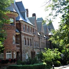
Chestnut Hill Reservoir Historic District, Historic water management district in Chestnut Hill, Boston, US.

Description

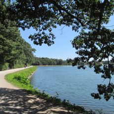
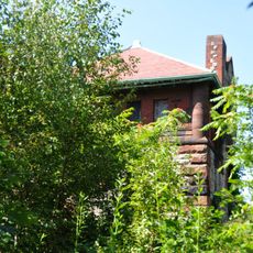
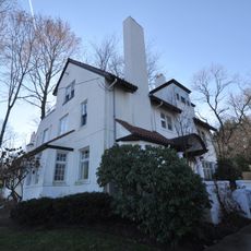
The Chestnut Hill Reservoir Historic District is a water management complex in Boston containing a large reservoir, an operational pumping station, and multiple stone buildings. The layout follows historic aqueduct lines and serves as a functioning part of the regional water supply system.

History

The reservoir was built between 1865 and 1870 to provide additional water capacity for Boston's expanding population. This expansion connected multiple aqueduct systems and became a vital turning point in the city's ability to serve rapidly growing neighborhoods.

Culture

The district reveals how residents relied on engineered water systems as cities grew, and valued the infrastructure as essential infrastructure for urban life. The stone structures and water channels remain symbols of this commitment to shared resources.

Practical

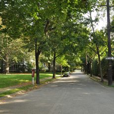
The district has well-maintained paths for walking and jogging around the water basin and stone buildings. Visitors should wear comfortable shoes and allow time to explore both the open grounds and access to the historic structures.

Did you know?

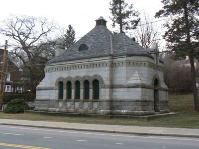
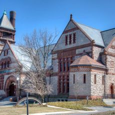
A distinctive feature is the Romanesque stone terminal chamber on Beacon Street, which housed gates controlling water from two separate sources. This rare junction point reveals how engineers of that era merged multiple water systems into one coherent network.

Location
GPS coordinates
42.33510,-71.15850
Latest update
December 14, 2025 14:21

AroundUs brings together thousands of curated places, local tips, and hidden gems, enriched daily by 60,000 contributors worldwide. Discover all places nearby (Boston).

Around this place
United States of America

Alumni Stadium

649 m
Chestnut Hill Reservoir
United States of America

Chestnut Hill Reservoir

3 m
Gasson Hall
United States of America

Gasson Hall

989 m
Boston College Main Campus Historic District
United States of America

Boston College Main Campus Historic District

1.1 km
Eddie Pellagrini Diamond at John Shea Field
United States of America

Eddie Pellagrini Diamond at John Shea Field

389 m
Chestnut Hill Reservation
United States of America

Chestnut Hill Reservation

0 m
Harrington Athletics Village
United States of America

Harrington Athletics Village

390 m
Fisher Hill Reservoir
United States of America

Fisher Hill Reservoir

1.4 km
Evergreen Cemetery
United States of America

Evergreen Cemetery

519 m
The Chestnut Hill
United States of America

The Chestnut Hill

1.4 km
Reginald A. Fessenden House
United States of America

Reginald A. Fessenden House

1.2 km
Chestnut Hill Historic District
United States of America

Chestnut Hill Historic District

936 m
Fisher Hill Historic District
United States of America

Fisher Hill Historic District

1.5 km
Old Chestnut Hill Historic District
United States of America

Old Chestnut Hill Historic District

942 m
Hammond House
United States of America

Hammond House

1.3 km
Paine Estate
United States of America

Paine Estate

1.4 km
House at 41 Middlesex Road
United States of America

House at 41 Middlesex Road

1.1 km
House at 107 Waban Hill Road
United States of America

House at 107 Waban Hill Road

1.3 km
Strathmore Road Historic District
United States of America

Strathmore Road Historic District

980 m
House at 152 Suffolk Road
United States of America

House at 152 Suffolk Road

1.4 km
House at 12–16 Corey Road
United States of America

House at 12–16 Corey Road

1.3 km
House at 155 Reservoir
United States of America

House at 155 Reservoir

1.1 km
Kilsyth Terrace
United States of America

Kilsyth Terrace

1.4 km
House at 83 Penniman Place
United States of America

House at 83 Penniman Place

920 m
Metropolitan Waterworks Museum
United States of America

Metropolitan Waterworks Museum

446 m
Leavitt-Riedler Pumping Engine
United States of America

Leavitt-Riedler Pumping Engine

445 m
McMullen Museum of Art, Boston College
United States of America

McMullen Museum of Art, Boston College

717 m
Kingsbury House
United States of America

Kingsbury House

1.3 km
Show the full map
« Chestnut Hill Reservoir Historic District - Historic water management district in Chestnut Hill, Boston, US » is provided by Around Us (aroundus.com). Images and texts are derived from Wikimedia project under a Creative Commons license. You are allowed to copy, distribute, and modify copies of this page, under the conditions set by the license, as long as this note is clearly visible.

Discover hidden gems everywhere you go!

From secret cafés to breathtaking viewpoints, skip the crowded tourist spots and find places that match your style. Our app makes it easy with voice search, smart filtering, route optimization, and insider tips from travelers worldwide. Download now for the complete mobile experience.

Around Us App Screenshot

A unique approach to discovering new places

Le Figaro

All the places worth exploring

France Info

A tailor-made excursion in just a few clicks

20 Minutes

Around Us
Travel Guide & Maps
Download

Send to your phone

QR Code
1

Open the camera app on your mobile.

2

Point at the QR code with your camera. A notification will appear.

3

Tap the notification to open the link.