Fishtrap Lake State Park, State park with lake in Pike County, Kentucky, US.
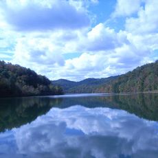
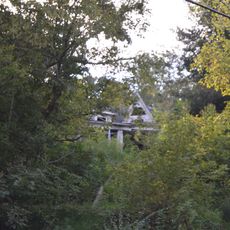
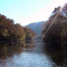
Fishtrap Lake State Park is a state park featuring a reservoir surrounded by steep hills and thick forest in southeastern Kentucky. The water sits tucked between forested ridges that rise sharply from the shoreline.
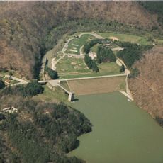
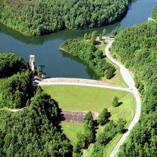
The Army Corps of Engineers built the reservoir between 1962 and 1968 to control flooding along the Ohio and Big Sandy Rivers. Creating the lake transformed how water moved through this mountain region.
The name comes from fish weirs that Native peoples built long ago, and you can sense this heritage walking through the forested land around the water.
The park is easy to reach and navigate, with clear paths from the parking areas to different sections. Spring through fall offers the best weather for walking and enjoying the water.
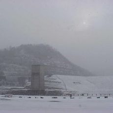
The reservoir sits behind one of the state's tallest dams, a feat of engineering that visitors often overlook. This massive structure holds back millions of gallons of water that would otherwise flood the valleys below.
Location: Kentucky
Inception: 2003
Website: http://parks.ky.gov/parks/recreationparks/fishtrap-lake/default.aspx
GPS coordinates: 37.43500,-82.41940
Latest update: December 14, 2025 11:02
Breaks Interstate Park
18.9 kmPikeville Cut-Through
11.5 km
Jenny Wiley State Resort Park
39.8 km
Dewey Lake
43.1 km
Coal House
29.2 km
Fishtrap Lake
500 m
Samuel May House
42 km
Elkhorn City Railroad Museum
16 km
Ralph Stanley Museum
31.9 km
Big Sandy Heritage Center
10.1 km
Sunnydale Farm
33.6 km
Buchanan County Courthouse
33.3 km
Martin Himler House
45.1 km
Clinch Ranger District Cluster
38 km
Methodist Episcopal Church, South
40.4 km
Dickenson County Courthouse
31.9 km
College Street Historic District
10.1 km
Little Laurel Branch
20.6 km
North Fork of the Pound
39.9 km
Pikeville College Academy Building
10.1 km
Williamson Historic District
29.6 km
Front Street Historic District
40.6 km
Pikeville Commercial Historic District
10 km
Fitzpatrick-Harmon House
40.6 km
Matewan Depot Replica Welcome Center and Museum
30.4 km
North Fork Pound Reservoir
39.3 km
Matewan Historic District
30.6 km
Boldman Bridge
20.6 kmVisited this place? Tap the stars to rate it and share your experience / photos with the community! Try now! You can cancel it anytime.
Discover hidden gems everywhere you go!
From secret cafés to breathtaking viewpoints, skip the crowded tourist spots and find places that match your style. Our app makes it easy with voice search, smart filtering, route optimization, and insider tips from travelers worldwide. Download now for the complete mobile experience.
A unique approach to discovering new places❞
— Le Figaro
All the places worth exploring❞
— France Info
A tailor-made excursion in just a few clicks❞
— 20 Minutes