Chest opened
+${chestReward.xp} XP
Explorer
NOUVEAU ×${chestReward.collectible.quantity}
tapez pour fermer
Chest locked

Open chests in the app

Around Us is built for your phone — chests unlock when you walk, explore and capture nearby places.

Enable Location

We need your location to show you interesting places around you

Discover nearby places

Find interesting locations and hidden gems around you

Precise directions

Get accurate directions and distances to places

Your location is never shared with other users. It's only used when you tap the location button.

Fort DeRussy

Log in to your account

Start exploring — it's free

Trusted by 72,989 travelers worldwide

Continue with Google
Continue with Apple
or

We will send you a code to connect

By continuing, you accept our Terms and Conditions and our Privacy Policy

Check your inbox

We've sent a pincode in your inbox. Please enter the code below.

Discussion Reviews 1 Photos
3.1k Popularity

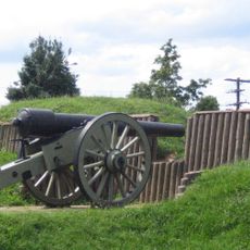
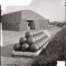
Fort DeRussy, Civil War fortification in Rock Creek Park, United States.

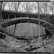
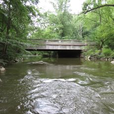
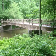
Fort DeRussy is a Civil War fortification in Rock Creek Park in Washington, D.C., located on elevated terrain with original perimeter dimensions of about 190 yards. The surviving earthwork walls and trenches outline the former installation embedded within the park landscape.

The fortification was built in 1861 by the 4th New York Heavy Artillery as part of the defensive network surrounding the capital. It played a role during the Battle of Fort Stevens in the defense of Washington against attacks from the north.

The fort was part of the defensive ring protecting Washington, and it shows how soldiers shaped the landscape for military purposes. Today visitors can see the earthwork layout and understand how this place functioned during wartime.

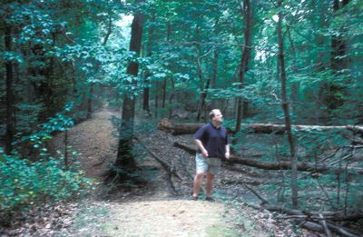
The site is accessible via a dirt trail starting at the intersection of Military Road and Oregon Avenue, leading through the park. Visitors should expect uneven ground and steps, and the site is best explored during dry weather.

During the fighting in 1864, the fort held strategic importance in repelling attacks on the city. The guns positioned here had a reach that extended far beyond the immediate site and protected surrounding areas.

The community of curious travelers

AroundUs brings together thousands of curated places, local tips, and hidden gems, enriched daily by 60,000 contributors worldwide.

Start exploring
Location
Inception
1861
Elevation above the sea
103 m
Part of
Civil War defenses of Washington, D.C.
GPS coordinates
38.96306,-77.05111
Latest update
December 18, 2025 11:40
Around this place
Hillwood Estate, Museum & Gardens
United States of America

Hillwood Estate, Museum & Gardens

2.2 km
Hughes Memorial Tower
United States of America

Hughes Memorial Tower

2.1 km
Fort Stevens
United States of America

Fort Stevens

1.9 km
Brightwood
United States of America

Brightwood

2.1 km
Peter Muhlenberg Memorial
United States of America

Peter Muhlenberg Memorial

1.9 km
Twelve Monograms
United States of America

Twelve Monograms

2.2 km
Carter Barron Amphitheatre
United States of America

Carter Barron Amphitheatre

1.6 km
Battleground National Cemetery
United States of America

Battleground National Cemetery

2.3 km
Joaquin Miller Cabin
United States of America

Joaquin Miller Cabin

429 m
Avalon Theatre
United States of America

Avalon Theatre

2.2 km
Washington Heights Historic District
United States of America

Washington Heights Historic District

2.1 km
Building 40
United States of America

Building 40

2.1 km
Boulder Bridge
United States of America

Boulder Bridge

1.7 km
Fort Kearny
United States of America

Fort Kearny

1.6 km
Chevy Chase Arcade
United States of America

Chevy Chase Arcade

2 km
Boulder Bridge and Ross Drive Bridge
United States of America

Boulder Bridge and Ross Drive Bridge

1.7 km
Fort View Apartments
United States of America

Fort View Apartments

1.7 km
Ponce de Leon Apartment Building
United States of America

Ponce de Leon Apartment Building

2 km
Ross Drive Bridge
United States of America

Ross Drive Bridge

1.2 km
Chevy Chase Neighborhood Library
United States of America

Chevy Chase Neighborhood Library

2.1 km
Military Road School
United States of America

Military Road School

1.6 km
Rock Creek Park Nature Center and Planetarium
United States of America

Rock Creek Park Nature Center and Planetarium

348 m
Penguin Fountain
United States of America

Penguin Fountain

2.3 km
Rock Creek Park Historic District
United States of America

Rock Creek Park Historic District

1.7 km
Soapstone Valley Park
United States of America

Soapstone Valley Park

2 km
Rapids Footbridge
United States of America

Rapids Footbridge

1.3 km
Joyce Road Bridge
United States of America

Joyce Road Bridge

825 m
Riley Spring Bridge
United States of America

Riley Spring Bridge

1.8 km
Show the full map
Reviews
Share your experience

No review yet

Discussions
Start a discussion...

No discussion yet

« Fort DeRussy - Civil War fortification in Rock Creek Park, United States » is provided by Around Us (aroundus.com). Images and texts are derived from Wikimedia project under a Creative Commons license. You are allowed to copy, distribute, and modify copies of this page, under the conditions set by the license, as long as this note is clearly visible.

Discover hidden gems everywhere you go!

From secret cafés to breathtaking viewpoints, skip the crowded tourist spots and find places that match your style. Our app makes it easy with voice search, smart filtering, route optimization, and insider tips from travelers worldwide. Download now for the complete mobile experience.

Around Us App Screenshot

A unique approach to discovering new places

Le Figaro

All the places worth exploring

France Info

A tailor-made excursion in just a few clicks

20 Minutes

Around Us
Travel Guide & Maps
Download

Send to your phone

QR Code
1

Open the camera app on your mobile.

2

Point at the QR code with your camera. A notification will appear.

3

Tap the notification to open the link.