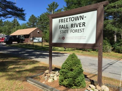
Freetown Fall River State Forest, Protected forest in southeastern Massachusetts.
Freetown Fall River State Forest is a protected area in southeastern Massachusetts that covers roughly 2,200 hectares and includes hiking trails, unpaved roads, and Rattlesnake Brook. The landscape shifts between deciduous forest, pine stands, and open wetlands that follow natural watercourses.
The Civilian Conservation Corps laid out the basic structure of the forest between 1935 and 1937, building trails, shelters, and fire pits. These installations still shape the paths and rest areas throughout the territory.
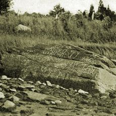
The name Profile Rock refers to a granite formation that resembles a human face and has held meaning for the Wampanoag for centuries. Part of the forest today forms a reservation where traditional connections to the land continue.
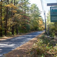
The forest is open daily from sunrise to sunset and offers about 80 kilometers of trails for walkers, cyclists, and riders. In winter, visitors use the same routes for snowshoeing and cross-country skiing when snow cover permits.
The forest forms part of the Southeastern Massachusetts Bioreserve and contributes to natural filtration of drinking water for several surrounding towns. This function remains mostly invisible to visitors, though it explains the protection of watercourses.
The community of curious travelers
AroundUs brings together thousands of curated places, local tips, and hidden gems, enriched daily by 60,000 contributors worldwide.