Chest opened
+${chestReward.xp} XP
Explorer
NOUVEAU ×${chestReward.collectible.quantity}
tapez pour fermer
Chest locked

Open chests in the app

Around Us is built for your phone — chests unlock when you walk, explore and capture nearby places.

Enable Location

We need your location to show you interesting places around you

Discover nearby places

Find interesting locations and hidden gems around you

Precise directions

Get accurate directions and distances to places

Your location is never shared with other users. It's only used when you tap the location button.

Log in to your account

Start exploring — it's free

Trusted by 72,963 travelers worldwide

Continue with Google
Continue with Apple
or

We will send you a code to connect

By continuing, you accept our Terms and Conditions and our Privacy Policy

Check your inbox

We've sent a pincode in your inbox. Please enter the code below.

Gilmor's Raid
Discussion Reviews Photo
2.4k Popularity

Gilmor's Raid, Civil War cavalry raid in Baltimore County, United States

Gilmor's Raid was a Confederate cavalry operation in 1864 that deployed about 135 soldiers from Maryland regiments through Baltimore and Harford counties. The forces under Major Harry Gilmor targeted railroad infrastructure and supply stations across the region.

The raid took place in 1864 as part of campaigns during the American Civil War. It occurred when Confederate forces sought to disrupt Union supply lines and threaten military positions in Maryland.

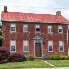
The raid affected local communities when Confederate forces captured supplies from Jerusalem Mill store before advancing toward Magnolia Station.

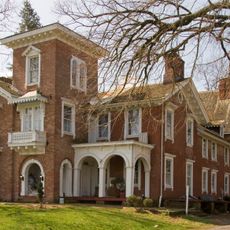
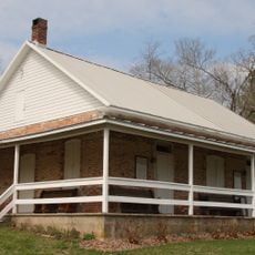
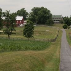
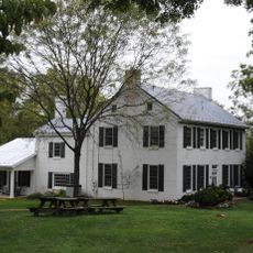
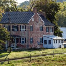
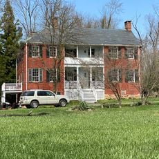
The locations involved in this action spread across Baltimore and Harford counties in a wide geographic area. Visitors should expect that sites related to this history are dispersed and require travel between different parts of the region.

During the raid, Union General William B. Franklin was captured by Confederate forces, making him a notable prisoner of war. His capture was significant because senior officers rarely fell into enemy hands during operations like this one.

The community of curious travelers

AroundUs brings together thousands of curated places, local tips, and hidden gems, enriched daily by 60,000 contributors worldwide.

Start exploring
Location
GPS coordinates
39.57670,-77.00000
Latest update
December 13, 2025 11:42
Around this place
Whittaker Chambers Farm
United States of America

Whittaker Chambers Farm

9.5 km
Bear Branch Nature Center
United States of America

Bear Branch Nature Center

7.6 km
Carroll County Almshouse and Farm
United States of America

Carroll County Almshouse and Farm

2.1 km
Western Maryland College Historic District
United States of America

Western Maryland College Historic District

565 m
Trevanion
United States of America

Trevanion

13.1 km
Avondale
United States of America

Avondale

3.2 km
Appler-Englar House
United States of America

Appler-Englar House

11.3 km
Pipe Creek Friends Meetinghouse
United States of America

Pipe Creek Friends Meetinghouse

14.7 km
Uniontown Historic District
United States of America

Uniontown Historic District

10.1 km
Baker Memorial Chapel
United States of America

Baker Memorial Chapel

813 m
Westminster Historic District
United States of America

Westminster Historic District

445 m
Charlotte's Quest Nature Center
United States of America

Charlotte's Quest Nature Center

14.2 km
Hampstead School
United States of America

Hampstead School

13.4 km
Christopher Erb House
United States of America

Christopher Erb House

12.2 km
Meadow Brook Farm
United States of America

Meadow Brook Farm

3.2 km
Slagle-Byers House
United States of America

Slagle-Byers House

5 km
Linwood Historic District
United States of America

Linwood Historic District

12.3 km
Philip and Uriah Arter Farm
United States of America

Philip and Uriah Arter Farm

10.4 km
United States of America

Solomon Arter House

12.2 km
New Windsor Historic District
United States of America

New Windsor Historic District

9.8 km
Rockland Farm
United States of America

Rockland Farm

4.1 km
Friendship Valley Farm
United States of America

Friendship Valley Farm

3.3 km
Robert and Phyllis Scott House
United States of America

Robert and Phyllis Scott House

5.4 km
John Orendorff Farm
United States of America

John Orendorff Farm

4.7 km
Hard Lodging
United States of America

Hard Lodging

14.3 km
Englar-Schweigart-Rinehart Farm
United States of America

Englar-Schweigart-Rinehart Farm

3.4 km
Stoner-Saum Farm
United States of America

Stoner-Saum Farm

14.9 km
Wilson's Inheritance
United States of America

Wilson's Inheritance

13.7 km
Show the full map
Reviews
Share your experience

No review yet

Discussions
Start a discussion...

No discussion yet

« Gilmor's Raid - Civil War cavalry raid in Baltimore County, United States » is provided by Around Us (aroundus.com). Images and texts are derived from Wikimedia project under a Creative Commons license. You are allowed to copy, distribute, and modify copies of this page, under the conditions set by the license, as long as this note is clearly visible.

Discover hidden gems everywhere you go!

From secret cafés to breathtaking viewpoints, skip the crowded tourist spots and find places that match your style. Our app makes it easy with voice search, smart filtering, route optimization, and insider tips from travelers worldwide. Download now for the complete mobile experience.

Around Us App Screenshot

A unique approach to discovering new places

Le Figaro

All the places worth exploring

France Info

A tailor-made excursion in just a few clicks

20 Minutes

Around Us
Travel Guide & Maps
Download

Send to your phone

QR Code
1

Open the camera app on your mobile.

2

Point at the QR code with your camera. A notification will appear.

3

Tap the notification to open the link.