Chest opened
+${chestReward.xp} XP
Explorer
NOUVEAU ×${chestReward.collectible.quantity}
tapez pour fermer
Chest locked

Open chests in the app

Around Us is built for your phone — chests unlock when you walk, explore and capture nearby places.

Enable Location

We need your location to show you interesting places around you

Discover nearby places

Find interesting locations and hidden gems around you

Precise directions

Get accurate directions and distances to places

Your location is never shared with other users. It's only used when you tap the location button.

Log in to your account

Start exploring — it's free

Trusted by 72,930 travelers worldwide

Continue with Google
Continue with Apple
or

We will send you a code to connect

By continuing, you accept our Terms and Conditions and our Privacy Policy

Check your inbox

We've sent a pincode in your inbox. Please enter the code below.

Hales Island
Discussion Reviews Photo
1.9k Popularity

Hales Island, River island in Haverhill, Massachusetts.

Hales Island is a river island in the Merrimack River covering roughly 54 acres with natural vegetation across its surface. Several artesian wells feed the site and contribute to its landscape character.

The island was initially used as grazing land for livestock before becoming a golf course in the early 1900s. A major flood in 1936 destroyed the golf facilities and restructured the landscape.

The island was once home to recreational activities that drew players from the surrounding region. Traces of this sporting past remain visible to observant visitors.

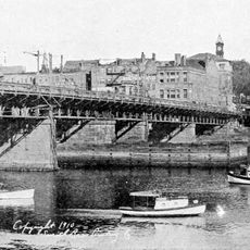
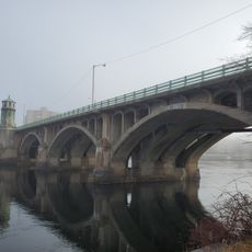
A stone bridge connects the island to Bradford and becomes partially visible when water levels drop. High water levels cause the bridge to submerge completely, restricting access to the site.

The island still contains foundation remains from the former golf clubhouse that visitors can explore. These remnants offer a tangible connection to the site's sporting past and its transformation over time.

The community of curious travelers

AroundUs brings together thousands of curated places, local tips, and hidden gems, enriched daily by 60,000 contributors worldwide.

Start exploring
Location
GPS coordinates
42.76110,-71.05610
Latest update
December 21, 2025 16:05
Around this place
Winnekenni Castle
United States of America

Winnekenni Castle

3.1 km
Dustin House
United States of America

Dustin House

6 km
L.H. Hamel Leather Company Historic District
United States of America

L.H. Hamel Leather Company Historic District

2.9 km
Samuel Chase House
United States of America

Samuel Chase House

5.4 km
George Kunhardt Estate
United States of America

George Kunhardt Estate

6.5 km
Rocks Village Historic District
United States of America

Rocks Village Historic District

6.9 km
Haverhill Historical Society Historic District
United States of America

Haverhill Historical Society Historic District

1.6 km
Ephraim Davis House
United States of America

Ephraim Davis House

6.9 km
Newell Farm
United States of America

Newell Farm

5.9 km
Bradford Common Historic District
United States of America

Bradford Common Historic District

2 km
Joseph Hardy House
United States of America

Joseph Hardy House

4.2 km
Hazen-Spiller House
United States of America

Hazen-Spiller House

5.1 km
George Hopkinson House
United States of America

George Hopkinson House

1.7 km
Emerson House
United States of America

Emerson House

2.8 km
Winter Street School
United States of America

Winter Street School

2.9 km
East Parish Meeting House
United States of America

East Parish Meeting House

4.7 km
Adams-Clarke House
United States of America

Adams-Clarke House

5.9 km
School Street School
United States of America

School Street School

2 km
Primrose Street Schoolhouse
United States of America

Primrose Street Schoolhouse

3.1 km
Washington Street Shoe District
United States of America

Washington Street Shoe District

2.7 km
Soldiers and Sailors Memorial Building
United States of America

Soldiers and Sailors Memorial Building

6.8 km
Georgetown Central School
United States of America

Georgetown Central School

6.7 km
The Museum of Printing
United States of America

The Museum of Printing

5.5 km
Hastings-Morse House
United States of America

Hastings-Morse House

5.1 km
Main Street Historic District
United States of America

Main Street Historic District

2.6 km
Intervale Factory
United States of America

Intervale Factory

3.4 km
Haverhill Bridge
United States of America

Haverhill Bridge

2.2 km
Basiliere Bridge
United States of America

Basiliere Bridge

2.2 km
Show the full map
Reviews
Share your experience

No review yet

Discussions
Start a discussion...

No discussion yet

« Hales Island - River island in Haverhill, Massachusetts » is provided by Around Us (aroundus.com). Images and texts are derived from Wikimedia project under a Creative Commons license. You are allowed to copy, distribute, and modify copies of this page, under the conditions set by the license, as long as this note is clearly visible.

Discover hidden gems everywhere you go!

From secret cafés to breathtaking viewpoints, skip the crowded tourist spots and find places that match your style. Our app makes it easy with voice search, smart filtering, route optimization, and insider tips from travelers worldwide. Download now for the complete mobile experience.

Around Us App Screenshot

A unique approach to discovering new places

Le Figaro

All the places worth exploring

France Info

A tailor-made excursion in just a few clicks

20 Minutes

Around Us
Travel Guide & Maps
Download

Send to your phone

QR Code
1

Open the camera app on your mobile.

2

Point at the QR code with your camera. A notification will appear.

3

Tap the notification to open the link.