·

Enable Location

We need your location to show you interesting places around you

Discover nearby places

Find interesting locations and hidden gems around you

Precise directions

Get accurate directions and distances to places

Your location is never shared with other users. It's only used when you tap the location button.

Hartford City Courthouse Square Historic District

Log in to your account

Start exploring — it's free

Trusted by 62,699 travelers worldwide

Continue with Google
Continue with Apple
or

We will send you a code to connect

By continuing, you accept our Terms and Conditions and our Privacy Policy

Check your inbox

We've sent a pincode in your inbox. Please enter the code below.

Hartford City Courthouse Square Historic District

Hartford City Courthouse Square Historic District, National Historic District in Hartford City, Indiana.

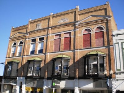
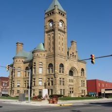
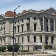
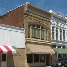
Hartford City Courthouse Square Historic District is a collection of more than 60 buildings surrounding the Blackford County Courthouse in Indiana. The structures display Commercial Italianate, Renaissance Revival, and Romanesque Revival architectural styles from around the 1890s.

The district arose during the Indiana Gas Boom of the 1880s when natural gas discovery transformed the area from an agricultural community into a manufacturing center. The courthouse and surrounding buildings grew as expressions of this economic shift.

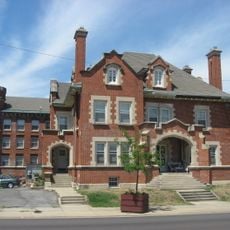
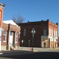
The brick buildings show how the town transformed from farmland into an industrial center during its prosperous years. Walking through the district, you notice how these structures reflect the confidence and wealth of that time.

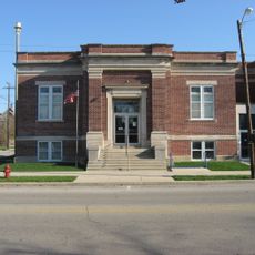
The district contains administrative buildings, shops, and war memorials that remain publicly accessible today. You get the best experience by strolling through the streets to discover the facade details and the central courthouse square.

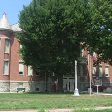
The clock tower of the Blackford County Courthouse serves as the focal point of the district, showcasing the wealth generated by the gas industry boom. Many visitors pass by without noticing the intricate details that made this building a symbol of civic pride.

The community of curious travelers

AroundUs brings together thousands of curated places, local tips, and hidden gems, enriched daily by 60,000 contributors worldwide.

Start exploring
Location
GPS coordinates
40.45139,-85.36806
Latest update
December 14, 2025 11:22
Around this place
Scheumann Stadium
United States of America

Scheumann Stadium

26.5 km
Minnetrista
United States of America

Minnetrista

27.4 km
Marie Webster House
United States of America

Marie Webster House

27.2 km
Gene Stratton-Porter Cabin
United States of America

Gene Stratton-Porter Cabin

3.7 km
Marion National Cemetery
United States of America

Marion National Cemetery

23.5 km
Blackford County Courthouse
United States of America

Blackford County Courthouse

31 m
First Presbyterian Church
United States of America

First Presbyterian Church

156 m
Cumberland Covered Bridge
United States of America

Cumberland Covered Bridge

12.1 km
Grant County Jail and Sheriff's Residence
United States of America

Grant County Jail and Sheriff's Residence

27.3 km
Mount Zion Methodist Episcopal Church
United States of America

Mount Zion Methodist Episcopal Church

11.9 km
Miami Indian
United States of America

Miami Indian

13.8 km
Israel Jenkins House
United States of America

Israel Jenkins House

14.4 km
Marion Downtown Commercial Historic District
United States of America

Marion Downtown Commercial Historic District

27.4 km
Rebecca Rankin Round Barn
United States of America

Rebecca Rankin Round Barn

24.6 km
Montpelier Carnegie Library
United States of America

Montpelier Carnegie Library

13.6 km
Redkey Historic District
United States of America

Redkey Historic District

21.5 km
West Ward School
United States of America

West Ward School

21.5 km
Baldwin Addition Historic District
United States of America

Baldwin Addition Historic District

24.2 km
Thompson-Ray House
United States of America

Thompson-Ray House

20.8 km
Felt's Farm
United States of America

Felt's Farm

13.1 km
Abijah C. Jay House
United States of America

Abijah C. Jay House

27.3 km
J.W. Patterson House
United States of America

J.W. Patterson House

24.1 km
Fairmount Commercial Historic District
United States of America

Fairmount Commercial Historic District

24.3 km
Joseph & Lucinda Thawley House
United States of America

Joseph & Lucinda Thawley House

26.4 km
Hamilton Township Schoolhouse No. 4
United States of America

Hamilton Township Schoolhouse No. 4

22 km
Wysor Heights Historic District
United States of America

Wysor Heights Historic District

27.5 km
Job Garner-Jacob W. Miller House
United States of America

Job Garner-Jacob W. Miller House

26 km
LaFollette Complex
United States of America

LaFollette Complex

27.4 km
Show the full map
« Hartford City Courthouse Square Historic District - National Historic District in Hartford City, Indiana » is provided by Around Us (aroundus.com). Images and texts are derived from Wikimedia project under a Creative Commons license. You are allowed to copy, distribute, and modify copies of this page, under the conditions set by the license, as long as this note is clearly visible.

Discover hidden gems everywhere you go!

From secret cafés to breathtaking viewpoints, skip the crowded tourist spots and find places that match your style. Our app makes it easy with voice search, smart filtering, route optimization, and insider tips from travelers worldwide. Download now for the complete mobile experience.

Around Us App Screenshot

A unique approach to discovering new places

Le Figaro

All the places worth exploring

France Info

A tailor-made excursion in just a few clicks

20 Minutes

Around Us
Travel Guide & Maps
Download

Send to your phone

QR Code
1

Open the camera app on your mobile.

2

Point at the QR code with your camera. A notification will appear.

3

Tap the notification to open the link.