Enable Location

We need your location to show you interesting places around you

Discover nearby places

Find interesting locations and hidden gems around you

Precise directions

Get accurate directions and distances to places

Your location is never shared with other users. It's only used when you tap the location button.

Log in to your account

Start exploring — it's free

Trusted by 68,096 travelers worldwide

Continue with Google
Continue with Apple
or

We will send you a code to connect

By continuing, you accept our Terms and Conditions and our Privacy Policy

Check your inbox

We've sent a pincode in your inbox. Please enter the code below.

Harvey Point
Discussion Reviews Photo
20.1k Popularity

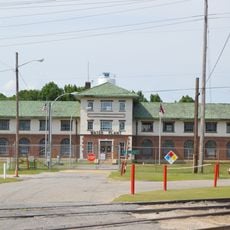
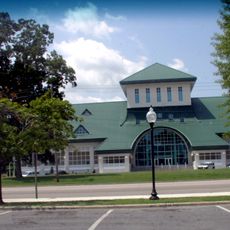
Harvey Point, Military testing facility in Perquimans County, North Carolina, US

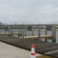
Harvey Point is a military testing facility on a peninsula along Albemarle Sound, featuring two operational runways spread across a large property. The landscape includes water areas, open fields, and building complexes designed to support weapons testing and tactical training operations.

The Department of Defense acquired the property in 1942 to establish a naval air base for seaplane operations against submarines. Over the following decades, it evolved into a facility for advanced military training and weapons evaluation activities.

This facility has trained more than 18,000 international intelligence officers, creating a network of expertise in defense and security operations.

The facility is not open to the public and visits are not permitted. Airspace above the property is subject to military restrictions affecting general aviation traffic.

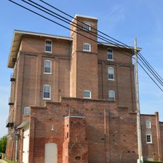
The site contains replica structures that simulate specific training scenarios, preparing personnel under realistic conditions. These replicas are periodically updated to match evolving tactical requirements.

The community of curious travelers

AroundUs brings together thousands of curated places, local tips, and hidden gems, enriched daily by 60,000 contributors worldwide.

Start exploring
Location
Inception
1942
GPS coordinates
36.10000,-76.33000
Latest update
December 7, 2025 10:06
Around this place
Hayes Plantation
United States of America

Hayes Plantation

25.1 km
Edenton Historic District
United States of America

Edenton Historic District

25.6 km
St. Paul's Church, Edenton
United States of America

St. Paul's Church, Edenton

25.5 km
Chowan County Courthouse
United States of America

Chowan County Courthouse

25.5 km
Land's End
United States of America

Land's End

9.8 km
James Iredell House
United States of America

James Iredell House

25.3 km
Elizabeth City Historic District
United States of America

Elizabeth City Historic District

24.2 km
Sutton-Newby House
United States of America

Sutton-Newby House

10.8 km
Athol
United States of America

Athol

23 km
Stockton
United States of America

Stockton

12.9 km
Isaac White House
United States of America

Isaac White House

12.1 km
Newbold-White House
United States of America

Newbold-White House

12.2 km
Cove Grove
United States of America

Cove Grove

12.2 km
Strawberry Hill
United States of America

Strawberry Hill

24.4 km
Mulberry Hill
United States of America

Mulberry Hill

21.1 km
Tyrrell County Courthouse
United States of America

Tyrrell County Courthouse

21.5 km
Sandy Point
United States of America

Sandy Point

19.8 km
Northside Historic District
United States of America

Northside Historic District

25 km
Episcopal Cemetery
United States of America

Episcopal Cemetery

23.9 km
Perquimans County Courthouse
United States of America

Perquimans County Courthouse

15.7 km
Riverside Historic District
United States of America

Riverside Historic District

24.3 km
Elizabeth City Water Plant
United States of America

Elizabeth City Water Plant

25.5 km
Edenton Cotton Mill Historic District
United States of America

Edenton Cotton Mill Historic District

24.9 km
Scuppernong River Bridge
United States of America

Scuppernong River Bridge

21.4 km
Columbia Historic District
United States of America

Columbia Historic District

21.4 km
Museum of the Albemarle
United States of America

Museum of the Albemarle

24 km
Taylor Twin Cinema
United States of America

Taylor Twin Cinema

25.5 km
Lane House
United States of America

Lane House

25.1 km
Show the full map
Reviews
Share your experience

No review yet

Discussions
Start a discussion...

No discussion yet

« Harvey Point - Military testing facility in Perquimans County, North Carolina, US » is provided by Around Us (aroundus.com). Images and texts are derived from Wikimedia project under a Creative Commons license. You are allowed to copy, distribute, and modify copies of this page, under the conditions set by the license, as long as this note is clearly visible.

Discover hidden gems everywhere you go!

From secret cafés to breathtaking viewpoints, skip the crowded tourist spots and find places that match your style. Our app makes it easy with voice search, smart filtering, route optimization, and insider tips from travelers worldwide. Download now for the complete mobile experience.

Around Us App Screenshot

A unique approach to discovering new places

Le Figaro

All the places worth exploring

France Info

A tailor-made excursion in just a few clicks

20 Minutes

Around Us
Travel Guide & Maps
Download

Send to your phone

QR Code
1

Open the camera app on your mobile.

2

Point at the QR code with your camera. A notification will appear.

3

Tap the notification to open the link.