Enable Location

We need your location to show you interesting places around you

Discover nearby places

Find interesting locations and hidden gems around you

Precise directions

Get accurate directions and distances to places

Your location is never shared with other users. It's only used when you tap the location button.

Log in to your account

Start exploring — it's free

Trusted by 64,550 travelers worldwide

Continue with Google
Continue with Apple
or

We will send you a code to connect

By continuing, you accept our Terms and Conditions and our Privacy Policy

Check your inbox

We've sent a pincode in your inbox. Please enter the code below.

Indian Head Mountain
Discussion Reviews Photo
3.3k Popularity

Indian Head Mountain, Mountain summit in Catskill Mountains, New York, US.

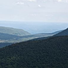
Indian Head Mountain is a summit in the Catskill Mountains of New York, featuring a steep cliff face on its eastern side and two distinct knolls at the top. The peak sits within a forested ridge system and is reached by foot trails that vary in difficulty.

The land around this peak was incorporated into New York's Catskill State Park during the 19th century, when the state began setting aside forested land for public use. That decision has kept the area open and largely undeveloped ever since.

The mountain's name comes from how European settlers read the shape of the eastern cliffs, seeing in them the profile of a human head. Hikers today often stop at certain points on the trail below to try to make out that same silhouette for themselves.

Weather in the Catskills can shift quickly at higher elevations, so sturdy footwear and a rain layer are worth carrying. The rocky sections near the top can become slippery after rain, so take your time on those stretches.

When seen from certain lower vantage points, the two summit knolls and the cliff face together form the outline of a human head in profile. Many hikers only notice this once someone points it out, which makes spotting it a small but memorable moment on the trail.

The community of curious travelers

AroundUs brings together thousands of curated places, local tips, and hidden gems, enriched daily by 60,000 contributors worldwide.

Start exploring
Location
Part of
Devil's Path
GPS coordinates
42.11620,-74.11458
Latest update
March 3, 2026 13:58
Around this place
Kaaterskill Falls
United States of America

Kaaterskill Falls

9.6 km
Big Pink
United States of America

Big Pink

6.8 km
Opus 40
United States of America

Opus 40

10.1 km
Overlook Mountain
United States of America

Overlook Mountain

3.9 km
Karma Triyana Dharmachakra
United States of America

Karma Triyana Dharmachakra

5.1 km
Byrdcliffe Colony
United States of America

Byrdcliffe Colony

7.2 km
United States of America

Platte Clove

3.5 km
Hunter Mountain Fire Tower
United States of America

Hunter Mountain Fire Tower

11.7 km
Maverick Concert Hall
United States of America

Maverick Concert Hall

11.4 km
Church of the Holy Transfiguration of Christ-on-the-Mount
United States of America

Church of the Holy Transfiguration of Christ-on-the-Mount

6.8 km
Sugarloaf Mountain
United States of America

Sugarloaf Mountain

3.4 km
North Mountain
United States of America

North Mountain

12.5 km
All Souls Church
United States of America

All Souls Church

12.2 km
Twin Mountain
United States of America

Twin Mountain

1.6 km
Hathaway
United States of America

Hathaway

12.1 km
Wynkoop House
United States of America

Wynkoop House

12 km
Rowena Memorial School
United States of America

Rowena Memorial School

10.2 km
Judge Jonathan Hasbrouck House
United States of America

Judge Jonathan Hasbrouck House

8.3 km
St. Mary's of the Mountain Church
United States of America

St. Mary's of the Mountain Church

12.1 km
Vosburg Turning Mill Complex
United States of America

Vosburg Turning Mill Complex

11 km
Tannersville Main Street Historic District
United States of America

Tannersville Main Street Historic District

8.9 km
Harry Fischel House
United States of America

Harry Fischel House

13.5 km
Tuscarora Club Bridge
United States of America

Tuscarora Club Bridge

9 km
Frank D. Layman Memorial
United States of America

Frank D. Layman Memorial

9.2 km
National Youth Administration Woodstock Resident Work Center
United States of America

National Youth Administration Woodstock Resident Work Center

8.6 km
Hunter Mountain
United States of America

Hunter Mountain

11.8 km
Kaaterskill High Peak
United States of America

Kaaterskill High Peak

5.9 km
Hunter Synagogue
United States of America

Hunter Synagogue

13.4 km
Show the full map
Reviews
Share your experience

No review yet

Discussions
Start a discussion...

No discussion yet

« Indian Head Mountain - Mountain summit in Catskill Mountains, New York, US » is provided by Around Us (aroundus.com). Images and texts are derived from Wikimedia project under a Creative Commons license. You are allowed to copy, distribute, and modify copies of this page, under the conditions set by the license, as long as this note is clearly visible.

Discover hidden gems everywhere you go!

From secret cafés to breathtaking viewpoints, skip the crowded tourist spots and find places that match your style. Our app makes it easy with voice search, smart filtering, route optimization, and insider tips from travelers worldwide. Download now for the complete mobile experience.

Around Us App Screenshot

A unique approach to discovering new places

Le Figaro

All the places worth exploring

France Info

A tailor-made excursion in just a few clicks

20 Minutes

Around Us
Travel Guide & Maps
Download

Send to your phone

QR Code
1

Open the camera app on your mobile.

2

Point at the QR code with your camera. A notification will appear.

3

Tap the notification to open the link.