Chest opened
+${chestReward.xp} XP
Explorer
NOUVEAU ×${chestReward.collectible.quantity}
tapez pour fermer
Chest locked

Open chests in the app

Around Us is built for your phone — chests unlock when you walk, explore and capture nearby places.

Enable Location

We need your location to show you interesting places around you

Discover nearby places

Find interesting locations and hidden gems around you

Precise directions

Get accurate directions and distances to places

Your location is never shared with other users. It's only used when you tap the location button.

Log in to your account

Start exploring — it's free

Trusted by 72,882 travelers worldwide

Continue with Google
Continue with Apple
or

We will send you a code to connect

By continuing, you accept our Terms and Conditions and our Privacy Policy

Check your inbox

We've sent a pincode in your inbox. Please enter the code below.

Keyser Formation
Discussion Reviews Photo
1.6k Popularity

Keyser Formation, Limestone formation across Pennsylvania, Maryland, Virginia, and West Virginia, US.

The Keyser Formation is a rock layer that extends across Pennsylvania, Maryland, Virginia, and West Virginia, made up of limestone and sedimentary rocks stacked in distinct bands. The thickness and composition of these layers change from place to place, showing how conditions shifted over time in the ancient seabed.

This rock formation developed during the Late Silurian and Early Devonian times, when shallow seas covered the Appalachian basin. It was first systematically documented and named in 1911, becoming an important record of how the region's geology came to be.

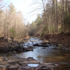
Many geology students and researchers visit the formation annually to study the abundant marine fossils, including crinoids, stromatoporoids, and brachiopods.

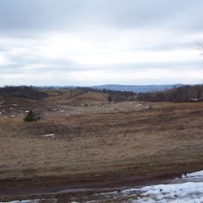
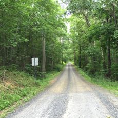
Spring and fall months offer the best conditions for visiting, with mild weather and easy trail access. Many observation points are found in quarries and along marked paths, reachable with proper footwear and basic hiking preparation.

The layers contain nodular formations and show repeating patterns that reveal shifting tidal and shallow water conditions. These cycling patterns help geologists understand how ancient ocean conditions changed over time in regular intervals.

The community of curious travelers

AroundUs brings together thousands of curated places, local tips, and hidden gems, enriched daily by 60,000 contributors worldwide.

Start exploring
GPS coordinates
38.30000,-79.60000
Latest update
March 25, 2026 18:12
Around this place
Battle of Camp Allegheny
United States of America

Battle of Camp Allegheny

22.2 km
Ramsey's Draft Wilderness
United States of America

Ramsey's Draft Wilderness

22.6 km
Reber Radio Telescope
United States of America

Reber Radio Telescope

23.9 km
Monterey Hotel
United States of America

Monterey Hotel

12.6 km
Crab Run Lane Truss Bridge
United States of America

Crab Run Lane Truss Bridge

10.4 km
Fort Edward Johnson
United States of America

Fort Edward Johnson

18.7 km
Monterey High School
United States of America

Monterey High School

12.3 km
Deerfield School
United States of America

Deerfield School

20.6 km
Mansion House
United States of America

Mansion House

10.4 km
United States of America

Clarks Cave

23.9 km
McClung Farm Historic District
United States of America

McClung Farm Historic District

6.1 km
The Wilderness
United States of America

The Wilderness

20.7 km
C.P. Jones House and Law Office
United States of America

C.P. Jones House and Law Office

12.7 km
Green Bank Observatory Science Center
United States of America

Green Bank Observatory Science Center

23.9 km
Green Bank Jansky Antenna
United States of America

Green Bank Jansky Antenna

23.9 km
Green Bank 45ft telescope
United States of America

Green Bank 45ft telescope

24.4 km
United States of America

Blue Grass Theatre

19.3 km
George Washington National Forest
United States of America

George Washington National Forest

23.4 km
United States of America

Camp Allegheny

22.2 km
United States of America

Eagle’s Sugar Camp

17.4 km
United States of America

Fort Edward Johnson (1862)

19 km
United States of America

Byrd Point

11.7 km
United States of America

Rexrode’s Sugar Orchard

15.9 km
United States of America

Puffenbarger Sugar Camp

18 km
United States of America

Morning Glories and Moonflowers

12.7 km
United States of America

Observatory Overlook

24.2 km
United States of America

Scenic viewpoint

22.9 km
United States of America

Scenic viewpoint

18.9 km
Show the full map
Reviews
Share your experience

No review yet

Discussions
Start a discussion...

No discussion yet

« Keyser Formation - Limestone formation across Pennsylvania, Maryland, Virginia, and West Virginia, US » is provided by Around Us (aroundus.com). Images and texts are derived from Wikimedia project under a Creative Commons license. You are allowed to copy, distribute, and modify copies of this page, under the conditions set by the license, as long as this note is clearly visible.

Discover hidden gems everywhere you go!

From secret cafés to breathtaking viewpoints, skip the crowded tourist spots and find places that match your style. Our app makes it easy with voice search, smart filtering, route optimization, and insider tips from travelers worldwide. Download now for the complete mobile experience.

Around Us App Screenshot

A unique approach to discovering new places

Le Figaro

All the places worth exploring

France Info

A tailor-made excursion in just a few clicks

20 Minutes

Around Us
Travel Guide & Maps
Download

Send to your phone

QR Code
1

Open the camera app on your mobile.

2

Point at the QR code with your camera. A notification will appear.

3

Tap the notification to open the link.