Enable Location

We need your location to show you interesting places around you

Discover nearby places

Find interesting locations and hidden gems around you

Precise directions

Get accurate directions and distances to places

Your location is never shared with other users. It's only used when you tap the location button.

Lincoln Woods State Park

Log in to your account

Start exploring — it's free

Trusted by 61,867 travelers worldwide

Continue with Google
Continue with Apple
or

We will send you a code to connect

By continuing, you accept our Terms and Conditions and our Privacy Policy

Check your inbox

We've sent a pincode in your inbox. Please enter the code below.

Lincoln Woods State Park

Lincoln Woods State Park, State park in Lincoln, Rhode Island, US.

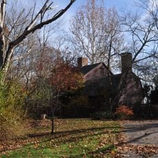
Lincoln Woods State Park is a public recreation area in Rhode Island featuring a central pond surrounded by forest and open spaces for various outdoor activities. The property includes swimming beaches, walking and hiking trails, boat ramps, and picnic grounds spread throughout the grounds.

The site was created in 1908 as Rhode Island's first state park and was named to honor President Abraham Lincoln. Over time, additional land was purchased and added to expand the park's size and amenities.

The park serves as a gathering place for the local community, where families spend weekends together and schools bring students for outdoor learning. The trails and picnic areas have become part of the rhythm of life for people who live nearby.

The area is easy to navigate with marked trails and separate zones for different activities like cycling and horseback riding. Most visitors find parking and basic facilities like restrooms and water stations readily available.

A covered bridge at the Breakneck Hill entrance creates a distinctive passage into the park that many visitors overlook. This architectural feature marks the transition from the parking area into the natural landscape beyond.

The community of curious travelers

AroundUs brings together thousands of curated places, local tips, and hidden gems, enriched daily by 60,000 contributors worldwide.

Start exploring
Location
Inception
1908
GPS coordinates
41.89720,-71.43610
Latest update
December 10, 2025 20:03
Around this place
Eleazer Arnold House
United States of America

Eleazer Arnold House

1.4 km
Saylesville, Rhode Island
United States of America

Saylesville, Rhode Island

1.9 km
Jenks Park & Cogswell Tower
United States of America

Jenks Park & Cogswell Tower

4 km
Lime Rock
United States of America

Lime Rock

3.8 km
Lonsdale
United States of America

Lonsdale

2.9 km
St. John the Baptist Church
United States of America

St. John the Baptist Church

4.1 km
Hearthside
United States of America

Hearthside

1.1 km
Great Road Historic District
United States of America

Great Road Historic District

1.4 km
Valley Falls Mill
United States of America

Valley Falls Mill

3.9 km
Benjamin F. Greene House
United States of America

Benjamin F. Greene House

4.3 km
Saylesville Meetinghouse
United States of America

Saylesville Meetinghouse

1.5 km
Valentine Whitman House
United States of America

Valentine Whitman House

4.2 km
Fifth Ward Wardroom
United States of America

Fifth Ward Wardroom

4.4 km
Jenckes House
United States of America

Jenckes House

1.1 km
Berkeley Mill Village
United States of America

Berkeley Mill Village

3.8 km
Central Street School
United States of America

Central Street School

3.8 km
Israel Arnold House
United States of America

Israel Arnold House

1.2 km
Lime Kilns
United States of America

Lime Kilns

1.9 km
Jenckes House
United States of America

Jenckes House

2.1 km
South Central Falls Historic District
United States of America

South Central Falls Historic District

4 km
Samuel B. Conant House
United States of America

Samuel B. Conant House

4.1 km
Pullen Corner School
United States of America

Pullen Corner School

2.7 km
Whipple-Cullen House and Barn
United States of America

Whipple-Cullen House and Barn

3.7 km
G.A. Burnham House
United States of America

G.A. Burnham House

4.2 km
Patterson Brothers Commercial Building and House
United States of America

Patterson Brothers Commercial Building and House

3.7 km
Cumberland Town Hall Historic District
United States of America

Cumberland Town Hall Historic District

3.8 km
Elliot-Harris-Miner House
United States of America

Elliot-Harris-Miner House

2.1 km
Naushon Company Plant
United States of America

Naushon Company Plant

3.6 km
Show the full map
« Lincoln Woods State Park - State park in Lincoln, Rhode Island, US » is provided by Around Us (aroundus.com). Images and texts are derived from Wikimedia project under a Creative Commons license. You are allowed to copy, distribute, and modify copies of this page, under the conditions set by the license, as long as this note is clearly visible.

Discover hidden gems everywhere you go!

From secret cafés to breathtaking viewpoints, skip the crowded tourist spots and find places that match your style. Our app makes it easy with voice search, smart filtering, route optimization, and insider tips from travelers worldwide. Download now for the complete mobile experience.

Around Us App Screenshot

A unique approach to discovering new places

Le Figaro

All the places worth exploring

France Info

A tailor-made excursion in just a few clicks

20 Minutes

Around Us
Travel Guide & Maps
Download

Send to your phone

QR Code
1

Open the camera app on your mobile.

2

Point at the QR code with your camera. A notification will appear.

3

Tap the notification to open the link.