Enable Location

We need your location to show you interesting places around you

Discover nearby places

Find interesting locations and hidden gems around you

Precise directions

Get accurate directions and distances to places

Your location is never shared with other users. It's only used when you tap the location button.

Merchants Millpond State Park

Log in to your account

Start exploring — it's free

Trusted by 65,329 travelers worldwide

Continue with Google
Continue with Apple
or

We will send you a code to connect

By continuing, you accept our Terms and Conditions and our Privacy Policy

Check your inbox

We've sent a pincode in your inbox. Please enter the code below.

Merchants Millpond State Park
Discussion Reviews 1 Photos
4.4k Popularity

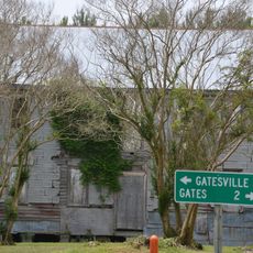
Merchants Millpond State Park, State park and water trail in Gates County, United States.

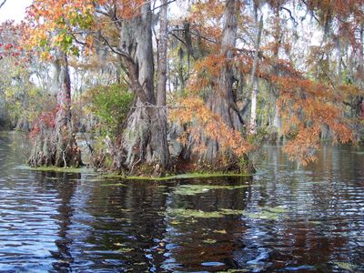
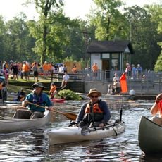
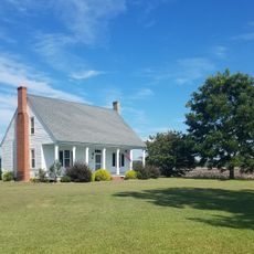
Merchants Millpond State Park is a water trail and state park in Gates County, North Carolina, built around a large pond covered by old-growth cypress and gum trees. The park offers canoe and kayak routes on the water, foot trails along the shore, and primitive camping spots spread through the surrounding woodland.

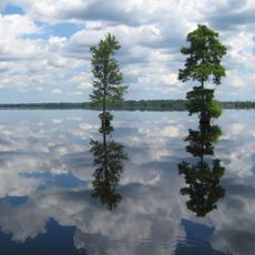
The pond was created in the early 1800s when a dam was built to power a grain mill, and the water has remained in this landscape ever since. The state took steps to protect the area in 1973, turning it into a park to keep the land and water from being developed.

The name of this park comes from the merchants who once operated water mills across this part of North Carolina. Today, people come here mainly to paddle through the dark, mirror-like water beneath old cypress trees, a practice that feels more like exploring a flooded forest than a standard lake outing.

The main entrance is off Millpond Road and has a parking area with direct access to the boat launch and the start of the foot trails. Going out on the water in the morning tends to give calmer conditions and better light for spotting wildlife along the banks.

The park sits at the northern edge of the natural range of the American alligator, making it one of the few places where this reptile lives in the wild this far north. Spotting one is possible but not guaranteed, as they tend to stay near the water's edge in warmer months.

The community of curious travelers

AroundUs brings together thousands of curated places, local tips, and hidden gems, enriched daily by 60,000 contributors worldwide.

Start exploring
Location
Inception
1973
GPS coordinates
36.43720,-76.68440
Latest update
March 3, 2026 08:13
Around this place
Dismal Swamp Canal
United States of America

Dismal Swamp Canal

30.3 km
Great Dismal Swamp National Wildlife Refuge
United States of America

Great Dismal Swamp National Wildlife Refuge

26.5 km
Dismal Swamp State Park
United States of America

Dismal Swamp State Park

25.4 km
Elmwood Plantation
United States of America

Elmwood Plantation

5 km
Belvidere
United States of America

Belvidere

22.4 km
Holland Historic District (Suffolk, Virginia)
United States of America

Holland Historic District (Suffolk, Virginia)

28.6 km
Buckland
United States of America

Buckland

8.5 km
Oak Crest
United States of America

Oak Crest

31.6 km
Somerton Historic District
United States of America

Somerton Historic District

15.8 km
Mount Sinai Baptist Church
United States of America

Mount Sinai Baptist Church

26 km
Ahoskie Downtown Historic District
United States of America

Ahoskie Downtown Historic District

31.9 km
Freeman House
United States of America

Freeman House

14.1 km
Eure-Roberts House
United States of America

Eure-Roberts House

7 km
Ahoskie School
United States of America

Ahoskie School

32.1 km
Morgan House
United States of America

Morgan House

31.5 km
Whaleyville Historic District
United States of America

Whaleyville Historic District

17 km
Ahoskie Historic District
United States of America

Ahoskie Historic District

31.7 km
West End Historic District
United States of America

West End Historic District

33.5 km
Roberts H. Jernigan House
United States of America

Roberts H. Jernigan House

31.7 km
Gray Gables
United States of America

Gray Gables

22.9 km
Gates County Courthouse
United States of America

Gates County Courthouse

7.2 km
Suffolk Peanut Company
United States of America

Suffolk Peanut Company

33.2 km
Nansemond County Training School
United States of America

Nansemond County Training School

24.9 km
Phoenix Bank of Nansemond
United States of America

Phoenix Bank of Nansemond

33.6 km
Reid's Grove School
United States of America

Reid's Grove School

6.9 km
Cullen and Elizabeth Jones House
United States of America

Cullen and Elizabeth Jones House

28.4 km
Mitchell-Ward House
United States of America

Mitchell-Ward House

20.9 km
Zion Christian Church, Suffolk, Virginia
United States of America

Zion Christian Church, Suffolk, Virginia

24.8 km
Show the full map
Reviews
Share your experience

No review yet

Discussions
Start a discussion...

No discussion yet

« Merchants Millpond State Park - State park and water trail in Gates County, United States » is provided by Around Us (aroundus.com). Images and texts are derived from Wikimedia project under a Creative Commons license. You are allowed to copy, distribute, and modify copies of this page, under the conditions set by the license, as long as this note is clearly visible.

Discover hidden gems everywhere you go!

From secret cafés to breathtaking viewpoints, skip the crowded tourist spots and find places that match your style. Our app makes it easy with voice search, smart filtering, route optimization, and insider tips from travelers worldwide. Download now for the complete mobile experience.

Around Us App Screenshot

A unique approach to discovering new places

Le Figaro

All the places worth exploring

France Info

A tailor-made excursion in just a few clicks

20 Minutes

Around Us
Travel Guide & Maps
Download

Send to your phone

QR Code
1

Open the camera app on your mobile.

2

Point at the QR code with your camera. A notification will appear.

3

Tap the notification to open the link.