Minnesota Valley State Recreation Area

Log in to your account

AroundUs is a community-driven map of interesting places, built by curious explorers like you. It grows with every review, story, and photo you share.
Connect to save your favorite spots, contribute locations, and create personalized routes.
Continue with Google
Continue with Apple
Continue with X
Continue with Facebook
Continue with email
By continuing, you accept our Terms and Conditions and our Privacy Policy
Create an account
Add to collection
Map
Suggest a change
Share

Minnesota Valley State Recreation Area, State recreation area in Scott County, Minnesota, US

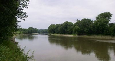
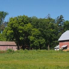
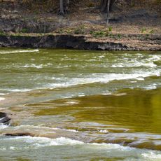
Minnesota Valley State Recreation Area is a protected landscape along the Minnesota River with river valleys, wetlands, and forests. The area features multiple trails and camping spots spread across different terrain types, creating habitats where various wildlife can thrive.

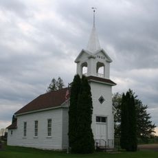
The land was originally home to Indigenous peoples who depended on its natural resources and waterways for survival. European settlers later arrived and similarly relied on the river valley for their livelihood and settlement.

The area reflects how people have long valued the river landscape through the way they use and care for it today. Visitors can observe how nature and human activity have always been intertwined in this valley.

The area has an extensive trail network for hiking, biking, and other outdoor pursuits across its varied landscape. Visitors should prepare for changing conditions depending on the season and weather, and bring appropriate gear for their chosen activity.

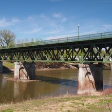
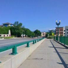
The area connects multiple cities through paved bike paths that stretch from Shakopee to Belle Plaine. These linked routes make it easy for cyclists to explore different communities across the region without leaving the trail system.

Location: Scott County

GPS coordinates: 44.66190,-93.70330

Latest update: December 13, 2025 12:21

Photos
Around this place
Hazeltine National Golf Club
United States of America

Hazeltine National Golf Club

21.1 km
Church of St. Wenceslaus
United States of America

Church of St. Wenceslaus

16.6 km
Guardian Angels Church
United States of America

Guardian Angels Church

15.8 km
Zoar Moravian Church
United States of America

Zoar Moravian Church

17.6 km
Andrew Peterson Farmstead
United States of America

Andrew Peterson Farmstead

22.6 km
Holmes Street Bridge
United States of America

Holmes Street Bridge

20.8 km
Young America City Hall
United States of America

Young America City Hall

21.3 km
Saint Mary's Church of the Purification
United States of America

Saint Mary's Church of the Purification

14.4 km
Episcopal Church of the Transfiguration
United States of America

Episcopal Church of the Transfiguration

6.3 km
Foss and Wells House
United States of America

Foss and Wells House

6.1 km
Walnut Street Historic District
United States of America

Walnut Street Historic District

16.1 km
Chaska Bridge
United States of America

Chaska Bridge

15.8 km
Strunk–Nyssen House
United States of America

Strunk–Nyssen House

18.2 km
Carver Historic District
United States of America

Carver Historic District

12.9 km
Early Shakopee Houses
United States of America

Early Shakopee Houses

20.9 km
German Evangelical Salem Church
United States of America

German Evangelical Salem Church

20.7 km
Splash pad
United States of America

Splash pad

18.8 km
Julius A. Coller House
United States of America

Julius A. Coller House

21.1 km
Abraham Bisson House
United States of America

Abraham Bisson House

585 m
August F. Poehler House
United States of America

August F. Poehler House

22.2 km
Johann Schimmelpfennig Farmstead
United States of America

Johann Schimmelpfennig Farmstead

18.9 km
Henderson Commercial Historic District
United States of America

Henderson Commercial Historic District

21.9 km
SandVenture Aquatic Park
United States of America

SandVenture Aquatic Park

18.8 km
Little Rapids Fur Post Historical Marker
United States of America

Little Rapids Fur Post Historical Marker

15.3 km
Norwood Methodist Episcopal Church
United States of America

Norwood Methodist Episcopal Church

21.4 km
Church of the Ascension
United States of America

Church of the Ascension

21.7 km
Hooper–Bowler–Hillstrom House
United States of America

Hooper–Bowler–Hillstrom House

6.3 km
Carver Rapids
United States of America

Carver Rapids

9 km
Show the full map
Reviews

Visited this place? Tap the stars to rate it and share your experience / photos with the community! Try now! You can cancel it anytime.

« Minnesota Valley State Recreation Area - State recreation area in Scott County, Minnesota, US » is provided by Around Us (aroundus.com). Images and texts are derived from Wikimedia project under a Creative Commons license. You are allowed to copy, distribute, and modify copies of this page, under the conditions set by the license, as long as this note is clearly visible.

Discover hidden gems everywhere you go!

From secret cafés to breathtaking viewpoints, skip the crowded tourist spots and find places that match your style. Our app makes it easy with voice search, smart filtering, route optimization, and insider tips from travelers worldwide. Download now for the complete mobile experience.

Around Us App Screenshot

A unique approach to discovering new places

Le Figaro

All the places worth exploring

France Info

A tailor-made excursion in just a few clicks

20 Minutes