Chest opened
+${chestReward.xp} XP
Explorer
NOUVEAU ×${chestReward.collectible.quantity}
tapez pour fermer
Chest locked

Open chests in the app

Around Us is built for your phone — chests unlock when you walk, explore and capture nearby places.

Enable Location

We need your location to show you interesting places around you

Discover nearby places

Find interesting locations and hidden gems around you

Precise directions

Get accurate directions and distances to places

Your location is never shared with other users. It's only used when you tap the location button.

Log in to your account

Start exploring — it's free

Trusted by 72,882 travelers worldwide

Continue with Google
Continue with Apple
or

We will send you a code to connect

By continuing, you accept our Terms and Conditions and our Privacy Policy

Check your inbox

We've sent a pincode in your inbox. Please enter the code below.

Ozark Highlands Trail
Discussion Reviews Photo
8k Popularity

Ozark Highlands Trail, National Recreation Trail in Arkansas, United States

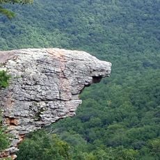
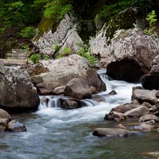
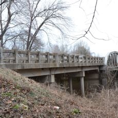
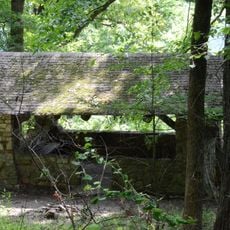
The Ozark Highlands Trail is a hiking path that winds through the forests and river valleys of northern Arkansas. It connects Lake Fort Smith State Park to Buffalo National River, taking walkers through changing landscapes of wooded ridges, stream crossings, and open meadows.

The trail began development in the 1980s with the Boston Mountains section completed by 1989. Since then it has become an established hiking route through the region's natural landscape.

This path through northern Arkansas connects multiple communities while promoting outdoor activities and environmental conservation.

Check trail conditions before you go, and wear visible orange clothing during hunting seasons for safety. The trail markings help you stay on course and find your way through different sections.

The path is marked with white blazes at eye level, making navigation straightforward throughout the journey. Detailed mile markers along the route let hikers track their progress and confirm their location.

The community of curious travelers

AroundUs brings together thousands of curated places, local tips, and hidden gems, enriched daily by 60,000 contributors worldwide.

Start exploring
Location
GPS coordinates
35.72278,-93.50806
Latest update
December 8, 2025 19:59
Around this place
Upper Buffalo Wilderness
United States of America

Upper Buffalo Wilderness

20 km
Richland Creek Wilderness
United States of America

Richland Creek Wilderness

20 km
Clarksville Confederate Monument
United States of America

Clarksville Confederate Monument

28.5 km
Wiederkehr Wine Cellar
United States of America

Wiederkehr Wine Cellar

29.3 km
Union School
United States of America

Union School

19 km
Big Piney Creek Bridge
United States of America

Big Piney Creek Bridge

25.1 km
St. Paul Lutheran School
United States of America

St. Paul Lutheran School

34 km
Harmony Presbyterian Church
United States of America

Harmony Presbyterian Church

20 km
Pioneer House
United States of America

Pioneer House

29.4 km
Villines Mill
United States of America

Villines Mill

31.4 km
U.S. 64 Horsehead Creek Bridge
United States of America

U.S. 64 Horsehead Creek Bridge

33.2 km
Dunlap House
United States of America

Dunlap House

28.4 km
Gray Spring Recreation Area
United States of America

Gray Spring Recreation Area

36.2 km
Edward Taylor McConnell House
United States of America

Edward Taylor McConnell House

28.5 km
Ozone School
United States of America

Ozone School

11.8 km
Bunch-Walton Post No. 22 American Legion Hut
United States of America

Bunch-Walton Post No. 22 American Legion Hut

28.3 km
Pettigrew School
United States of America

Pettigrew School

16.6 km
MacLean Hall
United States of America

MacLean Hall

27.7 km
Johnson County Courthouse
United States of America

Johnson County Courthouse

28.3 km
Clarksville National Guard Armory
United States of America

Clarksville National Guard Armory

27.9 km
McKennon House
United States of America

McKennon House

28.5 km
Pennington House
United States of America

Pennington House

28 km
Munger House
United States of America

Munger House

36 km
Clarksville Commercial Historic District
United States of America

Clarksville Commercial Historic District

28.3 km
Davis House
United States of America

Davis House

28.7 km
St. Paul School Building
United States of America

St. Paul School Building

25.9 km
Capt. Archibald S. McKennon House
United States of America

Capt. Archibald S. McKennon House

28.1 km
Haw Creek Falls Recreation Area
United States of America

Haw Creek Falls Recreation Area

23.4 km
Show the full map
Reviews
Share your experience

No review yet

Discussions
Start a discussion...

No discussion yet

« Ozark Highlands Trail - National Recreation Trail in Arkansas, United States » is provided by Around Us (aroundus.com). Images and texts are derived from Wikimedia project under a Creative Commons license. You are allowed to copy, distribute, and modify copies of this page, under the conditions set by the license, as long as this note is clearly visible.

Discover hidden gems everywhere you go!

From secret cafés to breathtaking viewpoints, skip the crowded tourist spots and find places that match your style. Our app makes it easy with voice search, smart filtering, route optimization, and insider tips from travelers worldwide. Download now for the complete mobile experience.

Around Us App Screenshot

A unique approach to discovering new places

Le Figaro

All the places worth exploring

France Info

A tailor-made excursion in just a few clicks

20 Minutes

Around Us
Travel Guide & Maps
Download

Send to your phone

QR Code
1

Open the camera app on your mobile.

2

Point at the QR code with your camera. A notification will appear.

3

Tap the notification to open the link.