Chest opened
+${chestReward.xp} XP
Explorer
NOUVEAU ×${chestReward.collectible.quantity}
tapez pour fermer
Chest locked

Open chests in the app

Around Us is built for your phone — chests unlock when you walk, explore and capture nearby places.

Enable Location

We need your location to show you interesting places around you

Discover nearby places

Find interesting locations and hidden gems around you

Precise directions

Get accurate directions and distances to places

Your location is never shared with other users. It's only used when you tap the location button.

Log in to your account

Start exploring — it's free

Trusted by 72,948 travelers worldwide

Continue with Google
Continue with Apple
or

We will send you a code to connect

By continuing, you accept our Terms and Conditions and our Privacy Policy

Check your inbox

We've sent a pincode in your inbox. Please enter the code below.

Pettigrew State Park
Discussion Reviews Photo
5.7k Popularity

Pettigrew State Park, State park in Tyrrell and Washington Counties, North Carolina, United States

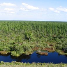
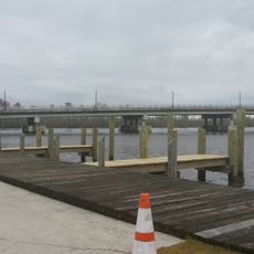
Pettigrew State Park encompasses about 5,951 acres (2,410 hectares) and centers on Lake Phelps and the Scuppernong River with cypress trees and natural waterways. The park offers tent and RV camping, boat ramps, and nine miles (14 kilometers) of hiking trails along with swimming, fishing, and paddling opportunities.

The park was established in 1939 during the Great Depression through a land lease from the Farm Security Administration program. This initiative helped the region during a period of economic hardship.

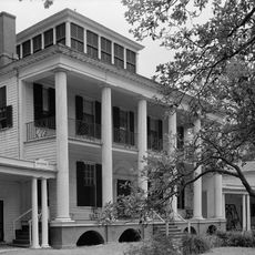
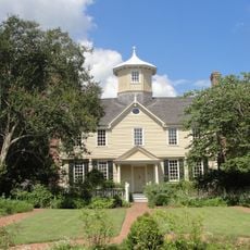
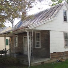
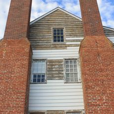
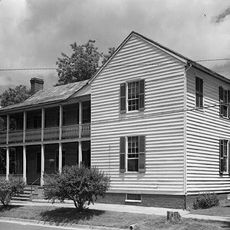
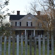
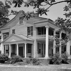
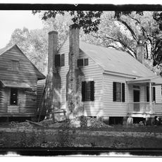
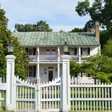
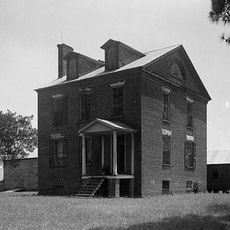
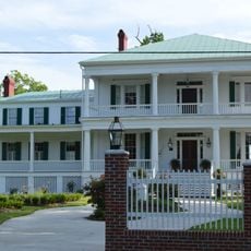
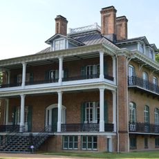
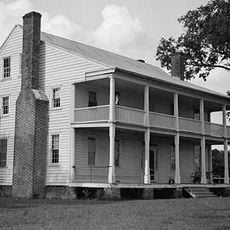
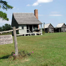
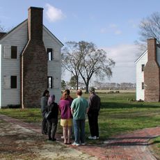
Somerset Place is a restored plantation complex from the 1830s with original and reconstructed buildings located within the park boundaries. The site shows how people lived and worked during that era.

The area is most accessible during fall and winter months when trails and waterways are easiest to navigate. Visitors should bring insect repellent and be prepared for wet conditions.

Lake Phelps has a distinctive water chemistry that has preserved hundreds of dugout canoes carved from logs dating back roughly 4,400 years. These prehistoric artifacts rest on the lake floor and provide insight into early human life in the region.

The community of curious travelers

AroundUs brings together thousands of curated places, local tips, and hidden gems, enriched daily by 60,000 contributors worldwide.

Start exploring
Location
Inception
1939
GPS coordinates
35.79720,-76.42190
Latest update
December 9, 2025 18:48
Around this place
Hayes Plantation
United States of America

Hayes Plantation

32.5 km
Pocosin Lakes National Wildlife Refuge
United States of America

Pocosin Lakes National Wildlife Refuge

9.5 km
Roanoke River Light
United States of America

Roanoke River Light

33.5 km
Cupola House
United States of America

Cupola House

33.6 km
Edenton Historic District
United States of America

Edenton Historic District

33.8 km
Barker House
United States of America

Barker House

33.5 km
Chowan County Courthouse
United States of America

Chowan County Courthouse

33.5 km
James Iredell House
United States of America

James Iredell House

33.7 km
Latham House
United States of America

Latham House

30.3 km
Athol
United States of America

Athol

27 km
Belgrade and St. David's Church
United States of America

Belgrade and St. David's Church

8.9 km
Strawberry Hill
United States of America

Strawberry Hill

33.3 km
Mulberry Hill
United States of America

Mulberry Hill

25.9 km
Pembroke Hall
United States of America

Pembroke Hall

33.7 km
Tyrrell County Courthouse
United States of America

Tyrrell County Courthouse

20.3 km
Wessington House
United States of America

Wessington House

33.7 km
Sandy Point
United States of America

Sandy Point

25.4 km
Perry-Spruill House
United States of America

Perry-Spruill House

30.5 km
Davenport House
United States of America

Davenport House

8.2 km
Edenton Cotton Mill Historic District
United States of America

Edenton Cotton Mill Historic District

33.2 km
Scuppernong River Bridge
United States of America

Scuppernong River Bridge

20.1 km
Columbia Historic District
United States of America

Columbia Historic District

20.4 km
Creswell Historic District
United States of America

Creswell Historic District

8.5 km
Roanoke River Light
United States of America

Roanoke River Light

33.5 km
Somerset Place State Historic Site
United States of America

Somerset Place State Historic Site

1.8 km
Taylor Twin Cinema
United States of America

Taylor Twin Cinema

33.7 km
Lane House
United States of America

Lane House

33.4 km
Tyrrell County Visitor Center
United States of America

Tyrrell County Visitor Center

20.1 km
Show the full map
Reviews
Share your experience

No review yet

Discussions
Start a discussion...

No discussion yet

« Pettigrew State Park - State park in Tyrrell and Washington Counties, North Carolina, United States » is provided by Around Us (aroundus.com). Images and texts are derived from Wikimedia project under a Creative Commons license. You are allowed to copy, distribute, and modify copies of this page, under the conditions set by the license, as long as this note is clearly visible.

Discover hidden gems everywhere you go!

From secret cafés to breathtaking viewpoints, skip the crowded tourist spots and find places that match your style. Our app makes it easy with voice search, smart filtering, route optimization, and insider tips from travelers worldwide. Download now for the complete mobile experience.

Around Us App Screenshot

A unique approach to discovering new places

Le Figaro

All the places worth exploring

France Info

A tailor-made excursion in just a few clicks

20 Minutes

Around Us
Travel Guide & Maps
Download

Send to your phone

QR Code
1

Open the camera app on your mobile.

2

Point at the QR code with your camera. A notification will appear.

3

Tap the notification to open the link.