Enable Location

We need your location to show you interesting places around you

Discover nearby places

Find interesting locations and hidden gems around you

Precise directions

Get accurate directions and distances to places

Your location is never shared with other users. It's only used when you tap the location button.

Peshtigo River State Forest

Log in to your account

Start exploring — it's free

Trusted by 62,937 travelers worldwide

Continue with Google
Continue with Apple
or

We will send you a code to connect

By continuing, you accept our Terms and Conditions and our Privacy Policy

Check your inbox

We've sent a pincode in your inbox. Please enter the code below.

Peshtigo River State Forest
Discussion Reviews 1 Photos
1.6k Popularity

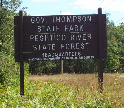
Peshtigo River State Forest, State forest along Peshtigo River in Wisconsin, US

Peshtigo River State Forest is a protected area in Marinette and Oconto counties in Wisconsin that covers roughly 5,000 hectares of mixed terrain. The land includes forests, river corridors, and wetlands that create a varied landscape for visitors to explore.

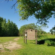
The forest was established in 2001 by the Wisconsin Department of Natural Resources as one of the state system's newest additions. This designation acknowledged the importance of protecting these landscape types for conservation purposes.

Local educational programs introduce visitors to the forest's ecosystems, emphasizing the importance of natural resource conservation and environmental stewardship.

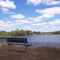
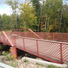
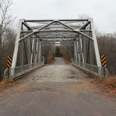
The area has several camping areas with basic facilities and about 8 miles (13 kilometers) of marked hiking trails for various skill levels. Visitors can also fish or paddle, with multiple access points available along the river corridors.

The area provides critical habitat for water fish like northern pike and walleye, as well as migratory waterfowl species across the seasons. These wetlands create specialized conditions for animals adapted to this particular environment that are difficult to spot elsewhere.

The community of curious travelers

AroundUs brings together thousands of curated places, local tips, and hidden gems, enriched daily by 60,000 contributors worldwide.

Start exploring
Inception
2001
GPS coordinates
45.28861,-88.19000
Latest update
December 14, 2025 13:02
Around this place
DeYoung Family Zoo
United States of America

DeYoung Family Zoo

42.7 km
Copper Culture State Park
United States of America

Copper Culture State Park

50.2 km
Interstate Bridge
United States of America

Interstate Bridge

48.8 km
Governor Thompson State Park
United States of America

Governor Thompson State Park

6.8 km
United States of America

Dave's Falls

28 km
United States of America

Lumberjack Steam Train

49.1 km
Peshtigo Fire Cemetery
United States of America

Peshtigo Fire Cemetery

42.9 km
Mountain Fire Lookout Tower
United States of America

Mountain Fire Lookout Tower

23 km
Riverside Site
United States of America

Riverside Site

46.3 km
Chute Pond Dam
United States of America

Chute Pond Dam

26.5 km
St. John the Baptist Catholic Church
United States of America

St. John the Baptist Catholic Church

49.5 km
F.J. Lauerman House
United States of America

F.J. Lauerman House

48.1 km
Mountain High School
United States of America

Mountain High School

25.3 km
Dunlap Square Building
United States of America

Dunlap Square Building

48.6 km
Minertown-Oneva
United States of America

Minertown-Oneva

35.6 km
First Street Historic District
United States of America

First Street Historic District

50.3 km
Armstrong Creek Bridge
United States of America

Armstrong Creek Bridge

44 km
Lena Road School
United States of America

Lena Road School

30.1 km
Bijou Theatre
United States of America

Bijou Theatre

48.7 km
Citizens State Bank of Gillett
United States of America

Citizens State Bank of Gillett

45.2 km
Chicago and North-Western Land Office
United States of America

Chicago and North-Western Land Office

40.5 km
Independent Order of Odd Fellows-Lodge No. 189 Building
United States of America

Independent Order of Odd Fellows-Lodge No. 189 Building

49.5 km
Grand Avenue Bridge
United States of America

Grand Avenue Bridge

39.3 km
Lumberjack Steam Train & Camp 5 Museum
United States of America

Lumberjack Steam Train & Camp 5 Museum

49.1 km
Wausaukee Bowl
United States of America

Wausaukee Bowl

20.8 km
Copper Culture State Park
United States of America

Copper Culture State Park

50.2 km
Menominee County Courthouse
United States of America

Menominee County Courthouse

49.6 km
Smyth Road Bridge
United States of America

Smyth Road Bridge

17.9 km
Show the full map
Reviews
Share your experience

No review yet

Discussions
Start a discussion...

No discussion yet

« Peshtigo River State Forest - State forest along Peshtigo River in Wisconsin, US » is provided by Around Us (aroundus.com). Images and texts are derived from Wikimedia project under a Creative Commons license. You are allowed to copy, distribute, and modify copies of this page, under the conditions set by the license, as long as this note is clearly visible.

Discover hidden gems everywhere you go!

From secret cafés to breathtaking viewpoints, skip the crowded tourist spots and find places that match your style. Our app makes it easy with voice search, smart filtering, route optimization, and insider tips from travelers worldwide. Download now for the complete mobile experience.

Around Us App Screenshot

A unique approach to discovering new places

Le Figaro

All the places worth exploring

France Info

A tailor-made excursion in just a few clicks

20 Minutes

Around Us
Travel Guide & Maps
Download

Send to your phone

QR Code
1

Open the camera app on your mobile.

2

Point at the QR code with your camera. A notification will appear.

3

Tap the notification to open the link.